Property Record
116 S Main St, Ellenville, NY 12428
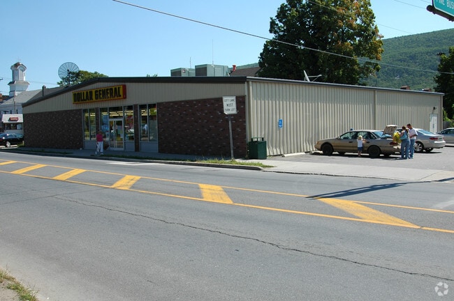
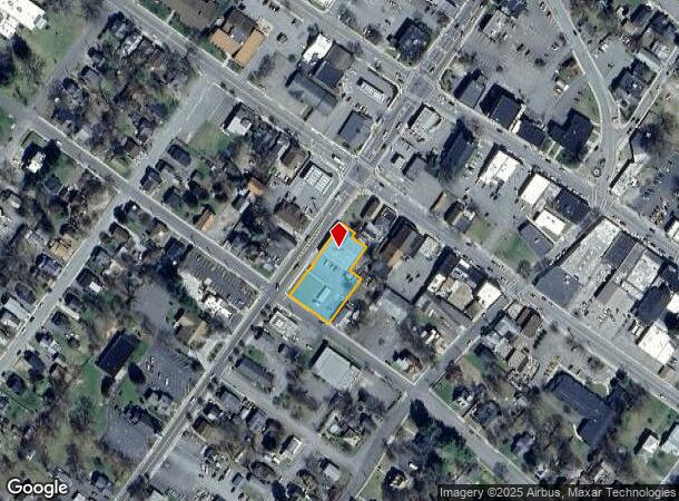
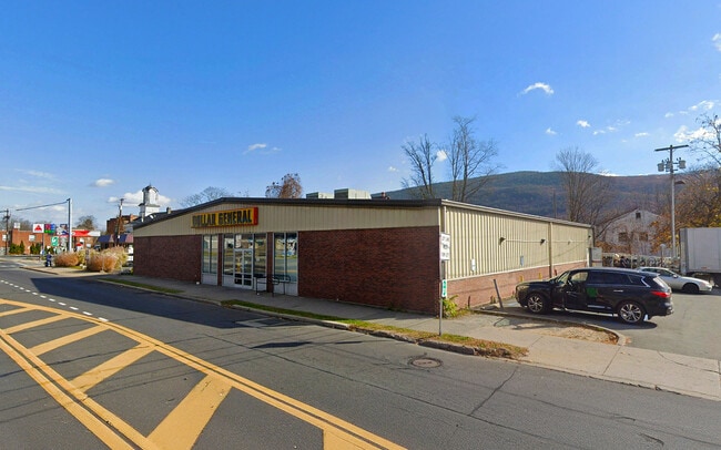
This Property Is For Sale
NEARBY LISTINGS FOR SALE OR LEASE
Property Detail
116 S Main St
5601-083.311-0004-047.200-0000
Ulster
Storesoffices
New York
X
47.200
36111C0685F
0.59 AC
2025
Hudson Valley Area
2024
Other Market Areas
954800
Kingston, NY
7,176 SF
DEMOGRAPHICS near 116 S Main St
1 Mile
3 Mile
5 Mile
2024 Total Population
4,719
7,312
9,685
2029 Population
4,741
7,318
9,669
Pop Growth 2024-2029
+ 0.47%
+ 0.08%
(0.17%)
Average Age
39
40
42
2024 Total Households
1,838
2,818
3,523
HH Growth 2024-2029
+ 0.49%
+ 0.04%
(0.26%)
Median Household Inc
$54,877
$57,692
$62,334
Avg Household Size
2.50
2.50
2.40
2024 Avg HH Vehicles
1.00
2.00
2.00
Median Home Value
$165,384
$179,229
$185,869
Median Year Built
1958
1958
1960
Nearby Places
- Restaurants
- Banks
- Shops
- Fitness
- Groceries
PUBLIC TRANSPORTATION
AIRPORT
New York Stewart International
DRIVE
WALK
Distance
New York Stewart International
47 min
30.0 mi
Freight Ports
Albany, NY Port
DRIVE
WALK
Distance
Albany, NY Port
94 min
78.5 mi
Nearby Properties
Address
Land Use
TOTAL SIZE
Lot Size
Zoning
Address
Land Use
TOTAL SIZE
Lot Size
Zoning
195,514 SF
39.73 AC
05 - COMME
Address
Land Use
TOTAL SIZE
Lot Size
Zoning
168,959 SF
177.40 AC
VP
Address
Land Use
TOTAL SIZE
Lot Size
Zoning
129,112 SF
14.10 AC
MU
Address
Land Use
TOTAL SIZE
Lot Size
Zoning
39,327 SF
10.70 AC
05 - COMME
Address
Land Use
TOTAL SIZE
Lot Size
Zoning
363 AC
RR40
Address
Land Use
TOTAL SIZE
Lot Size
Zoning
52,650 SF
26.20 AC
PCIM
Address
Land Use
TOTAL SIZE
Lot Size
Zoning
59,864 SF
17.70 AC
BH
Address
Land Use
TOTAL SIZE
Lot Size
Zoning
82,557 SF
463.60 AC
VP
Address
Land Use
TOTAL SIZE
Lot Size
Zoning
3,208 SF
83.10 AC
IL
Address
Land Use
TOTAL SIZE
Lot Size
Zoning
2,960 SF
3,716.78 AC
Address
Land Use
TOTAL SIZE
Lot Size
Zoning
8,928 SF
5.66 AC
R-3
Address
Land Use
TOTAL SIZE
Lot Size
Zoning
18,762 SF
3.19 AC
R-3
Address
Land Use
TOTAL SIZE
Lot Size
Zoning
5,700 SF
116.90 AC
VP
Address
Land Use
TOTAL SIZE
Lot Size
Zoning
19,097 SF
4.20 AC
MU
Address
Land Use
TOTAL SIZE
Lot Size
Zoning
19,752 SF
11 AC
05 - COMME
Address
Land Use
TOTAL SIZE
Lot Size
Zoning
15,080 SF
2.40 AC
05 - COMME
Address
Land Use
TOTAL SIZE
Lot Size
Zoning
29,280 SF
1.55 AC
05 - COMME
Address
Land Use
TOTAL SIZE
Lot Size
Zoning
1,500 SF
59 AC
RMH
Address
Land Use
TOTAL SIZE
Lot Size
Zoning
129,841 SF
8.13 AC
06 - INDUS
Address
Land Use
TOTAL SIZE
Lot Size
Zoning
4,048 SF
55.80 AC
RV15
Address
Land Use
TOTAL SIZE
Lot Size
Zoning
22,665 SF
0.50 AC
06 - INDUS
Address
Land Use
TOTAL SIZE
Lot Size
Zoning
10,800 SF
0.64 AC
05 - COMME
Address
Land Use
TOTAL SIZE
Lot Size
Zoning
56,640 SF
1.90 AC
05 - COMME
Address
Land Use
TOTAL SIZE
Lot Size
Zoning
24,548 SF
1.54 AC
05 - COMME
Address
Land Use
TOTAL SIZE
Lot Size
Zoning
15,037 SF
3.42 AC
R-2
Address
Land Use
TOTAL SIZE
Lot Size
Zoning
924 SF
17.20 AC
BH
Address
Land Use
TOTAL SIZE
Lot Size
Zoning
3,696 SF
0.60 AC
B-1
Address
Land Use
TOTAL SIZE
Lot Size
Zoning
8,923 SF
0.97 AC
05 - COMME
Address
Land Use
TOTAL SIZE
Lot Size
Zoning
15,124 SF
3 AC
05 - COMME
Address
Land Use
TOTAL SIZE
Lot Size
Zoning
350.20 AC
RP
The World's #1 Commercial Real Estate Marketplace
Connect with us
© 2025 CoStar Group
The information above has been obtained from sources believed reliable. While we do not doubt its accuracy we have not verified it and make no guarantee, warranty or representation about it. It is your responsibility to independently confirm its accuracy and completeness. Any projections, opinions, assumptions, or estimates used are for example only and do not represent the current or future performance of the property. The value of this transaction to you depends on tax and other factors which should be evaluated by your tax, financial, and legal advisors. You and your advisors should conduct a careful, independent investigation of the property to determine to your satisfaction the suitability of the property for your needs.