Property Record
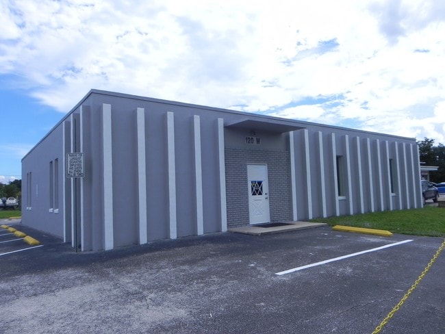
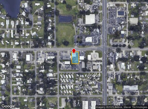
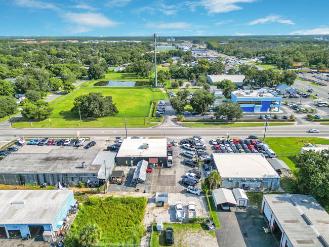
120 W Carroll St, Kissimmee, FL 34741

This Property Is For Sale
NEARBY LISTINGS FOR SALE OR LEASE
Property Detail
120 W Carroll St
Orlando-Kissimmee-Sanford, FL
Midway Park
10-25-29-4150-0001-0170
MIDWAY PARK PB 1 PG 130 LOTS 17 & 18 & N 40 FT LOTS 25 & 26 LESS N 13 FT FOR RD R/W
Officebuilding
Osceola
X
Florida
12097C0060G
17
2024
0.38 AC
2025
Osceola County
042201
Orlando
3,027 SF
DEMOGRAPHICS near 120 W Carroll St
1 Mile
3 Mile
5 Mile
2024 Total Population
13,926
104,204
241,180
2029 Population
16,693
121,330
276,123
Pop Growth 2024-2029
+ 19.87%
+ 16.44%
+ 14.49%
Average Age
38
38
38
2024 Total Households
4,967
35,467
79,373
HH Growth 2024-2029
+ 19.73%
+ 16.33%
+ 14.52%
Median Household Inc
$33,239
$49,627
$55,725
Avg Household Size
2.70
2.90
3.00
2024 Avg HH Vehicles
1.00
2.00
2.00
Median Home Value
$195,103
$265,734
$273,507
Median Year Built
1996
1993
1996
Nearby Places
- Restaurants
- Banks
- Shops
- Fitness
- Groceries
PUBLIC TRANSPORTATION
COMMUTER RAIL
Tupperware (SunRail - Florida Department of Transportation)
DRIVE
WALK
Distance
Tupperware (SunRail - Florida Department of Transportation)
5 min
2.2 mi
Kissimmee Amtrak Station (Silver Meteor - Amtrak, Silver Star - Amtrak, SunRail - Amtrak)
DRIVE
WALK
Distance
Kissimmee Amtrak Station (Silver Meteor - Amtrak, Silver Star - Amtrak, SunRail - Amtrak)
5 min
2.4 mi
AIRPORT
Orlando International
DRIVE
WALK
Distance
Orlando International
22 min
15.4 mi
Freight Ports
Port Canaveral
DRIVE
WALK
Distance
Port Canaveral
69 min
57.1 mi
Nearby Properties
Address
Land Use
TOTAL SIZE
Lot Size
Zoning
Address
Land Use
TOTAL SIZE
Lot Size
Zoning
579,863 SF
25.98 AC
KHF
Address
Land Use
TOTAL SIZE
Lot Size
Zoning
678,089 SF
34.79 AC
P-D
Address
Land Use
TOTAL SIZE
Lot Size
Zoning
425,391 SF
63.04 AC
Address
Land Use
TOTAL SIZE
Lot Size
Zoning
387,298 SF
19.17 AC
KMPU
Address
Land Use
TOTAL SIZE
Lot Size
Zoning
426,324 SF
25.52 AC
KRC2
Address
Land Use
TOTAL SIZE
Lot Size
Zoning
579,214 SF
27.67 AC
P-D
Address
Land Use
TOTAL SIZE
Lot Size
Zoning
475,697 SF
21.04 AC
OPD
Address
Land Use
TOTAL SIZE
Lot Size
Zoning
351,658 SF
31.52 AC
OPD
Address
Land Use
TOTAL SIZE
Lot Size
Zoning
360,431 SF
34.06 AC
KRPU
Address
Land Use
TOTAL SIZE
Lot Size
Zoning
449,570 SF
15.34 AC
OPD
Address
Land Use
TOTAL SIZE
Lot Size
Zoning
305,166 SF
30.36 AC
KMPU
Address
Land Use
TOTAL SIZE
Lot Size
Zoning
334,569 SF
11.82 AC
Address
Land Use
TOTAL SIZE
Lot Size
Zoning
416,762 SF
99.87 AC
KCF
Address
Land Use
TOTAL SIZE
Lot Size
Zoning
393,815 SF
17.89 AC
OPD
Address
Land Use
TOTAL SIZE
Lot Size
Zoning
379,943 SF
14.07 AC
OCT
Address
Land Use
TOTAL SIZE
Lot Size
Zoning
285,040 SF
31.45 AC
OPD
Address
Land Use
TOTAL SIZE
Lot Size
Zoning
382,006 SF
12.38 AC
OPD
Address
Land Use
TOTAL SIZE
Lot Size
Zoning
330,113 SF
21.83 AC
KSRP
Address
Land Use
TOTAL SIZE
Lot Size
Zoning
281,141 SF
7.36 AC
KOS
Address
Land Use
TOTAL SIZE
Lot Size
Zoning
286,320 SF
27.06 AC
Address
Land Use
TOTAL SIZE
Lot Size
Zoning
298,788 SF
12.07 AC
KAE
Address
Land Use
TOTAL SIZE
Lot Size
Zoning
667,892 SF
14.16 AC
P-D
Address
Land Use
TOTAL SIZE
Lot Size
Zoning
331,236 SF
21.86 AC
KMPU
Address
Land Use
TOTAL SIZE
Lot Size
Zoning
327,565 SF
13.88 AC
OPD
Address
Land Use
TOTAL SIZE
Lot Size
Zoning
220,535 SF
10.23 AC
KRA2
Address
Land Use
TOTAL SIZE
Lot Size
Zoning
395,563 SF
27.81 AC
P-D
Address
Land Use
TOTAL SIZE
Lot Size
Zoning
296,645 SF
14.65 AC
Address
Land Use
TOTAL SIZE
Lot Size
Zoning
366,024 SF
19.19 AC
KRC1
Address
Land Use
TOTAL SIZE
Lot Size
Zoning
351,537 SF
44.58 AC
OPD
Address
Land Use
TOTAL SIZE
Lot Size
Zoning
267,771 SF
7.09 AC
OPD
The World's #1 Commercial Real Estate Marketplace
Connect with us
© 2025 CoStar Group
The information above has been obtained from sources believed reliable. While we do not doubt its accuracy we have not verified it and make no guarantee, warranty or representation about it. It is your responsibility to independently confirm its accuracy and completeness. Any projections, opinions, assumptions, or estimates used are for example only and do not represent the current or future performance of the property. The value of this transaction to you depends on tax and other factors which should be evaluated by your tax, financial, and legal advisors. You and your advisors should conduct a careful, independent investigation of the property to determine to your satisfaction the suitability of the property for your needs.