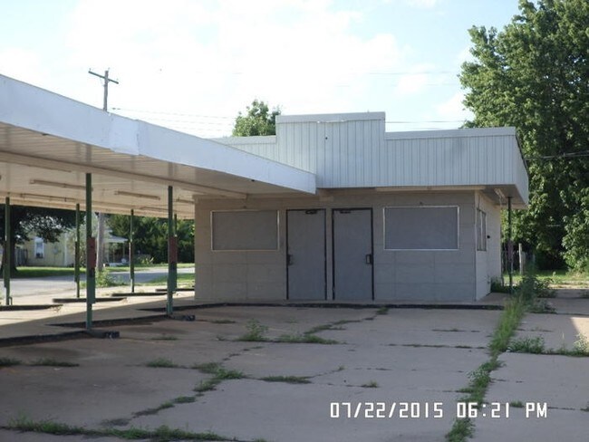
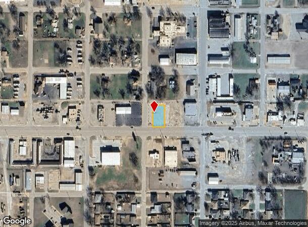
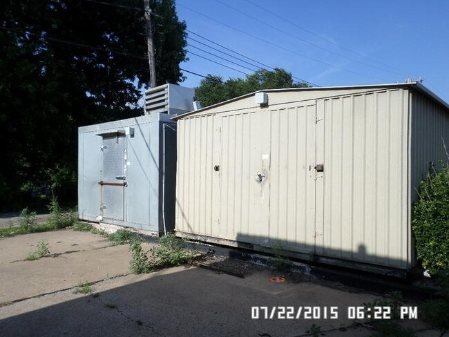
Property Record
120 W Russworm Dr, Watonga, OK 73772
NEARBY LISTINGS FOR SALE OR LEASE
-
-
View all Watonga listings for sale on LoopNet.com
Property Detail
120 W Russworm Dr
Other Market Areas
Watonga City
0125-00-090-007-0-000-00
BLK 90 W/2 OF 8 & ALL L7 WATONGA CITY 1527-698 WD 3/13/23 1398-28 WD 8/5/19 1350-319 GWD 8-2-18 1014-481 WD 7-7-09 744-20 AFF
Commercialacreage
Blaine
2024
Oklahoma
2025
7
958900
0.24 AC
3,040 SF
Oklahoma West Area
DEMOGRAPHICS near 120 W Russworm Dr
1 Mile
3 Mile
5 Mile
2024 Total Population
2,628
3,468
3,609
2029 Population
2,629
3,440
3,566
Pop Growth 2024-2029
+ 0.04%
(0.81%)
(1.19%)
Average Age
39
40
40
2024 Total Households
1,105
1,417
1,471
HH Growth 2024-2029
(0.63%)
(1.41%)
(1.77%)
Median Household Inc
$42,117
$44,254
$44,975
Avg Household Size
2.40
2.40
2.40
2024 Avg HH Vehicles
2.00
2.00
2.00
Median Home Value
$78,520
$98,714
$106,000
Median Year Built
1965
1968
1969
Nearby Places
Map Layers
Map Styles
 Street
 Aerial
- Restaurants
- Banks
- Shops
- Fitness
- Groceries
SALE & LEASE HISTORY
LISTING DATE
SALE/LEASE

Sep 24, 2016
For Sale
Nearby Properties
Address
Land Use
TOTAL SIZE
Lot Size
Zoning
Address
Land Use
TOTAL SIZE
Lot Size
Zoning
0.16 AC
C1
Address
Land Use
TOTAL SIZE
Lot Size
Zoning
142,210 SF
26.51 AC
C1
Address
Land Use
TOTAL SIZE
Lot Size
Zoning
7,638 SF
19.11 AC
CR
Address
Land Use
TOTAL SIZE
Lot Size
Zoning
6,000 SF
3.06 AC
C1
Address
Land Use
TOTAL SIZE
Lot Size
Zoning
5,155 SF
0.96 AC
C1
Address
Land Use
TOTAL SIZE
Lot Size
Zoning
1,176 SF
1.94 AC
C1
Address
Land Use
TOTAL SIZE
Lot Size
Zoning
748 SF
0.80 AC
C1
Address
Land Use
TOTAL SIZE
Lot Size
Zoning
12,524 SF
1.10 AC
C1
Address
Land Use
TOTAL SIZE
Lot Size
Zoning
10,968 SF
1.07 AC
C1
Address
Land Use
TOTAL SIZE
Lot Size
Zoning
11,800 SF
3.30 AC
C1
Address
Land Use
TOTAL SIZE
Lot Size
Zoning
3,473 SF
0.48 AC
R1
Address
Land Use
TOTAL SIZE
Lot Size
Zoning
2,900 SF
1.42 AC
C1
Address
Land Use
TOTAL SIZE
Lot Size
Zoning
5.58 AC
C1
Address
Land Use
TOTAL SIZE
Lot Size
Zoning
30,000 SF
3.68 AC
C1
Address
Land Use
TOTAL SIZE
Lot Size
Zoning
400 SF
1.13 AC
C1
Address
Land Use
TOTAL SIZE
Lot Size
Zoning
240 SF
0.48 AC
C1
Address
Land Use
TOTAL SIZE
Lot Size
Zoning
1,447 SF
0.64 AC
C1
Address
Land Use
TOTAL SIZE
Lot Size
Zoning
240 SF
0.16 AC
C1
Address
Land Use
TOTAL SIZE
Lot Size
Zoning
3,000 SF
2 AC
R1
Address
Land Use
TOTAL SIZE
Lot Size
Zoning
5,490 SF
0.74 AC
C1
Address
Land Use
TOTAL SIZE
Lot Size
Zoning
1,240 SF
0.48 AC
R1
Address
Land Use
TOTAL SIZE
Lot Size
Zoning
200 SF
0.48 AC
C1
Address
Land Use
TOTAL SIZE
Lot Size
Zoning
1,134 SF
3.67 AC
C1
Address
Land Use
TOTAL SIZE
Lot Size
Zoning
888 SF
1.85 AC
C1
Address
Land Use
TOTAL SIZE
Lot Size
Zoning
3,141 SF
3.55 AC
C1
Address
Land Use
TOTAL SIZE
Lot Size
Zoning
3,750 SF
0.42 AC
C1
Address
Land Use
TOTAL SIZE
Lot Size
Zoning
7,500 SF
2 AC
C1
Address
Land Use
TOTAL SIZE
Lot Size
Zoning
7,680 SF
0.60 AC
C1
The World's #1 Commercial Real Estate Marketplace
Connect with us
© 2025 CoStar Group
The information above has been obtained from sources believed reliable. While we do not doubt its accuracy we have not verified it and make no guarantee, warranty or representation about it. It is your responsibility to independently confirm its accuracy and completeness. Any projections, opinions, assumptions, or estimates used are for example only and do not represent the current or future performance of the property. The value of this transaction to you depends on tax and other factors which should be evaluated by your tax, financial, and legal advisors. You and your advisors should conduct a careful, independent investigation of the property to determine to your satisfaction the suitability of the property for your needs.