Property Record
1200 D St, Petaluma, CA 94952
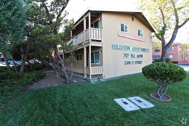


Property Detail
1200 D St
008-480-004
TWP 04N RGE 07W SEC 04 QTR SW4NW4
Apartment
Sonoma
CITYPE
California
B and X Area of moderate flood hazard, usually the area between the limits of the 100-year and 500-year floods.
1.34 AC
2025
Greater Petaluma
2025
North Bay/Santa Rosa
150800
Santa Rosa-Petaluma, CA
8,092 SF
NEARBY LISTINGS FOR SALE OR LEASE
DEMOGRAPHICS near 1200 D St
1 mile
3 mile
5 mile
2025 Total Population
11,834
54,812
66,595
2030 Population
11,839
54,795
66,258
Pop Growth 2025-2030
+ 0.04%
(0.03%)
(0.51%)
Average Age
45
44
44
2025 Total Households
4,948
21,548
25,955
HH Growth 2025-2030
+ 0.08%
+ 0.01%
(0.48%)
Median Household Inc
$117,992
$107,255
$112,508
Avg Household Size
2.30
2.50
2.50
2025 Avg HH Vehicles
2.00
2.00
2.00
Median Home Value
$1,043,848
$828,097
$847,058
Median Year Built
1963
1976
1979
Nearby Places
Map Layers
Map Styles
 Street
 Aerial
Layers
 Traffic
 Biking
Places
Listings with unknown addresses are not visible on the map
- Restaurants
- Banks
- Shops
- Fitness
- Groceries
PUBLIC TRANSPORTATION
COMMUTER RAIL
Smart Petaluma Downtown (Main Line - Sonoma Marin Area Rail Transit)
Drive
Walk
Distance
Smart Petaluma Downtown (Main Line - Sonoma Marin Area Rail Transit)
4 min
1.4 mi
Smart Petaluma North (Main Line - Sonoma Marin Area Rail Transit)
Drive
Walk
Distance
Smart Petaluma North (Main Line - Sonoma Marin Area Rail Transit)
11 min
4.3 mi
AIRPORT
Charles M Schulz - Sonoma County
Drive
Walk
Distance
Charles M Schulz - Sonoma County
36 min
25.8 mi
Freight Ports
Port of Richmond
Drive
Walk
Distance
Port of Richmond
49 min
34.1 mi
SALE & LEASE HISTORY
LISTING DATE
SALE/LEASE

Nov 27, 2017
For Sale
Nearby Properties
Address
Land Use
TOTAL SIZE
Lot Size
Zoning
Address
Land Use
TOTAL SIZE
Lot Size
Zoning
0.76 AC
ML
Address
Land Use
TOTAL SIZE
Lot Size
Zoning
226,772 SF
8.05 AC
Address
Land Use
TOTAL SIZE
Lot Size
Zoning
38,083 SF
16.14 AC
Address
Land Use
TOTAL SIZE
Lot Size
Zoning
3,967 SF
5.03 AC
CITYPE
Address
Land Use
TOTAL SIZE
Lot Size
Zoning
150,025 SF
1.48 AC
Address
Land Use
TOTAL SIZE
Lot Size
Zoning
134,732 SF
2.05 AC
Address
Land Use
TOTAL SIZE
Lot Size
Zoning
165,541 SF
12.61 AC
Address
Land Use
TOTAL SIZE
Lot Size
Zoning
63,000 SF
5.40 AC
CITYPE
Address
Land Use
TOTAL SIZE
Lot Size
Zoning
137,270 SF
10.04 AC
Address
Land Use
TOTAL SIZE
Lot Size
Zoning
35,408 SF
2.66 AC
Address
Land Use
TOTAL SIZE
Lot Size
Zoning
82,704 SF
14.63 AC
CITYPE
Address
Land Use
TOTAL SIZE
Lot Size
Zoning
59,351 SF
14.53 AC
Address
Land Use
TOTAL SIZE
Lot Size
Zoning
32,000 SF
5.89 AC
PCD
Address
Land Use
TOTAL SIZE
Lot Size
Zoning
23,979 SF
5.85 AC
Address
Land Use
TOTAL SIZE
Lot Size
Zoning
72,576 SF
8.39 AC
Address
Land Use
TOTAL SIZE
Lot Size
Zoning
109,993 SF
2.31 AC
Address
Land Use
TOTAL SIZE
Lot Size
Zoning
195,837 SF
16.32 AC
PCD
Address
Land Use
TOTAL SIZE
Lot Size
Zoning
85,582 SF
2.61 AC
CITYPE
Address
Land Use
TOTAL SIZE
Lot Size
Zoning
83,109 SF
9.56 AC
Address
Land Use
TOTAL SIZE
Lot Size
Zoning
5,640 SF
7.31 AC
CITYPE
Address
Land Use
TOTAL SIZE
Lot Size
Zoning
73,279 SF
0.96 AC
MG
Address
Land Use
TOTAL SIZE
Lot Size
Zoning
70,110 SF
1.11 AC
CITYPE
Address
Land Use
TOTAL SIZE
Lot Size
Zoning
10,000 SF
16.50 AC
Address
Land Use
TOTAL SIZE
Lot Size
Zoning
94,000 SF
4.87 AC
Address
Land Use
TOTAL SIZE
Lot Size
Zoning
71,600 SF
9.78 AC
CITYPE
Address
Land Use
TOTAL SIZE
Lot Size
Zoning
185,841 SF
11.05 AC
ML
Address
Land Use
TOTAL SIZE
Lot Size
Zoning
93,700 SF
6.02 AC
ML
Address
Land Use
TOTAL SIZE
Lot Size
Zoning
4,608 SF
1.43 AC
CITYPE
Address
Land Use
TOTAL SIZE
Lot Size
Zoning
81,975 SF
5 AC
The World's #1 Commercial Real Estate Marketplace
Connect with us
© 2026 CoStar Group
The information above has been obtained from sources believed reliable. While we do not doubt its accuracy we have not verified it and make no guarantee, warranty or representation about it. It is your responsibility to independently confirm its accuracy and completeness. Any projections, opinions, assumptions, or estimates used are for example only and do not represent the current or future performance of the property. The value of this transaction to you depends on tax and other factors which should be evaluated by your tax, financial, and legal advisors. You and your advisors should conduct a careful, independent investigation of the property to determine to your satisfaction the suitability of the property for your needs.