Property Record
1200 E Us Highway 169, Grand Rapids, MN 55744
Current Lease Availabilities
NEARBY LISTINGS FOR SALE OR LEASE
Property Detail
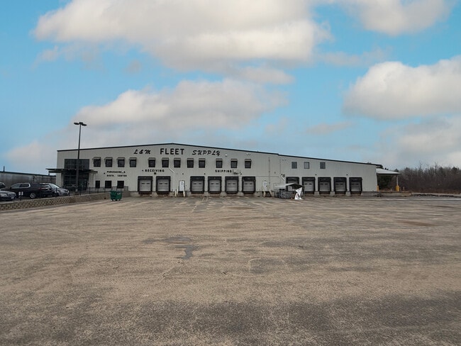
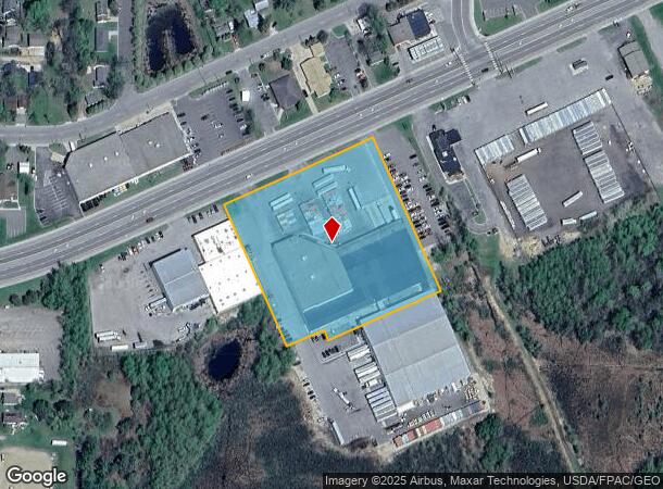
1200 E Us Highway 169
Grand Rapids, MN
Hoolihans Add. To Grand Rapids
93-480-0037
LT 3 LESS REV DESC 1 & LESS S 30FT OF W
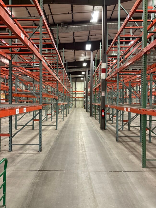
Warehouse
Itasca
X
Minnesota
27061C1662C
3
2025
3.68 AC
2024
Minnesota North Area
480902
Other Market Areas
37,704 SF
DEMOGRAPHICS near 1200 E Us Highway 169
1 Mile
3 Mile
5 Mile
2024 Total Population
3,626
11,661
15,516
2029 Population
3,646
11,705
15,562
Pop Growth 2024-2029
+ 0.55%
+ 0.38%
+ 0.30%
Average Age
39
42
42
2024 Total Households
1,574
4,933
6,475
HH Growth 2024-2029
+ 0.51%
+ 0.36%
+ 0.26%
Median Household Inc
$50,994
$55,597
$58,341
Avg Household Size
2.10
2.20
2.20
2024 Avg HH Vehicles
2.00
2.00
2.00
Median Home Value
$154,854
$181,128
$192,136
Median Year Built
1975
1979
1980
Nearby Places
Map Layers
Map Styles
 Street
 Aerial
- Restaurants
- Banks
- Shops
- Fitness
- Groceries
Nearby Properties
Address
Land Use
TOTAL SIZE
Lot Size
Zoning
Address
Land Use
TOTAL SIZE
Lot Size
Zoning
61,615 SF
2 AC
M
Address
Land Use
TOTAL SIZE
Lot Size
Zoning
158,658 SF
38.94 AC
M
Address
Land Use
TOTAL SIZE
Lot Size
Zoning
5,686 SF
132.01 AC
Address
Land Use
TOTAL SIZE
Lot Size
Zoning
44,062 SF
39.11 AC
M
Address
Land Use
TOTAL SIZE
Lot Size
Zoning
198,117 SF
18.90 AC
M
Address
Land Use
TOTAL SIZE
Lot Size
Zoning
118,940 SF
36.80 AC
M
Address
Land Use
TOTAL SIZE
Lot Size
Zoning
38,317 SF
7.19 AC
M
Address
Land Use
TOTAL SIZE
Lot Size
Zoning
45,170 SF
2.60 AC
M
Address
Land Use
TOTAL SIZE
Lot Size
Zoning
92,630 SF
40.42 AC
M
Address
Land Use
TOTAL SIZE
Lot Size
Zoning
32,222 SF
7.35 AC
Address
Land Use
TOTAL SIZE
Lot Size
Zoning
84,670 SF
6.22 AC
Address
Land Use
TOTAL SIZE
Lot Size
Zoning
36,890 SF
4.97 AC
M
Address
Land Use
TOTAL SIZE
Lot Size
Zoning
18,644 SF
7.60 AC
M
Address
Land Use
TOTAL SIZE
Lot Size
Zoning
128,378 SF
10.79 AC
M
Address
Land Use
TOTAL SIZE
Lot Size
Zoning
14,876 SF
1.76 AC
Address
Land Use
TOTAL SIZE
Lot Size
Zoning
13,262 SF
23.48 AC
M
Address
Land Use
TOTAL SIZE
Lot Size
Zoning
34,870 SF
14.01 AC
M
Address
Land Use
TOTAL SIZE
Lot Size
Zoning
68,789 SF
15.28 AC
M
Address
Land Use
TOTAL SIZE
Lot Size
Zoning
23,988 SF
36.34 AC
M
Address
Land Use
TOTAL SIZE
Lot Size
Zoning
15,500 SF
1.49 AC
Address
Land Use
TOTAL SIZE
Lot Size
Zoning
1.70 AC
M
Address
Land Use
TOTAL SIZE
Lot Size
Zoning
94,812 SF
9.52 AC
M
Address
Land Use
TOTAL SIZE
Lot Size
Zoning
16,422 SF
3.05 AC
M
Address
Land Use
TOTAL SIZE
Lot Size
Zoning
80,076 SF
9.89 AC
M
Address
Land Use
TOTAL SIZE
Lot Size
Zoning
6,954 SF
2.04 AC
M
Address
Land Use
TOTAL SIZE
Lot Size
Zoning
66,092 SF
9.82 AC
M
The World's #1 Commercial Real Estate Marketplace
Connect with us
© 2026 CoStar Group
The information above has been obtained from sources believed reliable. While we do not doubt its accuracy we have not verified it and make no guarantee, warranty or representation about it. It is your responsibility to independently confirm its accuracy and completeness. Any projections, opinions, assumptions, or estimates used are for example only and do not represent the current or future performance of the property. The value of this transaction to you depends on tax and other factors which should be evaluated by your tax, financial, and legal advisors. You and your advisors should conduct a careful, independent investigation of the property to determine to your satisfaction the suitability of the property for your needs.