Property Record
1200 Esplanade, Redondo Beach, CA 90277
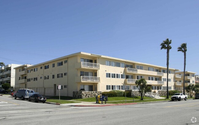


Property Detail
1200 Esplanade
7511-002-008
LOTS 10,11 AND 12 BLK 10 CLIFFTON AND LOT 8 BLK 10 TRACT # 2546
Multifamilydwelling
Los Angeles
RBRMD
California
B and X Area of moderate flood hazard, usually the area between the limits of the 100-year and 500-year floods.
10-12
2025
0.78 AC
2025
Redondo Beach
621326
Los Angeles
48,663 SF
Los Angeles-Long Beach-Glendale, CA
NEARBY LISTINGS FOR SALE OR LEASE
DEMOGRAPHICS near 1200 Esplanade
1 mile
3 mile
5 mile
2025 Total Population
19,346
136,193
343,073
2030 Population
19,497
135,938
341,445
Pop Growth 2025-2030
+ 0.78%
(0.19%)
(0.47%)
Average Age
45
43
43
2025 Total Households
9,230
55,487
132,237
HH Growth 2025-2030
+ 0.72%
(0.31%)
(0.63%)
Median Household Inc
$131,472
$136,476
$130,681
Avg Household Size
2.00
2.40
2.50
2025 Avg HH Vehicles
2.00
2.00
2.00
Median Home Value
$1,115,314
$1,111,273
$1,085,985
Median Year Built
1967
1965
1966
Nearby Places
Map Layers
Map Styles
 Street
 Aerial
Layers
 Traffic
 Biking
Places
Listings with unknown addresses are not visible on the map
- Restaurants
- Banks
- Shops
- Fitness
- Groceries
PUBLIC TRANSPORTATION
AIRPORT
Los Angeles International
Drive
Walk
Distance
Los Angeles International
20 min
9.6 mi
Long Beach (Daugherty Field)
Drive
Walk
Distance
Long Beach (Daugherty Field)
26 min
14.9 mi
Bob Hope
Drive
Walk
Distance
Bob Hope
52 min
35.8 mi
Freight Ports
Port of Los Angeles
Drive
Walk
Distance
Port of Los Angeles
27 min
13.0 mi
Nearby Properties
Address
Land Use
TOTAL SIZE
Lot Size
Zoning
Address
Land Use
TOTAL SIZE
Lot Size
Zoning
767,582 SF
13.62 AC
TOHHM
Address
Land Use
TOTAL SIZE
Lot Size
Zoning
1,261,764 SF
26.51 AC
TOMI-LT
Address
Land Use
TOTAL SIZE
Lot Size
Zoning
205,797 SF
4.10 AC
HBR3*
Address
Land Use
TOTAL SIZE
Lot Size
Zoning
267,131 SF
12.10 AC
TOHHM
Address
Land Use
TOTAL SIZE
Lot Size
Zoning
297,420 SF
6.65 AC
TOHC-CTR
Address
Land Use
TOTAL SIZE
Lot Size
Zoning
173,186 SF
2.07 AC
HBR3*
Address
Land Use
TOTAL SIZE
Lot Size
Zoning
202,924 SF
6.15 AC
TOHC-CTR
Address
Land Use
TOTAL SIZE
Lot Size
Zoning
257,723 SF
4.06 AC
TOCC-GEN
Address
Land Use
TOTAL SIZE
Lot Size
Zoning
405,352 SF
7.70 AC
TOHC-CTR
Address
Land Use
TOTAL SIZE
Lot Size
Zoning
103,228 SF
1.19 AC
TORR-HI
Address
Land Use
TOTAL SIZE
Lot Size
Zoning
75,054 SF
1.17 AC
RBRMD
Address
Land Use
TOTAL SIZE
Lot Size
Zoning
176,514 SF
3.74 AC
TORR-MH
Address
Land Use
TOTAL SIZE
Lot Size
Zoning
21.49 AC
RBP-GP
Address
Land Use
TOTAL SIZE
Lot Size
Zoning
147,414 SF
3.28 AC
TORR-MH
Address
Land Use
TOTAL SIZE
Lot Size
Zoning
81,328 SF
3.13 AC
TOCC-GEN
Address
Land Use
TOTAL SIZE
Lot Size
Zoning
308,439 SF
19.05 AC
TOHC-GEN
Address
Land Use
TOTAL SIZE
Lot Size
Zoning
318,052 SF
8.47 AC
TOHC-CTR
Address
Land Use
TOTAL SIZE
Lot Size
Zoning
121,931 SF
6.26 AC
TOHC-CTR
Address
Land Use
TOTAL SIZE
Lot Size
Zoning
287,730 SF
10.33 AC
TOHC-CTR
Address
Land Use
TOTAL SIZE
Lot Size
Zoning
438,614 SF
4.43 AC
RBW/W-VCS
Address
Land Use
TOTAL SIZE
Lot Size
Zoning
728,334 SF
11.44 AC
TOMI-BP
Address
Land Use
TOTAL SIZE
Lot Size
Zoning
76,807 SF
1.76 AC
TOHHM
Address
Land Use
TOTAL SIZE
Lot Size
Zoning
344,459 SF
2.05 AC
TOHC-CTR
Address
Land Use
TOTAL SIZE
Lot Size
Zoning
309,453 SF
16.87 AC
TOHC-CTR
Address
Land Use
TOTAL SIZE
Lot Size
Zoning
93,061 SF
2.30 AC
TOCC
Address
Land Use
TOTAL SIZE
Lot Size
Zoning
326,897 SF
3.33 AC
TOHHM
The World's #1 Commercial Real Estate Marketplace
Connect with us
© 2026 CoStar Group
The information above has been obtained from sources believed reliable. While we do not doubt its accuracy we have not verified it and make no guarantee, warranty or representation about it. It is your responsibility to independently confirm its accuracy and completeness. Any projections, opinions, assumptions, or estimates used are for example only and do not represent the current or future performance of the property. The value of this transaction to you depends on tax and other factors which should be evaluated by your tax, financial, and legal advisors. You and your advisors should conduct a careful, independent investigation of the property to determine to your satisfaction the suitability of the property for your needs.