Property Record
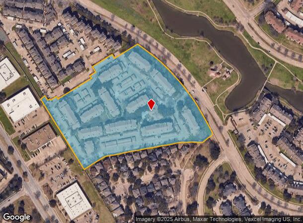
1200 Hidden Rdg, Irving, TX 75038

NEARBY LISTINGS FOR SALE OR LEASE
-
-
View all Irving listings for sale on LoopNet.com
Property Detail
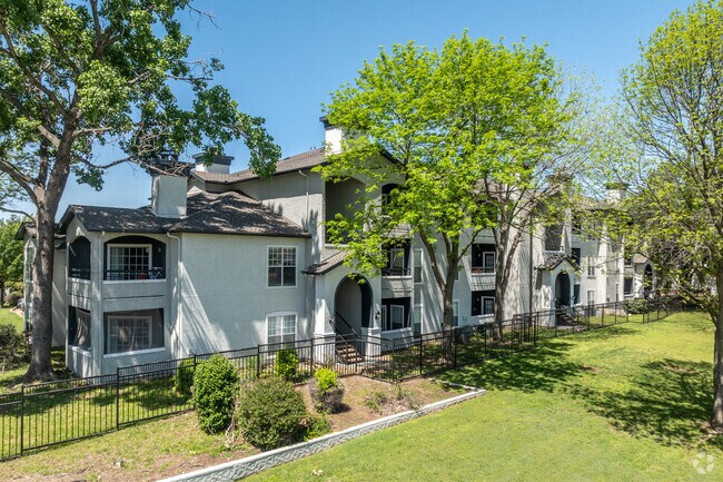
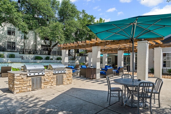
1200 Hidden Rdg
Dallas-Fort Worth-Arlington, TX
Bell Tower 1 & 2 Amnd
32023410000020000
BELL TOWER 1 & 2 AMND PT LT 2 ACS 11.861 INT202200119914 DD04282022 CO-DC 0234100000200 1CI02341000
Apartment
Dallas
X
Texas
48113C0165K
2
2024
11.86 AC
2025
Las Colinas
014320
Dallas/Ft Worth
345,151 SF
DEMOGRAPHICS near 1200 Hidden Rdg
1 Mile
3 Mile
5 Mile
2024 Total Population
8,828
114,455
233,509
2029 Population
8,730
113,299
232,824
Pop Growth 2024-2029
(1.11%)
(1.01%)
(0.29%)
Average Age
30
34
34
2024 Total Households
3,421
46,829
90,614
HH Growth 2024-2029
(1.40%)
(1.01%)
(0.48%)
Median Household Inc
$89,482
$80,495
$73,508
Avg Household Size
2.50
2.40
2.50
2024 Avg HH Vehicles
1.00
2.00
2.00
Median Home Value
$669,355
$342,917
$291,338
Median Year Built
1988
1989
1989
Nearby Places
Map Layers
Map Styles
 Street
 Aerial
- Restaurants
- Banks
- Shops
- Fitness
- Groceries
PUBLIC TRANSPORTATION
TRANSIT/SUBWAY
North Lake College (DART LIGHT RAIL - ORANGE LINE - Dallas Area Rapid Transit (DART), Orange Line - Dallas Area Rapid Transit (DART))
DRIVE
WALK
Distance
North Lake College (DART LIGHT RAIL - ORANGE LINE - Dallas Area Rapid Transit (DART), Orange Line - Dallas Area Rapid Transit (DART))
2 min
7 min
0.4 mi
Hidden Ridge Station (DART LIGHT RAIL - GREEN LINE - Dallas Area Rapid Transit (DART), DART LIGHT RAIL - ORANGE LINE - Dallas Area Rapid Transit (DART))
DRIVE
WALK
Distance
Hidden Ridge Station (DART LIGHT RAIL - GREEN LINE - Dallas Area Rapid Transit (DART), DART LIGHT RAIL - ORANGE LINE - Dallas Area Rapid Transit (DART))
3 min
19 min
1.0 mi
COMMUTER RAIL
Downtown Irving/Heritage Crossing Station (TRINITY RAILWAY - Dallas Area Rapid Transit (DART), Trinity Railway Express - Dallas Area Rapid Transit (DART))
DRIVE
WALK
Distance
Downtown Irving/Heritage Crossing Station (TRINITY RAILWAY - Dallas Area Rapid Transit (DART), Trinity Railway Express - Dallas Area Rapid Transit (DART))
13 min
5.4 mi
West Irving (TRINITY RAILWAY - Dallas Area Rapid Transit (DART), Trinity Railway Express - Dallas Area Rapid Transit (DART))
DRIVE
WALK
Distance
West Irving (TRINITY RAILWAY - Dallas Area Rapid Transit (DART), Trinity Railway Express - Dallas Area Rapid Transit (DART))
15 min
7.9 mi
AIRPORT
Dallas-Fort Worth International
DRIVE
WALK
Distance
Dallas-Fort Worth International
16 min
10.1 mi
Dallas Love Field
DRIVE
WALK
Distance
Dallas Love Field
19 min
11.2 mi
Freight Ports
Port of Shreveport
DRIVE
WALK
Distance
Port of Shreveport
229 min
210.4 mi
Nearby Properties
Address
Land Use
TOTAL SIZE
Lot Size
Zoning
Address
Land Use
TOTAL SIZE
Lot Size
Zoning
1,066,464 SF
4.10 AC
Z392
Address
Land Use
TOTAL SIZE
Lot Size
Zoning
2,496,382 SF
256.13 AC
Z392
Address
Land Use
TOTAL SIZE
Lot Size
Zoning
962,320 SF
23.81 AC
Z198
Address
Land Use
TOTAL SIZE
Lot Size
Zoning
1,520,000 SF
34.76 AC
Z243
Address
Land Use
TOTAL SIZE
Lot Size
Zoning
850,390 SF
16.12 AC
Address
Land Use
TOTAL SIZE
Lot Size
Zoning
565,728 SF
21.07 AC
Address
Land Use
TOTAL SIZE
Lot Size
Zoning
346,000 SF
15.52 AC
Z198
Address
Land Use
TOTAL SIZE
Lot Size
Zoning
1,673,367 SF
17.29 AC
Z243
Address
Land Use
TOTAL SIZE
Lot Size
Zoning
1,763,184 SF
11.25 AC
Z393
Address
Land Use
TOTAL SIZE
Lot Size
Zoning
379,000 SF
9.81 AC
Z243
Address
Land Use
TOTAL SIZE
Lot Size
Zoning
674,817 SF
15.35 AC
Z84
Address
Land Use
TOTAL SIZE
Lot Size
Zoning
631,947 SF
11.95 AC
Z393
Address
Land Use
TOTAL SIZE
Lot Size
Zoning
689,004 SF
25.23 AC
Z243
Address
Land Use
TOTAL SIZE
Lot Size
Zoning
654,829 SF
9.78 AC
Z243
Address
Land Use
TOTAL SIZE
Lot Size
Zoning
735,258 SF
4.83 AC
Z392
Address
Land Use
TOTAL SIZE
Lot Size
Zoning
471,524 SF
20.34 AC
Z84
Address
Land Use
TOTAL SIZE
Lot Size
Zoning
1,144,971 SF
19.43 AC
Z84
Address
Land Use
TOTAL SIZE
Lot Size
Zoning
729,870 SF
24.42 AC
Z393
Address
Land Use
TOTAL SIZE
Lot Size
Zoning
608,308 SF
7.26 AC
Z198
Address
Land Use
TOTAL SIZE
Lot Size
Zoning
464,996 SF
18.43 AC
SP2
Address
Land Use
TOTAL SIZE
Lot Size
Zoning
671,349 SF
5.31 AC
Z243
Address
Land Use
TOTAL SIZE
Lot Size
Zoning
724,643 SF
5.15 AC
Z243
Address
Land Use
TOTAL SIZE
Lot Size
Zoning
347,008 SF
9.54 AC
Z57
Address
Land Use
TOTAL SIZE
Lot Size
Zoning
1,219,380 SF
16.01 AC
Z243
Address
Land Use
TOTAL SIZE
Lot Size
Zoning
457,322 SF
22.98 AC
Z243
Address
Land Use
TOTAL SIZE
Lot Size
Zoning
543,965 SF
8.02 AC
Z323
Address
Land Use
TOTAL SIZE
Lot Size
Zoning
717,650 SF
28.32 AC
Z243
Address
Land Use
TOTAL SIZE
Lot Size
Zoning
588,626 SF
6.55 AC
Z84
Address
Land Use
TOTAL SIZE
Lot Size
Zoning
482,696 SF
5.39 AC
Z86
Address
Land Use
TOTAL SIZE
Lot Size
Zoning
529,640 SF
5.13 AC
Z393
The World's #1 Commercial Real Estate Marketplace
Connect with us
© 2026 CoStar Group
The information above has been obtained from sources believed reliable. While we do not doubt its accuracy we have not verified it and make no guarantee, warranty or representation about it. It is your responsibility to independently confirm its accuracy and completeness. Any projections, opinions, assumptions, or estimates used are for example only and do not represent the current or future performance of the property. The value of this transaction to you depends on tax and other factors which should be evaluated by your tax, financial, and legal advisors. You and your advisors should conduct a careful, independent investigation of the property to determine to your satisfaction the suitability of the property for your needs.