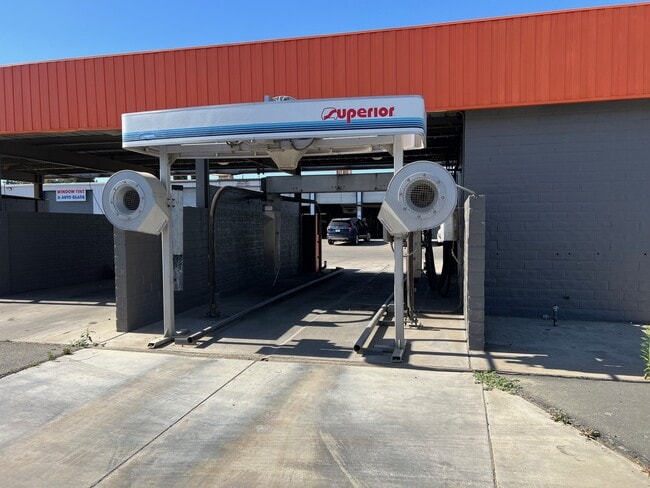
Property Record
9301 W Airport Dr, Visalia, CA 93277
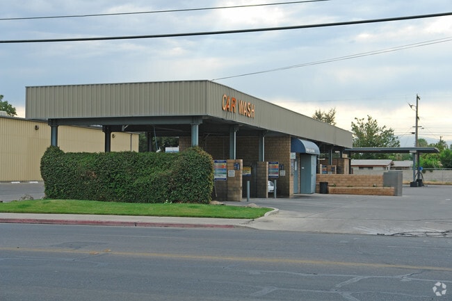

This Property Is For Sale
NEARBY LISTINGS FOR SALE OR LEASE
-
-
View all Visalia listings for sale on LoopNet.com
Property Detail
9301 W Airport Dr
098-161-016-000
PAR 1 PAR MAP 3415 V35 P17 PM
Miscellaneous
Tulare
X
California
06107C0934E
0.47 AC
2024
North Visalia
2025
Visalia/Porterville
001305
Visalia-Porterville, CA
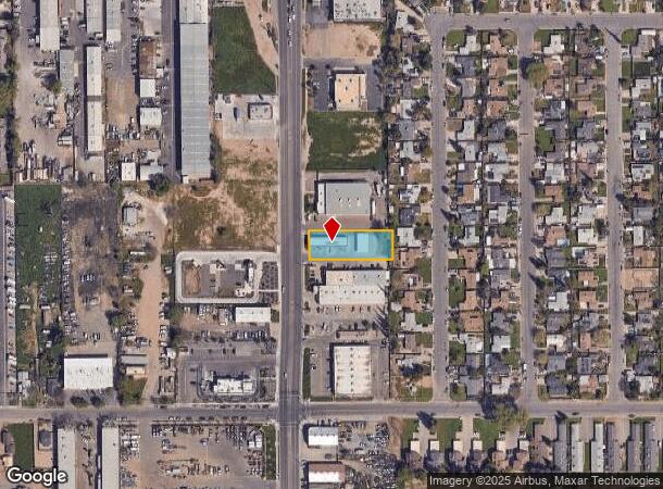
DEMOGRAPHICS near 9301 W Airport Dr
1 Mile
3 Mile
5 Mile
2024 Total Population
14,453
97,106
169,473
2029 Population
14,916
100,719
175,783
Pop Growth 2024-2029
+ 3.20%
+ 3.72%
+ 3.72%
Average Age
34
35
36
2024 Total Households
4,391
30,961
54,786
HH Growth 2024-2029
+ 3.23%
+ 3.68%
+ 3.71%
Median Household Inc
$52,803
$65,432
$68,399
Avg Household Size
3.20
3.10
3.00
2024 Avg HH Vehicles
2.00
2.00
2.00
Median Home Value
$226,132
$285,410
$292,618
Median Year Built
1983
1984
1986
Nearby Places
Map Layers
Map Styles
 Street
 Aerial
- Restaurants
- Banks
- Shops
- Fitness
- Groceries
PUBLIC TRANSPORTATION
AIRPORT
Fresno Yosemite International
DRIVE
WALK
Distance
Fresno Yosemite International
59 min
46.1 mi
Nearby Properties
Address
Land Use
TOTAL SIZE
Lot Size
Zoning
Address
Land Use
TOTAL SIZE
Lot Size
Zoning
393,784 SF
17.79 AC
CR
Address
Land Use
TOTAL SIZE
Lot Size
Zoning
47,768 SF
6.76 AC
RM2
Address
Land Use
TOTAL SIZE
Lot Size
Zoning
123.41 AC
Address
Land Use
TOTAL SIZE
Lot Size
Zoning
82.35 AC
QP
Address
Land Use
TOTAL SIZE
Lot Size
Zoning
146,890 SF
11.73 AC
CCM
Address
Land Use
TOTAL SIZE
Lot Size
Zoning
61,587 SF
0.43 AC
PA
Address
Land Use
TOTAL SIZE
Lot Size
Zoning
4.24 AC
Address
Land Use
TOTAL SIZE
Lot Size
Zoning
185,883 SF
9.97 AC
CSO
Address
Land Use
TOTAL SIZE
Lot Size
Zoning
56,384 SF
9.14 AC
Address
Land Use
TOTAL SIZE
Lot Size
Zoning
126,532 SF
8.63 AC
RM2
Address
Land Use
TOTAL SIZE
Lot Size
Zoning
47,242 SF
3.94 AC
QP-PA
Address
Land Use
TOTAL SIZE
Lot Size
Zoning
54,674 SF
1.26 AC
CDT
Address
Land Use
TOTAL SIZE
Lot Size
Zoning
134,055 SF
3.49 AC
CDT
Address
Land Use
TOTAL SIZE
Lot Size
Zoning
5.85 AC
RM2
Address
Land Use
TOTAL SIZE
Lot Size
Zoning
82,200 SF
6.29 AC
CSO
Address
Land Use
TOTAL SIZE
Lot Size
Zoning
87,160 SF
0.75 AC
PA
Address
Land Use
TOTAL SIZE
Lot Size
Zoning
69,120 SF
5.23 AC
CR
Address
Land Use
TOTAL SIZE
Lot Size
Zoning
83,011 SF
4.46 AC
QP
Address
Land Use
TOTAL SIZE
Lot Size
Zoning
88,589 SF
7.98 AC
CR
Address
Land Use
TOTAL SIZE
Lot Size
Zoning
133,910 SF
14.35 AC
CSO
Address
Land Use
TOTAL SIZE
Lot Size
Zoning
1.07 AC
CDT
Address
Land Use
TOTAL SIZE
Lot Size
Zoning
8,319 SF
19.68 AC
Address
Land Use
TOTAL SIZE
Lot Size
Zoning
103,550 SF
8.63 AC
CR
Address
Land Use
TOTAL SIZE
Lot Size
Zoning
47,035 SF
3.29 AC
CCM
Address
Land Use
TOTAL SIZE
Lot Size
Zoning
6.42 AC
CN
Address
Land Use
TOTAL SIZE
Lot Size
Zoning
32,741 SF
1.87 AC
Address
Land Use
TOTAL SIZE
Lot Size
Zoning
7,311 SF
2.31 AC
The World's #1 Commercial Real Estate Marketplace
Connect with us
© 2025 CoStar Group
The information above has been obtained from sources believed reliable. While we do not doubt its accuracy we have not verified it and make no guarantee, warranty or representation about it. It is your responsibility to independently confirm its accuracy and completeness. Any projections, opinions, assumptions, or estimates used are for example only and do not represent the current or future performance of the property. The value of this transaction to you depends on tax and other factors which should be evaluated by your tax, financial, and legal advisors. You and your advisors should conduct a careful, independent investigation of the property to determine to your satisfaction the suitability of the property for your needs.