Property Record
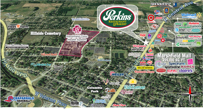
1200 N Central Ave, Marshfield, WI 54449


NEARBY LISTINGS FOR SALE OR LEASE
Property Detail
1200 N Central Ave
Wisconsin Rapids-Marshfield, WI
Northside Subd
3303809
C-MFLD NORTHSIDE SUBD LOTS 7, 8, 9, 10, 11 & THE E 1/2 OF LOT 12, EXC COM NE COR LOT 8, SLWY 32', NWLY PPD TO CENTRAL AVE 64.
Commercialnec
Wood
X
Wisconsin
55073C0795F
12,8
2024
1.75 AC
2024
Wausau/Stevens Point
010600
Other Market Areas
DEMOGRAPHICS near 1200 N Central Ave
1 Mile
3 Mile
5 Mile
2024 Total Population
6,014
20,708
24,324
2029 Population
6,000
20,688
24,341
Pop Growth 2024-2029
(0.23%)
(0.10%)
+ 0.07%
Average Age
42
42
42
2024 Total Households
2,953
9,448
10,864
HH Growth 2024-2029
(0.24%)
(0.08%)
+ 0.06%
Median Household Inc
$43,335
$53,323
$57,203
Avg Household Size
2.00
2.10
2.20
2024 Avg HH Vehicles
2.00
2.00
2.00
Median Home Value
$141,390
$164,244
$174,003
Median Year Built
1972
1972
1973
Nearby Places
Map Layers
Map Styles
 Street
 Aerial
- Restaurants
- Banks
- Shops
- Fitness
- Groceries
PUBLIC TRANSPORTATION
AIRPORT
Central Wisconsin
DRIVE
WALK
Distance
Central Wisconsin
52 min
31.4 mi
SALE & LEASE HISTORY
LISTING DATE
SALE/LEASE

May 18, 2021
For Sale
Nearby Properties
Address
Land Use
TOTAL SIZE
Lot Size
Zoning
Address
Land Use
TOTAL SIZE
Lot Size
Zoning
7.45 AC
Address
Land Use
TOTAL SIZE
Lot Size
Zoning
9.11 AC
Address
Land Use
TOTAL SIZE
Lot Size
Zoning
28.57 AC
Address
Land Use
TOTAL SIZE
Lot Size
Zoning
Address
Land Use
TOTAL SIZE
Lot Size
Zoning
10.95 AC
Address
Land Use
TOTAL SIZE
Lot Size
Zoning
Address
Land Use
TOTAL SIZE
Lot Size
Zoning
Address
Land Use
TOTAL SIZE
Lot Size
Zoning
20.74 AC
Address
Land Use
TOTAL SIZE
Lot Size
Zoning
19.18 AC
Address
Land Use
TOTAL SIZE
Lot Size
Zoning
5.99 AC
Address
Land Use
TOTAL SIZE
Lot Size
Zoning
13.02 AC
Address
Land Use
TOTAL SIZE
Lot Size
Zoning
19.13 AC
Address
Land Use
TOTAL SIZE
Lot Size
Zoning
7.73 AC
Address
Land Use
TOTAL SIZE
Lot Size
Zoning
8.65 AC
Address
Land Use
TOTAL SIZE
Lot Size
Zoning
Address
Land Use
TOTAL SIZE
Lot Size
Zoning
41.60 AC
Address
Land Use
TOTAL SIZE
Lot Size
Zoning
7.41 AC
Address
Land Use
TOTAL SIZE
Lot Size
Zoning
9.86 AC
Address
Land Use
TOTAL SIZE
Lot Size
Zoning
22.90 AC
Address
Land Use
TOTAL SIZE
Lot Size
Zoning
Address
Land Use
TOTAL SIZE
Lot Size
Zoning
3.55 AC
Address
Land Use
TOTAL SIZE
Lot Size
Zoning
7.18 AC
Address
Land Use
TOTAL SIZE
Lot Size
Zoning
Address
Land Use
TOTAL SIZE
Lot Size
Zoning
Address
Land Use
TOTAL SIZE
Lot Size
Zoning
Address
Land Use
TOTAL SIZE
Lot Size
Zoning
Address
Land Use
TOTAL SIZE
Lot Size
Zoning
12.31 AC
Address
Land Use
TOTAL SIZE
Lot Size
Zoning
16.08 AC
Address
Land Use
TOTAL SIZE
Lot Size
Zoning
Address
Land Use
TOTAL SIZE
Lot Size
Zoning
27.65 AC
The World's #1 Commercial Real Estate Marketplace
Connect with us
© 2026 CoStar Group
The information above has been obtained from sources believed reliable. While we do not doubt its accuracy we have not verified it and make no guarantee, warranty or representation about it. It is your responsibility to independently confirm its accuracy and completeness. Any projections, opinions, assumptions, or estimates used are for example only and do not represent the current or future performance of the property. The value of this transaction to you depends on tax and other factors which should be evaluated by your tax, financial, and legal advisors. You and your advisors should conduct a careful, independent investigation of the property to determine to your satisfaction the suitability of the property for your needs.