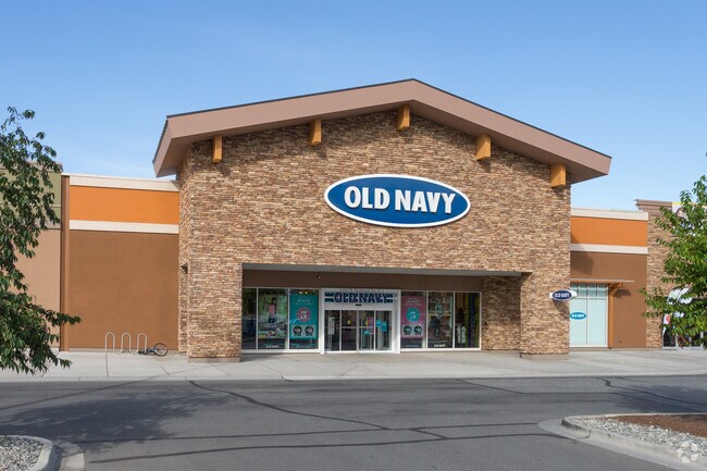
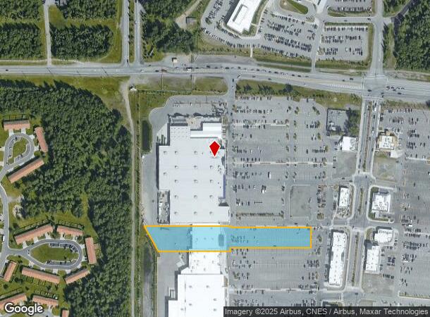
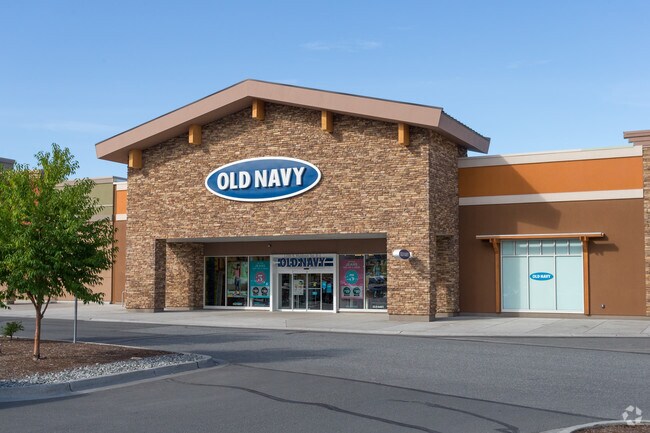
Property Record
1200 N Muldoon Rd, Anchorage, AK 99504
NEARBY LISTINGS FOR SALE OR LEASE
Property Detail
1200 N Muldoon Rd
00644126000
GATEWAY TR A FRAGMENT LT 2A-1
Regionalshoppingcenterormallwithanchorstore
Anchorage
ARE
Alaska
0200050780D
2a-1
2024
2.38 AC
2025
Post Rd/Glenn
980100
Anchorage
19,932 SF
Anchorage, AK
DEMOGRAPHICS near 1200 N Muldoon Rd
1 Mile
3 Mile
5 Mile
2024 Total Population
12,931
70,700
109,676
2029 Population
12,900
70,276
108,671
Pop Growth 2024-2029
(0.24%)
(0.60%)
(0.92%)
Average Age
32
34
35
2024 Total Households
4,614
24,561
39,972
HH Growth 2024-2029
(0.22%)
(0.65%)
(0.99%)
Median Household Inc
$68,803
$68,854
$70,010
Avg Household Size
2.60
2.60
2.50
2024 Avg HH Vehicles
2.00
2.00
2.00
Median Home Value
$272,378
$266,903
$282,885
Median Year Built
1987
1981
1978
Nearby Places
Map Layers
Map Styles
 Street
 Aerial
- Restaurants
- Banks
- Shops
- Fitness
- Groceries
PUBLIC TRANSPORTATION
AIRPORT
Merrill Field
DRIVE
WALK
Distance
Merrill Field
9 min
4.9 mi
Ted Stevens Anchorage International
DRIVE
WALK
Distance
Ted Stevens Anchorage International
22 min
12.6 mi
Freight Ports
Port of Anchorage
DRIVE
WALK
Distance
Port of Anchorage
16 min
7.6 mi
Nearby Properties
Address
Land Use
TOTAL SIZE
Lot Size
Zoning
Address
Land Use
TOTAL SIZE
Lot Size
Zoning
179,543 SF
26.03 AC
PLI
Address
Land Use
TOTAL SIZE
Lot Size
Zoning
171,604 SF
30.51 AC
PLI
Address
Land Use
TOTAL SIZE
Lot Size
Zoning
294,060 SF
69.74 AC
PLI
Address
Land Use
TOTAL SIZE
Lot Size
Zoning
320,366 SF
36.42 AC
PLI
Address
Land Use
TOTAL SIZE
Lot Size
Zoning
173,845 SF
19.98 AC
R2A
Address
Land Use
TOTAL SIZE
Lot Size
Zoning
204,769 SF
13.08 AC
R4SL
Address
Land Use
TOTAL SIZE
Lot Size
Zoning
1,800 SF
26.71 AC
PLI
Address
Land Use
TOTAL SIZE
Lot Size
Zoning
8,189 SF
26.11 AC
R3
Address
Land Use
TOTAL SIZE
Lot Size
Zoning
43,325 SF
28.68 AC
PLI
Address
Land Use
TOTAL SIZE
Lot Size
Zoning
48.70 AC
PLI
Address
Land Use
TOTAL SIZE
Lot Size
Zoning
190,766 SF
16.45 AC
I1
Address
Land Use
TOTAL SIZE
Lot Size
Zoning
62,020 SF
12.42 AC
I1SL
Address
Land Use
TOTAL SIZE
Lot Size
Zoning
159,834 SF
0.98 AC
ROSL
Address
Land Use
TOTAL SIZE
Lot Size
Zoning
170,534 SF
11.13 AC
B3SL
Address
Land Use
TOTAL SIZE
Lot Size
Zoning
183,438 SF
16.63 AC
B3SL
Address
Land Use
TOTAL SIZE
Lot Size
Zoning
35,192 SF
6.48 AC
ROSL
Address
Land Use
TOTAL SIZE
Lot Size
Zoning
58,508 SF
17.15 AC
PLI
Address
Land Use
TOTAL SIZE
Lot Size
Zoning
68,941 SF
10.64 AC
B3SL
Address
Land Use
TOTAL SIZE
Lot Size
Zoning
38,341 SF
3.19 AC
R3
Address
Land Use
TOTAL SIZE
Lot Size
Zoning
57,970 SF
4.28 AC
ROSL
Address
Land Use
TOTAL SIZE
Lot Size
Zoning
64,074 SF
14.32 AC
PLI
Address
Land Use
TOTAL SIZE
Lot Size
Zoning
138,785 SF
13.49 AC
B3SL
Address
Land Use
TOTAL SIZE
Lot Size
Zoning
81,819 SF
10.47 AC
B3SL
Address
Land Use
TOTAL SIZE
Lot Size
Zoning
176,403 SF
14.48 AC
B3SL
Address
Land Use
TOTAL SIZE
Lot Size
Zoning
143,464 SF
15.07 AC
B3SL
Address
Land Use
TOTAL SIZE
Lot Size
Zoning
40,585 SF
3.64 AC
ROSL
Address
Land Use
TOTAL SIZE
Lot Size
Zoning
7,968 SF
12.20 AC
PLI
Address
Land Use
TOTAL SIZE
Lot Size
Zoning
140,573 SF
12.77 AC
I1SL
Address
Land Use
TOTAL SIZE
Lot Size
Zoning
87,745 SF
5.85 AC
B3SL
Address
Land Use
TOTAL SIZE
Lot Size
Zoning
56,882 SF
8.31 AC
B3SL
The World's #1 Commercial Real Estate Marketplace
Connect with us
© 2026 CoStar Group
The information above has been obtained from sources believed reliable. While we do not doubt its accuracy we have not verified it and make no guarantee, warranty or representation about it. It is your responsibility to independently confirm its accuracy and completeness. Any projections, opinions, assumptions, or estimates used are for example only and do not represent the current or future performance of the property. The value of this transaction to you depends on tax and other factors which should be evaluated by your tax, financial, and legal advisors. You and your advisors should conduct a careful, independent investigation of the property to determine to your satisfaction the suitability of the property for your needs.