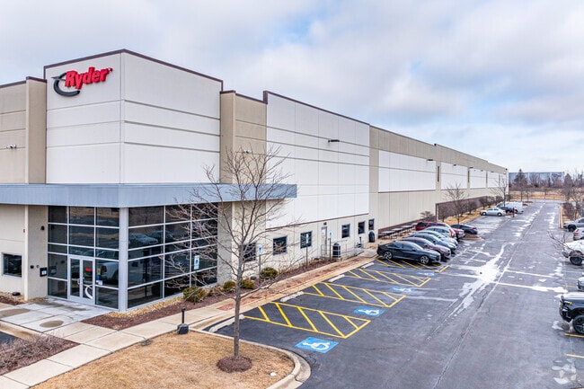
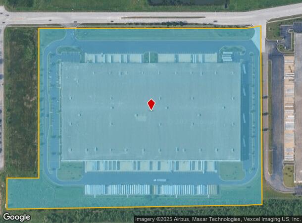
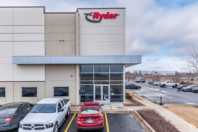
Property Record
1200 Orchard Gateway Blvd, North Aurora, IL 60542
NEARBY LISTINGS FOR SALE OR LEASE
Property Detail
1200 Orchard Gateway Blvd
Chicago-Naperville-Elgin, IL-IN-WI
Gateway Industrial North Aurora Resub
15-05-351-004
GATEWAY INDUSTRIAL NORTH AURORA RESUB LOT 1
Commercialnec
Kane
AE
Illinois
17089C0340H
1
2024
32.13 AC
2024
Central Kane / DuPage
853001
Chicago
DEMOGRAPHICS near 1200 Orchard Gateway Blvd
1 Mile
3 Mile
5 Mile
2024 Total Population
4,994
64,202
166,962
2029 Population
4,954
64,122
166,351
Pop Growth 2024-2029
(0.80%)
(0.12%)
(0.37%)
Average Age
43
39
39
2024 Total Households
2,034
22,398
57,165
HH Growth 2024-2029
(0.39%)
(0.08%)
(0.29%)
Median Household Inc
$72,711
$80,844
$82,732
Avg Household Size
2.30
2.80
2.80
2024 Avg HH Vehicles
2.00
2.00
2.00
Median Home Value
$197,349
$241,449
$252,598
Median Year Built
1995
1978
1975
Nearby Places
Map Layers
Map Styles
 Street
 Aerial
- Restaurants
- Banks
- Shops
- Fitness
- Groceries
PUBLIC TRANSPORTATION
COMMUTER RAIL
Aurora Station (Burlington Northern-Santa Fe Railway Line - Northeast Illinois Regional Commuter Railroad (Metra))
DRIVE
WALK
Distance
Aurora Station (Burlington Northern-Santa Fe Railway Line - Northeast Illinois Regional Commuter Railroad (Metra))
13 min
5.7 mi
Geneva Station (Union Pacific West Line - Northeast Illinois Regional Commuter Railroad (Metra))
DRIVE
WALK
Distance
Geneva Station (Union Pacific West Line - Northeast Illinois Regional Commuter Railroad (Metra))
14 min
7.6 mi
AIRPORT
Chicago O'Hare International
DRIVE
WALK
Distance
Chicago O'Hare International
56 min
39.7 mi
Freight Ports
Port Milwaukee
DRIVE
WALK
Distance
Port Milwaukee
137 min
111.4 mi
Nearby Properties
Address
Land Use
TOTAL SIZE
Lot Size
Zoning
Address
Land Use
TOTAL SIZE
Lot Size
Zoning
Address
Land Use
TOTAL SIZE
Lot Size
Zoning
530,523 SF
37.65 AC
Address
Land Use
TOTAL SIZE
Lot Size
Zoning
18.81 AC
Address
Land Use
TOTAL SIZE
Lot Size
Zoning
28.35 AC
Address
Land Use
TOTAL SIZE
Lot Size
Zoning
Address
Land Use
TOTAL SIZE
Lot Size
Zoning
18.48 AC
Address
Land Use
TOTAL SIZE
Lot Size
Zoning
Address
Land Use
TOTAL SIZE
Lot Size
Zoning
25.58 AC
Address
Land Use
TOTAL SIZE
Lot Size
Zoning
394,560 SF
19.34 AC
Address
Land Use
TOTAL SIZE
Lot Size
Zoning
840,912 SF
49.56 AC
Address
Land Use
TOTAL SIZE
Lot Size
Zoning
Address
Land Use
TOTAL SIZE
Lot Size
Zoning
20.56 AC
Address
Land Use
TOTAL SIZE
Lot Size
Zoning
622,072 SF
6.04 AC
Address
Land Use
TOTAL SIZE
Lot Size
Zoning
8.22 AC
Address
Land Use
TOTAL SIZE
Lot Size
Zoning
25.07 AC
Address
Land Use
TOTAL SIZE
Lot Size
Zoning
255,500 SF
17.64 AC
Address
Land Use
TOTAL SIZE
Lot Size
Zoning
83,424 SF
8.23 AC
Address
Land Use
TOTAL SIZE
Lot Size
Zoning
Address
Land Use
TOTAL SIZE
Lot Size
Zoning
Address
Land Use
TOTAL SIZE
Lot Size
Zoning
9.61 AC
Address
Land Use
TOTAL SIZE
Lot Size
Zoning
180,348 SF
14.33 AC
Address
Land Use
TOTAL SIZE
Lot Size
Zoning
301,468 SF
44.12 AC
Address
Land Use
TOTAL SIZE
Lot Size
Zoning
Address
Land Use
TOTAL SIZE
Lot Size
Zoning
15.58 AC
Address
Land Use
TOTAL SIZE
Lot Size
Zoning
181,268 SF
7.62 AC
Address
Land Use
TOTAL SIZE
Lot Size
Zoning
28.95 AC
Address
Land Use
TOTAL SIZE
Lot Size
Zoning
136,900 SF
3.63 AC
Address
Land Use
TOTAL SIZE
Lot Size
Zoning
21.80 AC
Address
Land Use
TOTAL SIZE
Lot Size
Zoning
2.73 AC
The World's #1 Commercial Real Estate Marketplace
Connect with us
© 2026 CoStar Group
The information above has been obtained from sources believed reliable. While we do not doubt its accuracy we have not verified it and make no guarantee, warranty or representation about it. It is your responsibility to independently confirm its accuracy and completeness. Any projections, opinions, assumptions, or estimates used are for example only and do not represent the current or future performance of the property. The value of this transaction to you depends on tax and other factors which should be evaluated by your tax, financial, and legal advisors. You and your advisors should conduct a careful, independent investigation of the property to determine to your satisfaction the suitability of the property for your needs.