Property Record
1200 Queens Way, Fairbanks, AK 99701


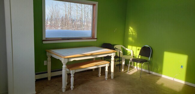
Property Detail
1200 Queens Way
Fairbanks-College, AK
TRACT D-1-B BLOCK 2 MARINER OUT OF TRACT D BLOCK 2 MARINER
446041
Fairbanks North Star
Industrialgeneral
Alaska
AE The base floodplain where base flood elevations are provided. AE Zones are now used on new format FIRMs instead of A1-A30 Zones.
d1b
2025
1.17 AC
2025
Alaska Regional
001000
Other Market Areas
8,861 SF
NEARBY LISTINGS FOR SALE OR LEASE
DEMOGRAPHICS near 1200 Queens Way
1 mile
3 mile
5 mile
2025 Total Population
1,330
26,243
43,717
2030 Population
1,315
26,360
43,828
Pop Growth 2025-2030
(1.13%)
+ 0.45%
+ 0.25%
Average Age
35
35
35
2025 Total Households
515
9,720
16,370
HH Growth 2025-2030
(1.17%)
+ 0.43%
+ 0.23%
Median Household Inc
$75,676
$66,774
$73,961
Avg Household Size
2.30
2.30
2.40
2025 Avg HH Vehicles
2.00
2.00
2.00
Median Home Value
$134,782
$247,944
$264,027
Median Year Built
1986
1981
1982
Nearby Places
Map Layers
Map Styles
 Street
 Aerial
Transit
 Traffic
 Biking
Places
Listings with unknown addresses are not visible on the map
- Restaurants
- Banks
- Shops
- Fitness
- Groceries
PUBLIC TRANSPORTATION
AIRPORT
Fairbanks International
Drive
Walk
Distance
Fairbanks International
22 min
7.0 mi
Freight Ports
Port of Anchorage
Drive
Walk
Distance
Port of Anchorage
442 min
361.4 mi
SALE & LEASE HISTORY
LISTING DATE
SALE/LEASE

May 03, 2021
For Sale
Nearby Properties
Address
Land Use
TOTAL SIZE
Lot Size
Zoning
Address
Land Use
TOTAL SIZE
Lot Size
Zoning
Address
Land Use
TOTAL SIZE
Lot Size
Zoning
Address
Land Use
TOTAL SIZE
Lot Size
Zoning
12,838 SF
Address
Land Use
TOTAL SIZE
Lot Size
Zoning
87.12 AC
Address
Land Use
TOTAL SIZE
Lot Size
Zoning
Address
Land Use
TOTAL SIZE
Lot Size
Zoning
Address
Land Use
TOTAL SIZE
Lot Size
Zoning
65,775.60 AC
Address
Land Use
TOTAL SIZE
Lot Size
Zoning
Address
Land Use
TOTAL SIZE
Lot Size
Zoning
178,992 SF
5.03 AC
Address
Land Use
TOTAL SIZE
Lot Size
Zoning
28,000 SF
5.22 AC
Address
Land Use
TOTAL SIZE
Lot Size
Zoning
320,451 SF
27.84 AC
Address
Land Use
TOTAL SIZE
Lot Size
Zoning
196,552 SF
56.08 AC
Address
Land Use
TOTAL SIZE
Lot Size
Zoning
85,213 SF
13.15 AC
Address
Land Use
TOTAL SIZE
Lot Size
Zoning
40,940 SF
41.82 AC
Address
Land Use
TOTAL SIZE
Lot Size
Zoning
59,223 SF
23.57 AC
Address
Land Use
TOTAL SIZE
Lot Size
Zoning
55,734 SF
6 AC
Address
Land Use
TOTAL SIZE
Lot Size
Zoning
64,725 SF
1.72 AC
Address
Land Use
TOTAL SIZE
Lot Size
Zoning
27,007.20 AC
Address
Land Use
TOTAL SIZE
Lot Size
Zoning
49,814 SF
7 AC
Address
Land Use
TOTAL SIZE
Lot Size
Zoning
43,463 SF
76.02 AC
Address
Land Use
TOTAL SIZE
Lot Size
Zoning
43,632 SF
1.27 AC
Address
Land Use
TOTAL SIZE
Lot Size
Zoning
79,445 SF
8.60 AC
Address
Land Use
TOTAL SIZE
Lot Size
Zoning
Address
Land Use
TOTAL SIZE
Lot Size
Zoning
66,362 SF
5.81 AC
Address
Land Use
TOTAL SIZE
Lot Size
Zoning
44,647 SF
2.78 AC
Address
Land Use
TOTAL SIZE
Lot Size
Zoning
21.78 AC
Address
Land Use
TOTAL SIZE
Lot Size
Zoning
Address
Land Use
TOTAL SIZE
Lot Size
Zoning
21,023.14 AC
Address
Land Use
TOTAL SIZE
Lot Size
Zoning
19.91 AC
Address
Land Use
TOTAL SIZE
Lot Size
Zoning
34.21 AC
The World's #1 Commercial Real Estate Marketplace
Connect with us
© 2026 CoStar Group
The information above has been obtained from sources believed reliable. While we do not doubt its accuracy we have not verified it and make no guarantee, warranty or representation about it. It is your responsibility to independently confirm its accuracy and completeness. Any projections, opinions, assumptions, or estimates used are for example only and do not represent the current or future performance of the property. The value of this transaction to you depends on tax and other factors which should be evaluated by your tax, financial, and legal advisors. You and your advisors should conduct a careful, independent investigation of the property to determine to your satisfaction the suitability of the property for your needs.