Property Record
1200 Resource Dr, Independence, OH 44131


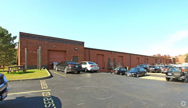

Property Detail
1200 Resource Dr
531-28-015
PARCEL H AFN- 202003020214
Multitenantindustrial
CUYAHOGA
LI
Ohio
2025
5.15 AC
2025
Brooklyn Hts
192300
Cleveland
36,290 SF
Cleveland-Elyria, OH
NEARBY LISTINGS FOR SALE OR LEASE
DEMOGRAPHICS near 1200 Resource Dr
1 mile
3 mile
5 mile
2025 Total Population
1,656
69,400
235,414
2030 Population
1,625
67,948
231,183
Pop Growth 2025-2030
(1.87%)
(2.09%)
(1.80%)
Average Age
46
41
41
2025 Total Households
675
29,609
100,008
HH Growth 2025-2030
(2.07%)
(2.27%)
(1.95%)
Median Household Inc
$98,119
$62,625
$56,694
Avg Household Size
2.40
2.30
2.30
2025 Avg HH Vehicles
2.00
2.00
2.00
Median Home Value
$250,328
$162,781
$149,127
Median Year Built
1965
1953
1952
Nearby Places
Map Layers
Map Styles
 Street
 Aerial
Transit
 Traffic
 Biking
Places
Listings with unknown addresses are not visible on the map
- Restaurants
- Banks
- Shops
- Fitness
- Groceries
PUBLIC TRANSPORTATION
COMMUTER RAIL
Drive
Walk
Distance
10 min
4.0 mi
Drive
Walk
Distance
12 min
5.7 mi
AIRPORT
Cleveland-Hopkins International
Drive
Walk
Distance
Cleveland-Hopkins International
22 min
11.4 mi
Akron-Canton Regional
Drive
Walk
Distance
Akron-Canton Regional
60 min
43.9 mi
SALE & LEASE HISTORY
LISTING DATE
SALE/LEASE

Mar 30, 2017
For Lease
Nearby Properties
Address
Land Use
TOTAL SIZE
Lot Size
Zoning
Address
Land Use
TOTAL SIZE
Lot Size
Zoning
162,711 SF
192.04 AC
IG
Address
Land Use
TOTAL SIZE
Lot Size
Zoning
32,400 SF
52.29 AC
U-4
Address
Land Use
TOTAL SIZE
Lot Size
Zoning
202,152 SF
21.04 AC
U-1
Address
Land Use
TOTAL SIZE
Lot Size
Zoning
436,164 SF
20.01 AC
U-5
Address
Land Use
TOTAL SIZE
Lot Size
Zoning
384,714 SF
4.75 AC
U-5-HR
Address
Land Use
TOTAL SIZE
Lot Size
Zoning
194,257 SF
94.46 AC
IG
Address
Land Use
TOTAL SIZE
Lot Size
Zoning
258,669 SF
12.80 AC
U-5
Address
Land Use
TOTAL SIZE
Lot Size
Zoning
248,498 SF
14.31 AC
U-8
Address
Land Use
TOTAL SIZE
Lot Size
Zoning
102,219 SF
14.01 AC
RB
Address
Land Use
TOTAL SIZE
Lot Size
Zoning
475,286 SF
5.81 AC
U-5-HR
Address
Land Use
TOTAL SIZE
Lot Size
Zoning
60,989 SF
9.31 AC
U-4
Address
Land Use
TOTAL SIZE
Lot Size
Zoning
205,724 SF
6.54 AC
U-8
Address
Land Use
TOTAL SIZE
Lot Size
Zoning
12.64 AC
U-4
Address
Land Use
TOTAL SIZE
Lot Size
Zoning
189,156 SF
24.49 AC
IG
Address
Land Use
TOTAL SIZE
Lot Size
Zoning
500,398 SF
24.49 AC
IG
Address
Land Use
TOTAL SIZE
Lot Size
Zoning
209,068 SF
23.10 AC
IG
Address
Land Use
TOTAL SIZE
Lot Size
Zoning
239,000 SF
6.29 AC
U-6A
Address
Land Use
TOTAL SIZE
Lot Size
Zoning
277,049 SF
24.15 AC
2F
Address
Land Use
TOTAL SIZE
Lot Size
Zoning
19.48 AC
U5-A
Address
Land Use
TOTAL SIZE
Lot Size
Zoning
124,224 SF
25.99 AC
U-1
Address
Land Use
TOTAL SIZE
Lot Size
Zoning
133,913 SF
18.36 AC
U-11B
Address
Land Use
TOTAL SIZE
Lot Size
Zoning
8.60 AC
U-4
Address
Land Use
TOTAL SIZE
Lot Size
Zoning
116,373 SF
13.28 AC
U-3
Address
Land Use
TOTAL SIZE
Lot Size
Zoning
54,055 SF
3.11 AC
U-4
Address
Land Use
TOTAL SIZE
Lot Size
Zoning
141,785 SF
9.13 AC
U-5
Address
Land Use
TOTAL SIZE
Lot Size
Zoning
336,730 SF
38.51 AC
U-11A
Address
Land Use
TOTAL SIZE
Lot Size
Zoning
17,158 SF
20.86 AC
MF-1
Address
Land Use
TOTAL SIZE
Lot Size
Zoning
197,916 SF
9.10 AC
MF-1
Address
Land Use
TOTAL SIZE
Lot Size
Zoning
99,916 SF
4.72 AC
U-3
Address
Land Use
TOTAL SIZE
Lot Size
Zoning
100,047 SF
5.34 AC
SF-A
The World's #1 Commercial Real Estate Marketplace
Connect with us
© 2026 CoStar Group
The information above has been obtained from sources believed reliable. While we do not doubt its accuracy we have not verified it and make no guarantee, warranty or representation about it. It is your responsibility to independently confirm its accuracy and completeness. Any projections, opinions, assumptions, or estimates used are for example only and do not represent the current or future performance of the property. The value of this transaction to you depends on tax and other factors which should be evaluated by your tax, financial, and legal advisors. You and your advisors should conduct a careful, independent investigation of the property to determine to your satisfaction the suitability of the property for your needs.