Property Record
1200 Stuyvesant Ave, Union, NJ 07083


Save to a Folder
{{folder.Name}}
{{folder.ListingIds.length}} Properties
{{folder.ListingIds.length}} Property
Create a New Folder
Property Detail
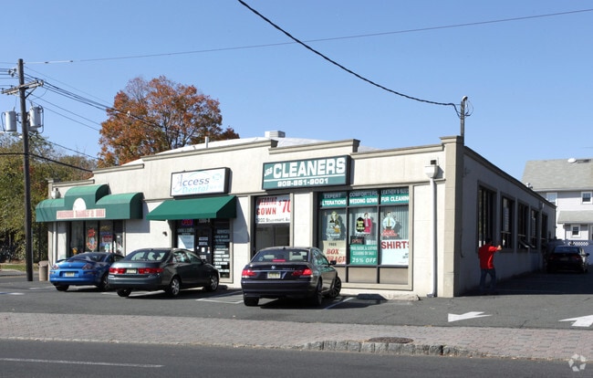
1200 Stuyvesant Ave
Newark, NJ
Union
19-05207-0000-00021
New Jersey
Storemultistory
21
B and X Area of moderate flood hazard, usually the area between the limits of the 100-year and 500-year floods.
0.34 AC
2025
Route 22 East
2026
Northern New Jersey
033100
NEARBY LISTINGS FOR SALE OR LEASE
DEMOGRAPHICS near 1200 Stuyvesant Ave
1 mile
3 mile
5 mile
2025 Total Population
21,136
248,924
677,224
2030 Population
22,077
259,195
704,019
Pop Growth 2025-2030
+ 4.45%
+ 4.13%
+ 3.96%
Average Age
42
40
39
2025 Total Households
7,149
87,338
241,095
HH Growth 2025-2030
+ 4.53%
+ 4.26%
+ 4.13%
Median Household Inc
$120,264
$99,685
$83,799
Avg Household Size
2.90
2.80
2.70
2025 Avg HH Vehicles
2.00
2.00
1.00
Median Home Value
$443,120
$461,944
$481,305
Median Year Built
1952
1952
1955
Nearby Places
Map Layers
Map Styles
 Street
 Aerial
Layers
 Traffic
 Biking
Places
Listings with unknown addresses are not visible on the map
- Restaurants
- Banks
- Shops
- Fitness
- Groceries
PUBLIC TRANSPORTATION
COMMUTER RAIL
Union (Raritan Valley Line - NJ Transit Commuter Rail (NJ Transit))
Drive
Walk
Distance
Union (Raritan Valley Line - NJ Transit Commuter Rail (NJ Transit))
5 min
2.0 mi
Roselle Park (Raritan Valley Line - NJ Transit Commuter Rail (NJ Transit))
Drive
Walk
Distance
Roselle Park (Raritan Valley Line - NJ Transit Commuter Rail (NJ Transit))
8 min
2.5 mi
AIRPORT
Newark Liberty International
Drive
Walk
Distance
Newark Liberty International
13 min
8.1 mi
LaGuardia
Drive
Walk
Distance
LaGuardia
50 min
27.5 mi
John F Kennedy International
Drive
Walk
Distance
John F Kennedy International
60 min
35.5 mi
Freight Ports
Maher Terminal
Drive
Walk
Distance
Maher Terminal
15 min
8.3 mi
Nearby Properties
Address
Land Use
TOTAL SIZE
Lot Size
Zoning
Address
Land Use
TOTAL SIZE
Lot Size
Zoning
1,136 SF
6.51 AC
Address
Land Use
TOTAL SIZE
Lot Size
Zoning
32.27 AC
CCRC
Address
Land Use
TOTAL SIZE
Lot Size
Zoning
107.41 AC
Address
Land Use
TOTAL SIZE
Lot Size
Zoning
Address
Land Use
TOTAL SIZE
Lot Size
Zoning
13.80 AC
R1-5
Address
Land Use
TOTAL SIZE
Lot Size
Zoning
310.45 AC
Address
Land Use
TOTAL SIZE
Lot Size
Zoning
1 SF
117.50 AC
Address
Land Use
TOTAL SIZE
Lot Size
Zoning
Address
Land Use
TOTAL SIZE
Lot Size
Zoning
7.07 AC
Address
Land Use
TOTAL SIZE
Lot Size
Zoning
5.48 AC
Address
Land Use
TOTAL SIZE
Lot Size
Zoning
Address
Land Use
TOTAL SIZE
Lot Size
Zoning
2.29 AC
Address
Land Use
TOTAL SIZE
Lot Size
Zoning
117,703 SF
8.29 AC
Address
Land Use
TOTAL SIZE
Lot Size
Zoning
6.05 AC
RO
Address
Land Use
TOTAL SIZE
Lot Size
Zoning
Address
Land Use
TOTAL SIZE
Lot Size
Zoning
103,773 SF
35.47 AC
Address
Land Use
TOTAL SIZE
Lot Size
Zoning
16.10 AC
R1-5
Address
Land Use
TOTAL SIZE
Lot Size
Zoning
4 AC
R1-5
Address
Land Use
TOTAL SIZE
Lot Size
Zoning
Address
Land Use
TOTAL SIZE
Lot Size
Zoning
37,191 SF
8.52 AC
Address
Land Use
TOTAL SIZE
Lot Size
Zoning
8.10 AC
Address
Land Use
TOTAL SIZE
Lot Size
Zoning
0.38 AC
Address
Land Use
TOTAL SIZE
Lot Size
Zoning
176,492 SF
8 AC
Address
Land Use
TOTAL SIZE
Lot Size
Zoning
16.82 AC
R1-7
Address
Land Use
TOTAL SIZE
Lot Size
Zoning
12.20 AC
Address
Land Use
TOTAL SIZE
Lot Size
Zoning
253,287 SF
6.03 AC
Address
Land Use
TOTAL SIZE
Lot Size
Zoning
55,362 SF
9.58 AC
Address
Land Use
TOTAL SIZE
Lot Size
Zoning
Address
Land Use
TOTAL SIZE
Lot Size
Zoning
3.23 AC
Address
Land Use
TOTAL SIZE
Lot Size
Zoning
4.82 AC
The World's #1 Commercial Real Estate Marketplace
Connect with us
© 2026 CoStar Group
The information above has been obtained from sources believed reliable. While we do not doubt its accuracy we have not verified it and make no guarantee, warranty or representation about it. It is your responsibility to independently confirm its accuracy and completeness. Any projections, opinions, assumptions, or estimates used are for example only and do not represent the current or future performance of the property. The value of this transaction to you depends on tax and other factors which should be evaluated by your tax, financial, and legal advisors. You and your advisors should conduct a careful, independent investigation of the property to determine to your satisfaction the suitability of the property for your needs.