Property Record
1200 Synthes Ave, Monument, CO 80132
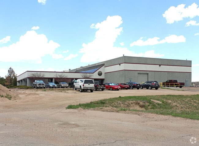

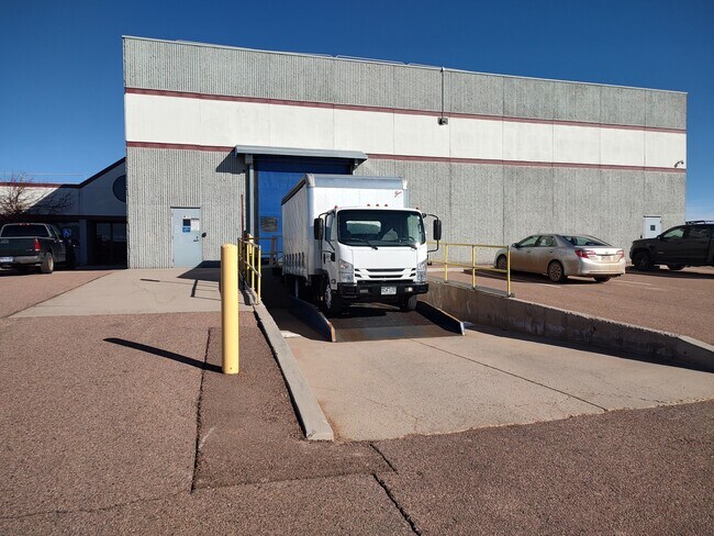

Property Detail
1200 Synthes Ave
71220-05-013
LOT 2B MONUMENT INDUSTRIAL PARK PHASE 2 FILING PLAT
Industrialgeneral
EL PASO
LI
Colorado
B and X Area of moderate flood hazard, usually the area between the limits of the 100-year and 500-year floods.
2b
2025
2.67 AC
2026
Northwest
003712
Colorado Springs
20,544 SF
Colorado Springs, CO
NEARBY LISTINGS FOR SALE OR LEASE
DEMOGRAPHICS near 1200 Synthes Ave
1 mile
3 mile
5 mile
2025 Total Population
3,157
24,558
45,934
2030 Population
3,303
25,373
47,075
Pop Growth 2025-2030
+ 4.62%
+ 3.32%
+ 2.48%
Average Age
40
41
42
2025 Total Households
1,127
8,773
16,282
HH Growth 2025-2030
+ 4.88%
+ 3.52%
+ 2.70%
Median Household Inc
$99,501
$143,296
$151,816
Avg Household Size
2.80
2.80
2.80
2025 Avg HH Vehicles
2.00
2.00
3.00
Median Home Value
$616,424
$722,173
$738,914
Median Year Built
1994
2000
2000
Nearby Places
Map Layers
Map Styles
 Street
 Aerial
Layers
 Traffic
 Biking
Places
Listings with unknown addresses are not visible on the map
- Restaurants
- Banks
- Shops
- Fitness
- Groceries
SALE & LEASE HISTORY
LISTING DATE
SALE/LEASE

Feb 26, 2024
For Lease
Feb 26, 2024
For Sale
Nearby Properties
Address
Land Use
TOTAL SIZE
Lot Size
Zoning
Address
Land Use
TOTAL SIZE
Lot Size
Zoning
136,906 SF
25.22 AC
PRD-4
Address
Land Use
TOTAL SIZE
Lot Size
Zoning
57,619 SF
3.26 AC
SFD-2
Address
Land Use
TOTAL SIZE
Lot Size
Zoning
45,186 SF
8.91 AC
PUD
Address
Land Use
TOTAL SIZE
Lot Size
Zoning
10,000 SF
23.39 AC
PUD
Address
Land Use
TOTAL SIZE
Lot Size
Zoning
248,689 SF
15.79 AC
Address
Land Use
TOTAL SIZE
Lot Size
Zoning
22,970 SF
5.45 AC
PUD
Address
Land Use
TOTAL SIZE
Lot Size
Zoning
49,258 SF
3.68 AC
PUD
Address
Land Use
TOTAL SIZE
Lot Size
Zoning
53,026 SF
17.20 AC
RR-5
Address
Land Use
TOTAL SIZE
Lot Size
Zoning
23,378 SF
3.34 AC
PUD
Address
Land Use
TOTAL SIZE
Lot Size
Zoning
222,850 SF
20.55 AC
PUD
Address
Land Use
TOTAL SIZE
Lot Size
Zoning
21,695 SF
1.17 AC
BP
Address
Land Use
TOTAL SIZE
Lot Size
Zoning
38,142 SF
7.28 AC
A-5
Address
Land Use
TOTAL SIZE
Lot Size
Zoning
25,600 SF
10.11 AC
CC
Address
Land Use
TOTAL SIZE
Lot Size
Zoning
13.14 AC
PUD
Address
Land Use
TOTAL SIZE
Lot Size
Zoning
150,335 SF
28 AC
LI
Address
Land Use
TOTAL SIZE
Lot Size
Zoning
16,608 SF
1.14 AC
P
Address
Land Use
TOTAL SIZE
Lot Size
Zoning
12,167 SF
1.40 AC
DB
Address
Land Use
TOTAL SIZE
Lot Size
Zoning
17,655 SF
7.01 AC
R-4
Address
Land Use
TOTAL SIZE
Lot Size
Zoning
14,684 SF
5 AC
RS-20000
Address
Land Use
TOTAL SIZE
Lot Size
Zoning
98,428 SF
16.92 AC
PUD
Address
Land Use
TOTAL SIZE
Lot Size
Zoning
16,235 SF
6.08 AC
RR-5
Address
Land Use
TOTAL SIZE
Lot Size
Zoning
1.68 AC
A-5
Address
Land Use
TOTAL SIZE
Lot Size
Zoning
9.62 AC
PID
Address
Land Use
TOTAL SIZE
Lot Size
Zoning
16,230 SF
2.81 AC
Address
Land Use
TOTAL SIZE
Lot Size
Zoning
198,725 SF
10.39 AC
PUD
Address
Land Use
TOTAL SIZE
Lot Size
Zoning
179,346 SF
9.88 AC
PUD
Address
Land Use
TOTAL SIZE
Lot Size
Zoning
86,779 SF
10.62 AC
PCD
Address
Land Use
TOTAL SIZE
Lot Size
Zoning
11,794 SF
17.98 AC
RR-5
Address
Land Use
TOTAL SIZE
Lot Size
Zoning
9,631 SF
15.85 AC
PUD
Address
Land Use
TOTAL SIZE
Lot Size
Zoning
53,337 SF
12 AC
PCD
The World's #1 Commercial Real Estate Marketplace
Connect with us
© 2026 CoStar Group
The information above has been obtained from sources believed reliable. While we do not doubt its accuracy we have not verified it and make no guarantee, warranty or representation about it. It is your responsibility to independently confirm its accuracy and completeness. Any projections, opinions, assumptions, or estimates used are for example only and do not represent the current or future performance of the property. The value of this transaction to you depends on tax and other factors which should be evaluated by your tax, financial, and legal advisors. You and your advisors should conduct a careful, independent investigation of the property to determine to your satisfaction the suitability of the property for your needs.