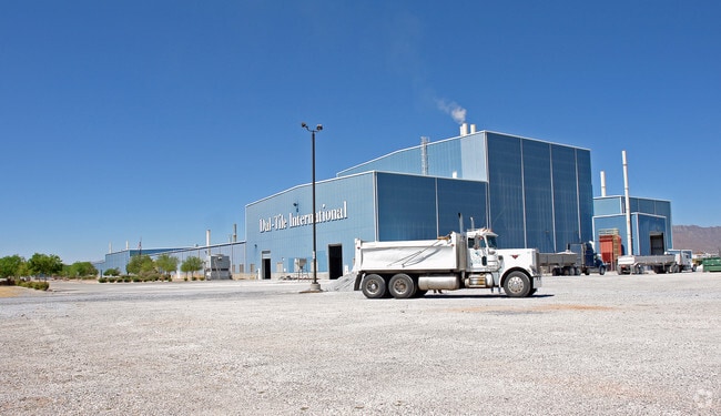
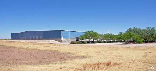
Property Record
12001 Railroad Dr, El Paso, TX 79934

NEARBY LISTINGS FOR SALE OR LEASE
Property Detail
12001 Railroad Dr
El Paso
Tsp 1 Sec 1 T & P Surv
El Paso, TX
80 TSP 1 SEC 22 T & P SURV TR 1 (47.681 AC)
X580-999-1220-0100
El Paso
Governmentalpublicusegeneral
Texas
0
47.68 AC
2025
Northeast
010224
DEMOGRAPHICS near 12001 Railroad Dr
1 Mile
3 Mile
5 Mile
2024 Total Population
5,358
11,493
58,791
2029 Population
5,370
11,558
59,392
Pop Growth 2024-2029
+ 0.22%
+ 0.57%
+ 1.02%
Average Age
28
30
34
2024 Total Households
1,823
3,913
19,717
HH Growth 2024-2029
+ 0.33%
+ 0.66%
+ 1.03%
Median Household Inc
$62,434
$58,496
$54,255
Avg Household Size
2.90
2.90
2.90
2024 Avg HH Vehicles
2.00
2.00
2.00
Median Home Value
$153,488
$144,259
$135,410
Median Year Built
2011
2010
1994
Nearby Places
Map Layers
Map Styles
 Street
 Aerial
- Restaurants
- Banks
- Shops
- Fitness
- Groceries
PUBLIC TRANSPORTATION
AIRPORT
El Paso International
DRIVE
WALK
Distance
El Paso International
31 min
15.4 mi
Freight Ports
Port of Corpus Christi
DRIVE
WALK
Distance
Port of Corpus Christi
696 min
703.3 mi
Nearby Properties
Address
Land Use
TOTAL SIZE
Lot Size
Zoning
Address
Land Use
TOTAL SIZE
Lot Size
Zoning
720,596 SF
23.98 AC
C2C
Address
Land Use
TOTAL SIZE
Lot Size
Zoning
424,325 SF
M1
Address
Land Use
TOTAL SIZE
Lot Size
Zoning
46,318 SF
4.92 AC
C3
Address
Land Use
TOTAL SIZE
Lot Size
Zoning
91,288 SF
14 AC
C1
Address
Land Use
TOTAL SIZE
Lot Size
Zoning
144,711 SF
10.50 AC
M1S
Address
Land Use
TOTAL SIZE
Lot Size
Zoning
77.84 AC
M1
Address
Land Use
TOTAL SIZE
Lot Size
Zoning
241,802 SF
9.81 AC
M1
Address
Land Use
TOTAL SIZE
Lot Size
Zoning
318,722 SF
50 AC
M1
Address
Land Use
TOTAL SIZE
Lot Size
Zoning
229.68 AC
RF
Address
Land Use
TOTAL SIZE
Lot Size
Zoning
52,000 SF
4.44 AC
M1
Address
Land Use
TOTAL SIZE
Lot Size
Zoning
152,002 SF
9.73 AC
C1C
Address
Land Use
TOTAL SIZE
Lot Size
Zoning
73,934 SF
5.81 AC
C4C
Address
Land Use
TOTAL SIZE
Lot Size
Zoning
25,282 SF
141.95 AC
M1
Address
Land Use
TOTAL SIZE
Lot Size
Zoning
18,536 SF
2.07 AC
M1S
Address
Land Use
TOTAL SIZE
Lot Size
Zoning
58,633 SF
19.81 AC
M1
Address
Land Use
TOTAL SIZE
Lot Size
Zoning
60,000 SF
10.21 AC
M1
Address
Land Use
TOTAL SIZE
Lot Size
Zoning
270.51 AC
RF
Address
Land Use
TOTAL SIZE
Lot Size
Zoning
153.32 AC
M1
Address
Land Use
TOTAL SIZE
Lot Size
Zoning
4,991 SF
2.03 AC
C4
Address
Land Use
TOTAL SIZE
Lot Size
Zoning
400.65 AC
RF
Address
Land Use
TOTAL SIZE
Lot Size
Zoning
38,788 SF
3.03 AC
C4
Address
Land Use
TOTAL SIZE
Lot Size
Zoning
15.13 AC
C4
Address
Land Use
TOTAL SIZE
Lot Size
Zoning
6,090 SF
4.01 AC
R4
Address
Land Use
TOTAL SIZE
Lot Size
Zoning
37.47 AC
RF
Address
Land Use
TOTAL SIZE
Lot Size
Zoning
14,400 SF
3 AC
M1
Address
Land Use
TOTAL SIZE
Lot Size
Zoning
58,755 SF
5.56 AC
Address
Land Use
TOTAL SIZE
Lot Size
Zoning
4,840 SF
10 AC
M1
Address
Land Use
TOTAL SIZE
Lot Size
Zoning
6.56 AC
RF
Address
Land Use
TOTAL SIZE
Lot Size
Zoning
14,700 SF
2 AC
C4
The World's #1 Commercial Real Estate Marketplace
Connect with us
© 2026 CoStar Group
The information above has been obtained from sources believed reliable. While we do not doubt its accuracy we have not verified it and make no guarantee, warranty or representation about it. It is your responsibility to independently confirm its accuracy and completeness. Any projections, opinions, assumptions, or estimates used are for example only and do not represent the current or future performance of the property. The value of this transaction to you depends on tax and other factors which should be evaluated by your tax, financial, and legal advisors. You and your advisors should conduct a careful, independent investigation of the property to determine to your satisfaction the suitability of the property for your needs.