Property Record
1201 6Th St, Umatilla, OR 97882

NEARBY LISTINGS FOR SALE OR LEASE
-
-
View all Umatilla listings for sale on LoopNet.com
Property Detail
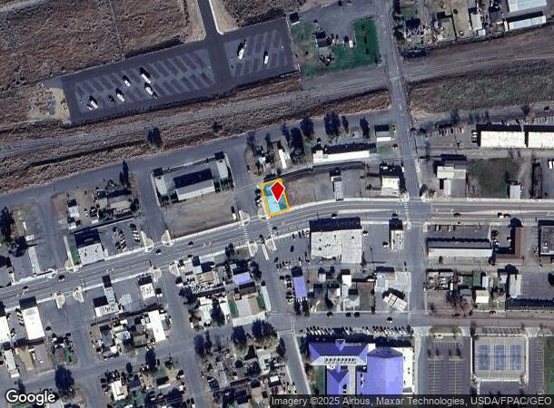
1201 6Th St
126975
Wardwells Add
Commercialnec
Umatilla
X
Oregon
41059C0262G
8
2024
0.13 AC
2024
Oregon East Area
950900
Other Market Areas
4,060 SF
Hermiston-Pendleton, OR
DEMOGRAPHICS near 1201 6Th St
1 Mile
3 Mile
5 Mile
2024 Total Population
2,596
7,943
12,320
2029 Population
2,613
7,981
12,408
Pop Growth 2024-2029
+ 0.65%
+ 0.48%
+ 0.71%
Average Age
35
37
37
2024 Total Households
859
2,219
3,633
HH Growth 2024-2029
+ 0.70%
+ 0.50%
+ 0.72%
Median Household Inc
$49,110
$55,649
$60,529
Avg Household Size
3.00
3.00
3.00
2024 Avg HH Vehicles
2.00
2.00
2.00
Median Home Value
$161,422
$199,317
$231,261
Median Year Built
1986
1989
1993
Nearby Places
Map Layers
Map Styles
 Street
 Aerial
- Restaurants
- Banks
- Shops
- Fitness
- Groceries
PUBLIC TRANSPORTATION
AIRPORT
Tri-Cities
DRIVE
WALK
Distance
Tri-Cities
40 min
30.7 mi
Nearby Properties
Address
Land Use
TOTAL SIZE
Lot Size
Zoning
Address
Land Use
TOTAL SIZE
Lot Size
Zoning
52,790 SF
372.70 AC
RURAL LAND
Address
Land Use
TOTAL SIZE
Lot Size
Zoning
72,761 SF
8.85 AC
CS
Address
Land Use
TOTAL SIZE
Lot Size
Zoning
20 SF
178.20 AC
M-1
Address
Land Use
TOTAL SIZE
Lot Size
Zoning
2,320 SF
22.19 AC
Address
Land Use
TOTAL SIZE
Lot Size
Zoning
10 SF
18.69 AC
CS
Address
Land Use
TOTAL SIZE
Lot Size
Zoning
10 SF
8.16 AC
M-2
Address
Land Use
TOTAL SIZE
Lot Size
Zoning
66,173 SF
14.44 AC
Address
Land Use
TOTAL SIZE
Lot Size
Zoning
4,770 SF
104.91 AC
Address
Land Use
TOTAL SIZE
Lot Size
Zoning
10 SF
3.49 AC
MC
Address
Land Use
TOTAL SIZE
Lot Size
Zoning
35,422 SF
3.03 AC
R3
Address
Land Use
TOTAL SIZE
Lot Size
Zoning
Address
Land Use
TOTAL SIZE
Lot Size
Zoning
20,850 SF
0.43 AC
DC
Address
Land Use
TOTAL SIZE
Lot Size
Zoning
17,981 SF
3.69 AC
GC
Address
Land Use
TOTAL SIZE
Lot Size
Zoning
8,031 SF
628.65 AC
G.M.A. AGR
Address
Land Use
TOTAL SIZE
Lot Size
Zoning
11,777 SF
3.16 AC
MC
Address
Land Use
TOTAL SIZE
Lot Size
Zoning
1,180 SF
79.68 AC
M-2
Address
Land Use
TOTAL SIZE
Lot Size
Zoning
10,012 SF
102.77 AC
R-2,CS
Address
Land Use
TOTAL SIZE
Lot Size
Zoning
10 SF
7.53 AC
M-2
Address
Land Use
TOTAL SIZE
Lot Size
Zoning
46,984 SF
2.42 AC
R2
Address
Land Use
TOTAL SIZE
Lot Size
Zoning
16,958 SF
0.74 AC
C-3
Address
Land Use
TOTAL SIZE
Lot Size
Zoning
14,550 SF
1.19 AC
R3
Address
Land Use
TOTAL SIZE
Lot Size
Zoning
4,255 SF
1.94 AC
M-1
Address
Land Use
TOTAL SIZE
Lot Size
Zoning
15,812 SF
2.23 AC
M-2
Address
Land Use
TOTAL SIZE
Lot Size
Zoning
19,770 SF
0.63 AC
R-3
Address
Land Use
TOTAL SIZE
Lot Size
Zoning
38,008 SF
1.70 AC
R-3
Address
Land Use
TOTAL SIZE
Lot Size
Zoning
19,360 SF
8.81 AC
M-1
Address
Land Use
TOTAL SIZE
Lot Size
Zoning
760 SF
146.63 AC
Address
Land Use
TOTAL SIZE
Lot Size
Zoning
15,676 SF
8.45 AC
LI
Address
Land Use
TOTAL SIZE
Lot Size
Zoning
5,616 SF
20.03 AC
Address
Land Use
TOTAL SIZE
Lot Size
Zoning
16,192 SF
0.76 AC
C-3
The World's #1 Commercial Real Estate Marketplace
Connect with us
© 2026 CoStar Group
The information above has been obtained from sources believed reliable. While we do not doubt its accuracy we have not verified it and make no guarantee, warranty or representation about it. It is your responsibility to independently confirm its accuracy and completeness. Any projections, opinions, assumptions, or estimates used are for example only and do not represent the current or future performance of the property. The value of this transaction to you depends on tax and other factors which should be evaluated by your tax, financial, and legal advisors. You and your advisors should conduct a careful, independent investigation of the property to determine to your satisfaction the suitability of the property for your needs.