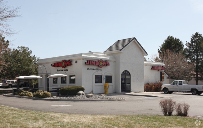
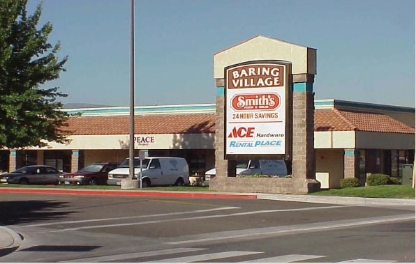
Property Record
1201 Baring Blvd, Sparks, NV 89434


Property Detail
1201 Baring Blvd
030-041-14
FRAC NW4 SE4 SEC 34 TWP 20N RGE 20E
Commercialnec
WASHOE
C2
Nevada
B and X Area of moderate flood hazard, usually the area between the limits of the 100-year and 500-year floods.
13.16 AC
2025
Northeast Sparks
2026
Reno/Sparks
003110
Reno, NV
89,264 SF
NEARBY LISTINGS FOR SALE OR LEASE
DEMOGRAPHICS near 1201 Baring Blvd
1 mile
3 mile
5 mile
2025 Total Population
18,250
80,579
171,122
2030 Population
18,463
82,342
176,038
Pop Growth 2025-2030
+ 1.17%
+ 2.19%
+ 2.87%
Average Age
41
40
39
2025 Total Households
6,654
31,337
64,379
HH Growth 2025-2030
+ 1.25%
+ 2.42%
+ 3.00%
Median Household Inc
$99,688
$84,632
$75,773
Avg Household Size
2.70
2.50
2.50
2025 Avg HH Vehicles
2.00
2.00
2.00
Median Home Value
$460,099
$461,766
$449,137
Median Year Built
1983
1987
1990
Nearby Places
Map Layers
Map Styles
 Street
 Aerial
Layers
 Traffic
 Biking
Places
Listings with unknown addresses are not visible on the map
- Restaurants
- Banks
- Shops
- Fitness
- Groceries
PUBLIC TRANSPORTATION
COMMUTER RAIL
Reno (California Zephyr - Amtrak)
Drive
Walk
Distance
Reno (California Zephyr - Amtrak)
13 min
7.1 mi
AIRPORT
Reno/Tahoe International
Drive
Walk
Distance
Reno/Tahoe International
32 min
10.7 mi
Freight Ports
Port of Stockton
Drive
Walk
Distance
Port of Stockton
216 min
185.2 mi
Nearby Properties
Address
Land Use
TOTAL SIZE
Lot Size
Zoning
Address
Land Use
TOTAL SIZE
Lot Size
Zoning
385,812 SF
16.47 AC
NUD
Address
Land Use
TOTAL SIZE
Lot Size
Zoning
6,641 SF
247.42 AC
PF
Address
Land Use
TOTAL SIZE
Lot Size
Zoning
294,872 SF
69.02 AC
PF
Address
Land Use
TOTAL SIZE
Lot Size
Zoning
356,160 SF
12.05 AC
MUD
Address
Land Use
TOTAL SIZE
Lot Size
Zoning
347,564 SF
10.23 AC
MUD
Address
Land Use
TOTAL SIZE
Lot Size
Zoning
321,941 SF
36 AC
NUD
Address
Land Use
TOTAL SIZE
Lot Size
Zoning
365,962 SF
3.54 AC
PD
Address
Land Use
TOTAL SIZE
Lot Size
Zoning
617,081 SF
2.62 AC
MUD
Address
Land Use
TOTAL SIZE
Lot Size
Zoning
279,596 SF
10.94 AC
NUD
Address
Land Use
TOTAL SIZE
Lot Size
Zoning
246,076 SF
16.43 AC
PD
Address
Land Use
TOTAL SIZE
Lot Size
Zoning
622,628 SF
2.91 AC
MUD
Address
Land Use
TOTAL SIZE
Lot Size
Zoning
79,748 SF
8.98 AC
NUD
Address
Land Use
TOTAL SIZE
Lot Size
Zoning
232,481 SF
9.45 AC
PD
Address
Land Use
TOTAL SIZE
Lot Size
Zoning
248,124 SF
19.35 AC
PD
Address
Land Use
TOTAL SIZE
Lot Size
Zoning
273,101 SF
15.96 AC
MF-3/PUD
Address
Land Use
TOTAL SIZE
Lot Size
Zoning
237,680 SF
16.65 AC
PD
Address
Land Use
TOTAL SIZE
Lot Size
Zoning
150,712 SF
16.90 AC
PO
Address
Land Use
TOTAL SIZE
Lot Size
Zoning
242,907 SF
4.18 AC
NUD
Address
Land Use
TOTAL SIZE
Lot Size
Zoning
203,367 SF
1 AC
MUD
Address
Land Use
TOTAL SIZE
Lot Size
Zoning
173,178 SF
8.15 AC
MUD
Address
Land Use
TOTAL SIZE
Lot Size
Zoning
1,269,958 SF
54.19 AC
I
Address
Land Use
TOTAL SIZE
Lot Size
Zoning
396,497 SF
20.80 AC
PD
Address
Land Use
TOTAL SIZE
Lot Size
Zoning
622,571 SF
25.69 AC
I
Address
Land Use
TOTAL SIZE
Lot Size
Zoning
133,992 SF
19.86 AC
TC
Address
Land Use
TOTAL SIZE
Lot Size
Zoning
136,331 SF
0.93 AC
MUD
Address
Land Use
TOTAL SIZE
Lot Size
Zoning
270,772 SF
32.96 AC
I
Address
Land Use
TOTAL SIZE
Lot Size
Zoning
203,303 SF
20.97 AC
C2
Address
Land Use
TOTAL SIZE
Lot Size
Zoning
127,618 SF
7.63 AC
I
Address
Land Use
TOTAL SIZE
Lot Size
Zoning
221,512 SF
15.32 AC
MUD
Address
Land Use
TOTAL SIZE
Lot Size
Zoning
514,464 SF
20.30 AC
I
The World's #1 Commercial Real Estate Marketplace
Connect with us
© 2026 CoStar Group
The information above has been obtained from sources believed reliable. While we do not doubt its accuracy we have not verified it and make no guarantee, warranty or representation about it. It is your responsibility to independently confirm its accuracy and completeness. Any projections, opinions, assumptions, or estimates used are for example only and do not represent the current or future performance of the property. The value of this transaction to you depends on tax and other factors which should be evaluated by your tax, financial, and legal advisors. You and your advisors should conduct a careful, independent investigation of the property to determine to your satisfaction the suitability of the property for your needs.