Property Record
1201 Commerce Dr, Wamego, KS 66547
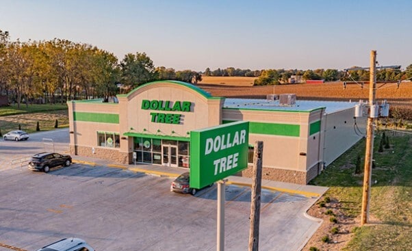

This Property Is For Sale
Property Detail
1201 Commerce Dr
293-05-0-10-04-002.00-0
WEST HWY 24 UNIT 3, S05, T10, R10, LOT 12, ACRES 0.79
Agriculturalland
POTTAWATOMIE
ET
Kansas
B and X Area of moderate flood hazard, usually the area between the limits of the 100-year and 500-year floods.
12
2024
0.79 AC
2025
I-70 Corridor
000200
Other Market Areas
10,664 SF
Manhattan, KS
NEARBY LISTINGS FOR SALE OR LEASE
-
-
View all Wamego listings for sale on LoopNet.com
DEMOGRAPHICS near 1201 Commerce Dr
1 mile
3 mile
5 mile
2025 Total Population
3,734
7,331
9,298
2030 Population
3,870
7,629
9,683
Pop Growth 2025-2030
+ 3.64%
+ 4.06%
+ 4.14%
Average Age
40
39
39
2025 Total Households
1,452
2,841
3,550
HH Growth 2025-2030
+ 3.65%
+ 4.12%
+ 4.17%
Median Household Inc
$97,172
$86,097
$84,305
Avg Household Size
2.50
2.50
2.60
2025 Avg HH Vehicles
2.00
2.00
2.00
Median Home Value
$196,945
$185,421
$199,638
Median Year Built
1975
1975
1977
Nearby Places
Map Layers
Map Styles
 Street
 Aerial
Layers
 Traffic
 Biking
Places
Listings with unknown addresses are not visible on the map
- Restaurants
- Banks
- Shops
- Fitness
- Groceries
PUBLIC TRANSPORTATION
AIRPORT
Manhattan Regional
Drive
Walk
Distance
Manhattan Regional
34 min
22.2 mi
Freight Ports
Tulsa Port Of Catoosa
Drive
Walk
Distance
Tulsa Port Of Catoosa
318 min
266.1 mi
Nearby Properties
Address
Land Use
TOTAL SIZE
Lot Size
Zoning
Address
Land Use
TOTAL SIZE
Lot Size
Zoning
138,289 SF
11.50 AC
Address
Land Use
TOTAL SIZE
Lot Size
Zoning
56,998 SF
8.68 AC
Address
Land Use
TOTAL SIZE
Lot Size
Zoning
112,022 SF
38.21 AC
Address
Land Use
TOTAL SIZE
Lot Size
Zoning
63,679 SF
2.90 AC
Address
Land Use
TOTAL SIZE
Lot Size
Zoning
42,782 SF
6.40 AC
Address
Land Use
TOTAL SIZE
Lot Size
Zoning
7,750 SF
36.04 AC
ET
Address
Land Use
TOTAL SIZE
Lot Size
Zoning
18,768 SF
5.41 AC
ET
Address
Land Use
TOTAL SIZE
Lot Size
Zoning
1,007 SF
13.60 AC
Address
Land Use
TOTAL SIZE
Lot Size
Zoning
8,959 SF
0.52 AC
Address
Land Use
TOTAL SIZE
Lot Size
Zoning
21,430 SF
1.38 AC
Address
Land Use
TOTAL SIZE
Lot Size
Zoning
1,451 SF
37.67 AC
Address
Land Use
TOTAL SIZE
Lot Size
Zoning
12,183 SF
27.17 AC
ET
Address
Land Use
TOTAL SIZE
Lot Size
Zoning
18,730 SF
14.44 AC
A1
Address
Land Use
TOTAL SIZE
Lot Size
Zoning
26,559 SF
6.38 AC
Address
Land Use
TOTAL SIZE
Lot Size
Zoning
12,656 SF
2.30 AC
Address
Land Use
TOTAL SIZE
Lot Size
Zoning
6,398 SF
5.80 AC
Address
Land Use
TOTAL SIZE
Lot Size
Zoning
9,788 SF
1.87 AC
Address
Land Use
TOTAL SIZE
Lot Size
Zoning
9,000 SF
14.30 AC
ET
Address
Land Use
TOTAL SIZE
Lot Size
Zoning
12,000 SF
2.75 AC
Address
Land Use
TOTAL SIZE
Lot Size
Zoning
9,296 SF
0.19 AC
Address
Land Use
TOTAL SIZE
Lot Size
Zoning
6,922 SF
3.80 AC
Address
Land Use
TOTAL SIZE
Lot Size
Zoning
2,114 SF
4.86 AC
Address
Land Use
TOTAL SIZE
Lot Size
Zoning
40,820 SF
42.03 AC
Address
Land Use
TOTAL SIZE
Lot Size
Zoning
12,378 SF
0.17 AC
Address
Land Use
TOTAL SIZE
Lot Size
Zoning
5,302 SF
0.34 AC
Address
Land Use
TOTAL SIZE
Lot Size
Zoning
49,372 SF
42.03 AC
Address
Land Use
TOTAL SIZE
Lot Size
Zoning
64,462 SF
21.96 AC
ET
Address
Land Use
TOTAL SIZE
Lot Size
Zoning
5,180 SF
0.79 AC
Address
Land Use
TOTAL SIZE
Lot Size
Zoning
Address
Land Use
TOTAL SIZE
Lot Size
Zoning
65,142 SF
42.03 AC
The World's #1 Commercial Real Estate Marketplace
Connect with us
© 2026 CoStar Group
The information above has been obtained from sources believed reliable. While we do not doubt its accuracy we have not verified it and make no guarantee, warranty or representation about it. It is your responsibility to independently confirm its accuracy and completeness. Any projections, opinions, assumptions, or estimates used are for example only and do not represent the current or future performance of the property. The value of this transaction to you depends on tax and other factors which should be evaluated by your tax, financial, and legal advisors. You and your advisors should conduct a careful, independent investigation of the property to determine to your satisfaction the suitability of the property for your needs.