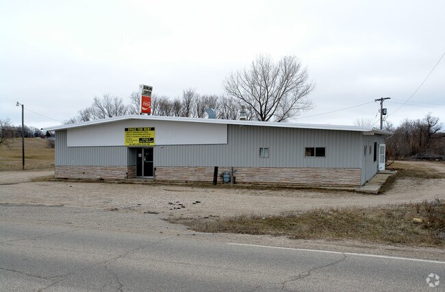
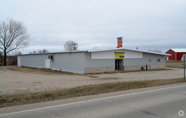
Property Record
1201 County Highway 9, Pelican Rapids, MN 56572

NEARBY LISTINGS FOR SALE OR LEASE
-
-
View all Pelican Rapids listings for sale on LoopNet.com
Property Detail
1201 County Highway 9
Fergus Falls, MN
SECT-22 TWP-136 RANGE-043 1.80 AC BG SW COR NW1/4 NE1/4 THEN E 300', N 260' W 300' S 260' TO BG
76000220006001
Otter Tail
Religious
Minnesota
2024
1.80 AC
2025
Minnesota Central Area
960300
Other Market Areas
8,820 SF
DEMOGRAPHICS near 1201 County Highway 9
1 Mile
3 Mile
5 Mile
2024 Total Population
1,258
2,812
3,510
2029 Population
1,250
2,780
3,498
Pop Growth 2024-2029
(0.64%)
(1.14%)
(0.34%)
Average Age
37
38
40
2024 Total Households
443
996
1,300
HH Growth 2024-2029
(0.90%)
(1.31%)
(0.31%)
Median Household Inc
$53,806
$58,531
$62,177
Avg Household Size
2.70
2.70
2.60
2024 Avg HH Vehicles
2.00
2.00
2.00
Median Home Value
$146,808
$170,192
$201,299
Median Year Built
1974
1973
1976
Nearby Places
Map Layers
Map Styles
 Street
 Aerial
- Restaurants
- Banks
- Shops
- Fitness
- Groceries
Nearby Properties
Address
Land Use
TOTAL SIZE
Lot Size
Zoning
Address
Land Use
TOTAL SIZE
Lot Size
Zoning
119,138 SF
5.26 AC
Address
Land Use
TOTAL SIZE
Lot Size
Zoning
62,982 SF
32.20 AC
Address
Land Use
TOTAL SIZE
Lot Size
Zoning
167,220 SF
80 AC
Address
Land Use
TOTAL SIZE
Lot Size
Zoning
168,526 SF
24.32 AC
Address
Land Use
TOTAL SIZE
Lot Size
Zoning
45,252 SF
3 AC
Address
Land Use
TOTAL SIZE
Lot Size
Zoning
43,544 SF
0.86 AC
Address
Land Use
TOTAL SIZE
Lot Size
Zoning
6,232 SF
2.32 AC
Address
Land Use
TOTAL SIZE
Lot Size
Zoning
5,000 SF
1.24 AC
Address
Land Use
TOTAL SIZE
Lot Size
Zoning
6,760 SF
0.46 AC
Address
Land Use
TOTAL SIZE
Lot Size
Zoning
Address
Land Use
TOTAL SIZE
Lot Size
Zoning
12,768 SF
0.45 AC
Address
Land Use
TOTAL SIZE
Lot Size
Zoning
Address
Land Use
TOTAL SIZE
Lot Size
Zoning
4,286 SF
0.15 AC
Address
Land Use
TOTAL SIZE
Lot Size
Zoning
1,832 SF
11.24 AC
Address
Land Use
TOTAL SIZE
Lot Size
Zoning
7,072 SF
0.83 AC
Address
Land Use
TOTAL SIZE
Lot Size
Zoning
9,914 SF
0.32 AC
Address
Land Use
TOTAL SIZE
Lot Size
Zoning
20,680 SF
1.24 AC
Address
Land Use
TOTAL SIZE
Lot Size
Zoning
1,788 SF
160 AC
Address
Land Use
TOTAL SIZE
Lot Size
Zoning
13,188 SF
0.60 AC
Address
Land Use
TOTAL SIZE
Lot Size
Zoning
7,124 SF
2.68 AC
Address
Land Use
TOTAL SIZE
Lot Size
Zoning
14,208 SF
1.60 AC
Address
Land Use
TOTAL SIZE
Lot Size
Zoning
26,688 SF
8.15 AC
Address
Land Use
TOTAL SIZE
Lot Size
Zoning
12,388 SF
2.49 AC
Address
Land Use
TOTAL SIZE
Lot Size
Zoning
Address
Land Use
TOTAL SIZE
Lot Size
Zoning
6,848 SF
0.65 AC
Address
Land Use
TOTAL SIZE
Lot Size
Zoning
9,322 SF
0.72 AC
Address
Land Use
TOTAL SIZE
Lot Size
Zoning
8,616 SF
0.55 AC
Address
Land Use
TOTAL SIZE
Lot Size
Zoning
20,000 SF
0.49 AC
Address
Land Use
TOTAL SIZE
Lot Size
Zoning
17,300 SF
2.53 AC
The World's #1 Commercial Real Estate Marketplace
Connect with us
© 2025 CoStar Group
The information above has been obtained from sources believed reliable. While we do not doubt its accuracy we have not verified it and make no guarantee, warranty or representation about it. It is your responsibility to independently confirm its accuracy and completeness. Any projections, opinions, assumptions, or estimates used are for example only and do not represent the current or future performance of the property. The value of this transaction to you depends on tax and other factors which should be evaluated by your tax, financial, and legal advisors. You and your advisors should conduct a careful, independent investigation of the property to determine to your satisfaction the suitability of the property for your needs.