Property Record
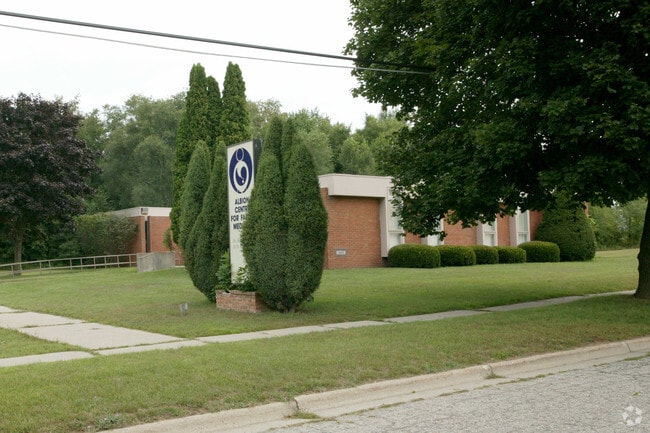
1201 E Broadwell St, Albion, MI 49224

Property Detail
1201 E Broadwell St
51-002-708-00
ALBION CITY, BENJAMIN SUBDIVISION THE W 400 FT OF LOT 1, ALSO THE W 465 FT OF THE N 129.5 FT OF LOT 2 EXC FOR THE W 60 FT OF
Medicalbuilding
Calhoun
MU
Michigan
B and X Area of moderate flood hazard, usually the area between the limits of the 100-year and 500-year floods.
1-2
2025
2.42 AC
2026
Eastern Calhoun County
003500
West Michigan
4,165 SF
Battle Creek, MI
NEARBY LISTINGS FOR SALE OR LEASE
DEMOGRAPHICS near 1201 E Broadwell St
1 mile
3 mile
5 mile
2025 Total Population
6,396
11,960
14,184
2030 Population
6,871
12,544
14,771
Pop Growth 2025-2030
+ 7.43%
+ 4.88%
+ 4.14%
Average Age
35
36
37
2025 Total Households
2,271
4,470
5,331
HH Growth 2025-2030
+ 8.23%
+ 5.21%
+ 4.39%
Median Household Inc
$41,250
$40,466
$43,413
Avg Household Size
2.30
2.30
2.40
2025 Avg HH Vehicles
1.00
2.00
2.00
Median Home Value
$87,128
$110,844
$128,571
Median Year Built
1957
1955
1956
Nearby Places
Map Layers
Map Styles
 Street
 Aerial
Layers
 Traffic
 Biking
Places
Listings with unknown addresses are not visible on the map
- Restaurants
- Banks
- Shops
- Fitness
- Groceries
PUBLIC TRANSPORTATION
COMMUTER RAIL
Albion (Wolverine - Amtrak)
Drive
Walk
Distance
Albion (Wolverine - Amtrak)
5 min
1.8 mi
Freight Ports
Port of Toledo
Drive
Walk
Distance
Port of Toledo
127 min
99.5 mi
Nearby Properties
Address
Land Use
TOTAL SIZE
Lot Size
Zoning
Address
Land Use
TOTAL SIZE
Lot Size
Zoning
844,532 SF
36.92 AC
M-1
Address
Land Use
TOTAL SIZE
Lot Size
Zoning
184,000 SF
M1
Address
Land Use
TOTAL SIZE
Lot Size
Zoning
92,597 SF
38.57 AC
LI/LIGHT I
Address
Land Use
TOTAL SIZE
Lot Size
Zoning
35,709 SF
HI/HEAVY I
Address
Land Use
TOTAL SIZE
Lot Size
Zoning
59,140 SF
1.58 AC
CBD
Address
Land Use
TOTAL SIZE
Lot Size
Zoning
126,528 SF
19.97 AC
M-2
Address
Land Use
TOTAL SIZE
Lot Size
Zoning
60,066 SF
9.95 AC
R-2
Address
Land Use
TOTAL SIZE
Lot Size
Zoning
76,113 SF
Address
Land Use
TOTAL SIZE
Lot Size
Zoning
128,884 SF
6.77 AC
M-1
Address
Land Use
TOTAL SIZE
Lot Size
Zoning
69,370 SF
7.89 AC
M-1
Address
Land Use
TOTAL SIZE
Lot Size
Zoning
76,157 SF
9.12 AC
C
Address
Land Use
TOTAL SIZE
Lot Size
Zoning
42,500 SF
86.43 AC
R-2
Address
Land Use
TOTAL SIZE
Lot Size
Zoning
Address
Land Use
TOTAL SIZE
Lot Size
Zoning
111,520 SF
12.33 AC
M-1
Address
Land Use
TOTAL SIZE
Lot Size
Zoning
37.31 AC
R-2
Address
Land Use
TOTAL SIZE
Lot Size
Zoning
1,127 SF
42.62 AC
AA/AGRICUL
Address
Land Use
TOTAL SIZE
Lot Size
Zoning
65,260 SF
25.29 AC
I 1
Address
Land Use
TOTAL SIZE
Lot Size
Zoning
24,791 SF
1.13 AC
MU
Address
Land Use
TOTAL SIZE
Lot Size
Zoning
8,816 SF
Address
Land Use
TOTAL SIZE
Lot Size
Zoning
39,417 SF
3.21 AC
C
Address
Land Use
TOTAL SIZE
Lot Size
Zoning
14,146 SF
1.60 AC
CD
Address
Land Use
TOTAL SIZE
Lot Size
Zoning
12,736 SF
3.10 AC
AA/AGRICUL
Address
Land Use
TOTAL SIZE
Lot Size
Zoning
1,400 SF
2.85 AC
I-1
Address
Land Use
TOTAL SIZE
Lot Size
Zoning
10,764 SF
B2
Address
Land Use
TOTAL SIZE
Lot Size
Zoning
38,894 SF
6.44 AC
HS/HWY.SVC
Address
Land Use
TOTAL SIZE
Lot Size
Zoning
71,117 SF
11.58 AC
C
Address
Land Use
TOTAL SIZE
Lot Size
Zoning
284,079 SF
23.29 AC
AA/AGRICUL
Address
Land Use
TOTAL SIZE
Lot Size
Zoning
379 AC
OC/OPENSPA
Address
Land Use
TOTAL SIZE
Lot Size
Zoning
29,239 SF
1.36 AC
MU
Address
Land Use
TOTAL SIZE
Lot Size
Zoning
2,048 SF
230.85 AC
AG
The World's #1 Commercial Real Estate Marketplace
Connect with us
© 2026 CoStar Group
The information above has been obtained from sources believed reliable. While we do not doubt its accuracy we have not verified it and make no guarantee, warranty or representation about it. It is your responsibility to independently confirm its accuracy and completeness. Any projections, opinions, assumptions, or estimates used are for example only and do not represent the current or future performance of the property. The value of this transaction to you depends on tax and other factors which should be evaluated by your tax, financial, and legal advisors. You and your advisors should conduct a careful, independent investigation of the property to determine to your satisfaction the suitability of the property for your needs.