Property Record
1201 E Main St, Albert Lea, MN 56007
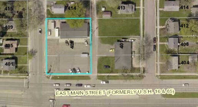

Property Detail
1201 E Main St
Albert Lea, MN
HOME ADDITION LOT-6-8 BLOCK-022 LOT 6 7 & 8 BLK 22 EXC HWY EASEMENT ALSO EXC PT LOT 8 BLK 22 SHOWN AS PARCEL 230 ON MN DEPT OF TRANPORTION ROW PLAT NUMBERED 24-11 SECOND & THIRD HOME ADD
34.180.4570
Freeborn
Commercialnec
Minnesota
B2
6-8
B and X Area of moderate flood hazard, usually the area between the limits of the 100-year and 500-year floods.
0.38 AC
2025
Minnesota South Area
2025
Other Market Areas
180600
NEARBY LISTINGS FOR SALE OR LEASE
-
-
View all Albert Lea listings for lease on LoopNet.com
DEMOGRAPHICS near 1201 E Main St
1 mile
3 mile
5 mile
2025 Total Population
6,100
18,697
20,533
2030 Population
6,018
18,541
20,371
Pop Growth 2025-2030
(1.34%)
(0.83%)
(0.79%)
Average Age
41
42
43
2025 Total Households
2,622
7,999
8,748
HH Growth 2025-2030
(1.37%)
(0.84%)
(0.80%)
Median Household Inc
$59,011
$61,838
$63,696
Avg Household Size
2.20
2.20
2.20
2025 Avg HH Vehicles
2.00
2.00
2.00
Median Home Value
$142,122
$157,869
$164,760
Median Year Built
1954
1959
1959
Nearby Places
Map Layers
Map Styles
 Street
 Aerial
Transit
 Traffic
 Biking
Places
Listings with unknown addresses are not visible on the map
- Restaurants
- Banks
- Shops
- Fitness
- Groceries
SALE & LEASE HISTORY
LISTING DATE
SALE/LEASE

Dec 06, 2019
For Lease
Dec 06, 2019
For Sale
Nearby Properties
Address
Land Use
TOTAL SIZE
Lot Size
Zoning
Address
Land Use
TOTAL SIZE
Lot Size
Zoning
8.30 AC
PD
Address
Land Use
TOTAL SIZE
Lot Size
Zoning
26.38 AC
Address
Land Use
TOTAL SIZE
Lot Size
Zoning
2.01 AC
B3
Address
Land Use
TOTAL SIZE
Lot Size
Zoning
21.14 AC
Address
Land Use
TOTAL SIZE
Lot Size
Zoning
81.57 AC
I1
Address
Land Use
TOTAL SIZE
Lot Size
Zoning
5.41 AC
PD
Address
Land Use
TOTAL SIZE
Lot Size
Zoning
15.50 AC
Address
Land Use
TOTAL SIZE
Lot Size
Zoning
16.79 AC
B2
Address
Land Use
TOTAL SIZE
Lot Size
Zoning
6.96 AC
I2
Address
Land Use
TOTAL SIZE
Lot Size
Zoning
Address
Land Use
TOTAL SIZE
Lot Size
Zoning
5.68 AC
PD
Address
Land Use
TOTAL SIZE
Lot Size
Zoning
69,582 SF
12.88 AC
B2
Address
Land Use
TOTAL SIZE
Lot Size
Zoning
Address
Land Use
TOTAL SIZE
Lot Size
Zoning
Address
Land Use
TOTAL SIZE
Lot Size
Zoning
31.20 AC
IDD
Address
Land Use
TOTAL SIZE
Lot Size
Zoning
0.88 AC
R3
Address
Land Use
TOTAL SIZE
Lot Size
Zoning
247,732 SF
13.04 AC
I2
Address
Land Use
TOTAL SIZE
Lot Size
Zoning
11.71 AC
B2
Address
Land Use
TOTAL SIZE
Lot Size
Zoning
4.98 AC
Address
Land Use
TOTAL SIZE
Lot Size
Zoning
4.87 AC
I2
Address
Land Use
TOTAL SIZE
Lot Size
Zoning
2.51 AC
R3
Address
Land Use
TOTAL SIZE
Lot Size
Zoning
9.37 AC
I2
Address
Land Use
TOTAL SIZE
Lot Size
Zoning
12.80 AC
PD
Address
Land Use
TOTAL SIZE
Lot Size
Zoning
0.26 AC
B3
Address
Land Use
TOTAL SIZE
Lot Size
Zoning
6.64 AC
PD
Address
Land Use
TOTAL SIZE
Lot Size
Zoning
1.71 AC
PD
Address
Land Use
TOTAL SIZE
Lot Size
Zoning
2.90 AC
R3
Address
Land Use
TOTAL SIZE
Lot Size
Zoning
0.29 AC
Address
Land Use
TOTAL SIZE
Lot Size
Zoning
14.73 AC
B4
The World's #1 Commercial Real Estate Marketplace
Connect with us
© 2026 CoStar Group
The information above has been obtained from sources believed reliable. While we do not doubt its accuracy we have not verified it and make no guarantee, warranty or representation about it. It is your responsibility to independently confirm its accuracy and completeness. Any projections, opinions, assumptions, or estimates used are for example only and do not represent the current or future performance of the property. The value of this transaction to you depends on tax and other factors which should be evaluated by your tax, financial, and legal advisors. You and your advisors should conduct a careful, independent investigation of the property to determine to your satisfaction the suitability of the property for your needs.