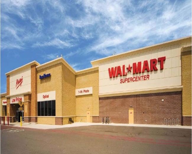
Property Record
1201 Grindstone Pkwy, Columbia, MO 65201
NEARBY LISTINGS FOR SALE OR LEASE
Property Detail
1201 Grindstone Pkwy
Columbia, MO
Grindstone Plaza Subdivision
17-701-00-26-001-00-01
GRINDSTONE PLAZA SUBDIVISION ADMN PLAT LOT 1 M PT LOT 1A (WALMART)
Wholesaleoutletdiscountstore
Boone
X
Missouri
29019C0287E
1
2025
18.57 AC
2025
Columbia/Jefferson City
001105
Other Market Areas
185,585 SF
DEMOGRAPHICS near 1201 Grindstone Pkwy
1 Mile
3 Mile
5 Mile
2024 Total Population
7,085
58,466
118,836
2029 Population
7,490
61,725
126,018
Pop Growth 2024-2029
+ 5.72%
+ 5.57%
+ 6.04%
Average Age
30
33
35
2024 Total Households
3,594
22,883
48,552
HH Growth 2024-2029
+ 5.84%
+ 6.18%
+ 6.49%
Median Household Inc
$47,639
$45,663
$55,368
Avg Household Size
1.90
2.10
2.20
2024 Avg HH Vehicles
2.00
2.00
2.00
Median Home Value
$152,073
$268,018
$251,642
Median Year Built
1995
1992
1990
Nearby Places
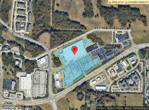
Map Layers
Map Styles
 Street
 Aerial
- Restaurants
- Banks
- Shops
- Fitness
- Groceries
PUBLIC TRANSPORTATION
AIRPORT
Columbia Regional
DRIVE
WALK
Distance
Columbia Regional
15 min
10.4 mi
SALE & LEASE HISTORY
LISTING DATE
SALE/LEASE

Jul 13, 2023
For Lease
Nearby Properties
Address
Land Use
TOTAL SIZE
Lot Size
Zoning
Address
Land Use
TOTAL SIZE
Lot Size
Zoning
373,370 SF
77.30 AC
O1
Address
Land Use
TOTAL SIZE
Lot Size
Zoning
149,686 SF
15.26 AC
MC
Address
Land Use
TOTAL SIZE
Lot Size
Zoning
6,390 SF
28.23 AC
Address
Land Use
TOTAL SIZE
Lot Size
Zoning
40,016 SF
2.13 AC
O1
Address
Land Use
TOTAL SIZE
Lot Size
Zoning
3,808 SF
0.39 AC
C2
Address
Land Use
TOTAL SIZE
Lot Size
Zoning
234,111 SF
2.27 AC
Address
Land Use
TOTAL SIZE
Lot Size
Zoning
10,459 SF
39.22 AC
RMH
Address
Land Use
TOTAL SIZE
Lot Size
Zoning
50,304 SF
8.78 AC
C1
Address
Land Use
TOTAL SIZE
Lot Size
Zoning
11,760 SF
22.98 AC
Address
Land Use
TOTAL SIZE
Lot Size
Zoning
159,169 SF
1.26 AC
R3
Address
Land Use
TOTAL SIZE
Lot Size
Zoning
89,638 SF
6.42 AC
C3
Address
Land Use
TOTAL SIZE
Lot Size
Zoning
52,568 SF
9.50 AC
Address
Land Use
TOTAL SIZE
Lot Size
Zoning
134,625 SF
0.79 AC
C2
Address
Land Use
TOTAL SIZE
Lot Size
Zoning
45,750 SF
0.66 AC
R3
Address
Land Use
TOTAL SIZE
Lot Size
Zoning
70,930 SF
9.66 AC
Address
Land Use
TOTAL SIZE
Lot Size
Zoning
38,500 SF
3.10 AC
O1
Address
Land Use
TOTAL SIZE
Lot Size
Zoning
97,092 SF
1.56 AC
Address
Land Use
TOTAL SIZE
Lot Size
Zoning
24,624 SF
21.42 AC
Address
Land Use
TOTAL SIZE
Lot Size
Zoning
136,448 SF
0.78 AC
C2
Address
Land Use
TOTAL SIZE
Lot Size
Zoning
3,420 SF
18.60 AC
R3
Address
Land Use
TOTAL SIZE
Lot Size
Zoning
8,678 SF
23.15 AC
R3
Address
Land Use
TOTAL SIZE
Lot Size
Zoning
264,960 SF
40.01 AC
R1
Address
Land Use
TOTAL SIZE
Lot Size
Zoning
148,500 SF
22.62 AC
R3
Address
Land Use
TOTAL SIZE
Lot Size
Zoning
68,408 SF
4.38 AC
O1
Address
Land Use
TOTAL SIZE
Lot Size
Zoning
119,520 SF
12.56 AC
Address
Land Use
TOTAL SIZE
Lot Size
Zoning
17,589 SF
0.52 AC
C2
Address
Land Use
TOTAL SIZE
Lot Size
Zoning
34,357 SF
15.59 AC
Address
Land Use
TOTAL SIZE
Lot Size
Zoning
34,707 SF
0.41 AC
R3
Address
Land Use
TOTAL SIZE
Lot Size
Zoning
93,320 SF
0.50 AC
C2
The World's #1 Commercial Real Estate Marketplace
Connect with us
© 2026 CoStar Group
The information above has been obtained from sources believed reliable. While we do not doubt its accuracy we have not verified it and make no guarantee, warranty or representation about it. It is your responsibility to independently confirm its accuracy and completeness. Any projections, opinions, assumptions, or estimates used are for example only and do not represent the current or future performance of the property. The value of this transaction to you depends on tax and other factors which should be evaluated by your tax, financial, and legal advisors. You and your advisors should conduct a careful, independent investigation of the property to determine to your satisfaction the suitability of the property for your needs.