Property Record
1201 W Iron Springs Rd, Prescott, AZ 86305
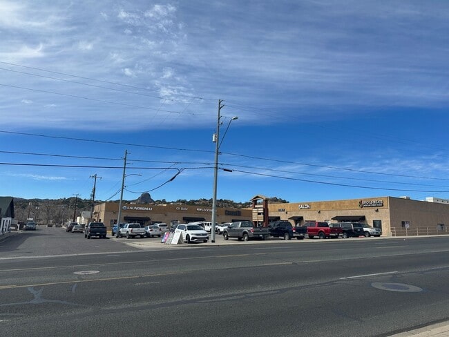

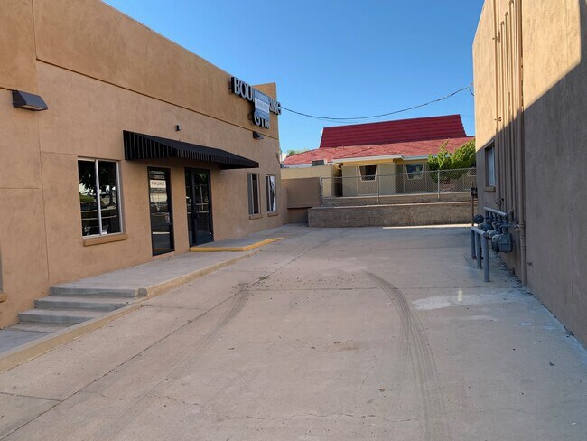
Property Detail
1201 W Iron Springs Rd
Prescott, AZ
HINMAN TRACT, BLOCK 1, REPLAT PORTIONS OF LOTS 2, 3 & 4 PER MAP 2 016-0055848, LOT 2-R
115-09-042F
Yavapai
Stripcommercialcenter
Arizona
B and X Area of moderate flood hazard, usually the area between the limits of the 100-year and 500-year floods.
2-4
2025
0.85 AC
2027
Prescott & Sedona
001003
Other Market Areas
13,000 SF
NEARBY LISTINGS FOR SALE OR LEASE
DEMOGRAPHICS near 1201 W Iron Springs Rd
1 mile
3 mile
5 mile
2025 Total Population
7,276
42,020
57,618
2030 Population
7,633
44,663
61,289
Pop Growth 2025-2030
+ 4.91%
+ 6.29%
+ 6.37%
Average Age
48
51
52
2025 Total Households
3,507
20,380
27,678
HH Growth 2025-2030
+ 4.96%
+ 6.39%
+ 6.51%
Median Household Inc
$56,142
$69,165
$70,938
Avg Household Size
1.90
2.00
2.00
2025 Avg HH Vehicles
2.00
2.00
2.00
Median Home Value
$416,667
$584,668
$596,272
Median Year Built
1986
1989
1992
Nearby Places
Map Layers
Map Styles
 Street
 Aerial
Layers
 Traffic
 Biking
Places
Listings with unknown addresses are not visible on the map
- Restaurants
- Banks
- Shops
- Fitness
- Groceries
SALE & LEASE HISTORY
LISTING DATE
SALE/LEASE

Sep 30, 2016
For Sale
Sep 28, 2016
For Sale
Sep 23, 2016
For Sale
Nov 13, 2018
For Sale
Feb 24, 2018
For Lease
Dec 04, 2020
For Lease
Aug 07, 2025
For Lease
Nearby Properties
Address
Land Use
TOTAL SIZE
Lot Size
Zoning
Address
Land Use
TOTAL SIZE
Lot Size
Zoning
633,861 SF
21.72 AC
Address
Land Use
TOTAL SIZE
Lot Size
Zoning
334,628 SF
15.03 AC
Address
Land Use
TOTAL SIZE
Lot Size
Zoning
288,789 SF
24.01 AC
Address
Land Use
TOTAL SIZE
Lot Size
Zoning
103,382 SF
3.43 AC
Address
Land Use
TOTAL SIZE
Lot Size
Zoning
17,200 SF
88.32 AC
Address
Land Use
TOTAL SIZE
Lot Size
Zoning
110,011 SF
8.04 AC
Address
Land Use
TOTAL SIZE
Lot Size
Zoning
122,130 SF
2.20 AC
Address
Land Use
TOTAL SIZE
Lot Size
Zoning
67,239 SF
Address
Land Use
TOTAL SIZE
Lot Size
Zoning
43,046 SF
3.13 AC
Address
Land Use
TOTAL SIZE
Lot Size
Zoning
142,636 SF
1.14 AC
Address
Land Use
TOTAL SIZE
Lot Size
Zoning
30,000 SF
44.55 AC
Address
Land Use
TOTAL SIZE
Lot Size
Zoning
142,343 SF
39.35 AC
Address
Land Use
TOTAL SIZE
Lot Size
Zoning
114,526 SF
9.68 AC
Address
Land Use
TOTAL SIZE
Lot Size
Zoning
64,987 SF
2.62 AC
Address
Land Use
TOTAL SIZE
Lot Size
Zoning
77,751 SF
3.88 AC
Address
Land Use
TOTAL SIZE
Lot Size
Zoning
35,353 SF
1.12 AC
Address
Land Use
TOTAL SIZE
Lot Size
Zoning
58,352 SF
4.48 AC
Address
Land Use
TOTAL SIZE
Lot Size
Zoning
48,488 SF
5.50 AC
Address
Land Use
TOTAL SIZE
Lot Size
Zoning
30,638 SF
1.25 AC
Address
Land Use
TOTAL SIZE
Lot Size
Zoning
160,788 SF
14.05 AC
Address
Land Use
TOTAL SIZE
Lot Size
Zoning
49,570 SF
2.75 AC
Address
Land Use
TOTAL SIZE
Lot Size
Zoning
98,858 SF
7.05 AC
Address
Land Use
TOTAL SIZE
Lot Size
Zoning
64,176 SF
3.10 AC
Address
Land Use
TOTAL SIZE
Lot Size
Zoning
60,978 SF
4.72 AC
Address
Land Use
TOTAL SIZE
Lot Size
Zoning
52,136 SF
0.75 AC
Address
Land Use
TOTAL SIZE
Lot Size
Zoning
49,477 SF
0.34 AC
Address
Land Use
TOTAL SIZE
Lot Size
Zoning
75,262 SF
67.69 AC
Address
Land Use
TOTAL SIZE
Lot Size
Zoning
43,896 SF
4.06 AC
Address
Land Use
TOTAL SIZE
Lot Size
Zoning
140,525 SF
7.64 AC
Address
Land Use
TOTAL SIZE
Lot Size
Zoning
49,165 SF
2.06 AC
The World's #1 Commercial Real Estate Marketplace
Connect with us
© 2026 CoStar Group
The information above has been obtained from sources believed reliable. While we do not doubt its accuracy we have not verified it and make no guarantee, warranty or representation about it. It is your responsibility to independently confirm its accuracy and completeness. Any projections, opinions, assumptions, or estimates used are for example only and do not represent the current or future performance of the property. The value of this transaction to you depends on tax and other factors which should be evaluated by your tax, financial, and legal advisors. You and your advisors should conduct a careful, independent investigation of the property to determine to your satisfaction the suitability of the property for your needs.