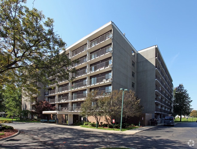
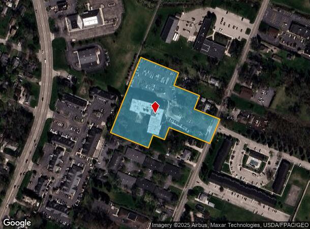
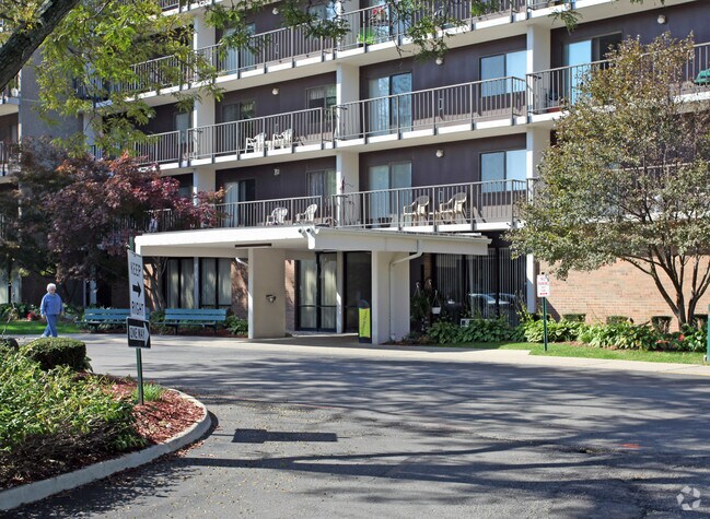
Property Record
1201 N Macomb St, Monroe, MI 48162
NEARBY LISTINGS FOR SALE OR LEASE
-
-
View all Monroe listings for sale on LoopNet.com
Property Detail
1201 N Macomb St
07-053-034-00
F-1056 SEC 32 T6S R9E & PC 53 & 652 - 3.975 AMOL COM 2127.23 FT N 24 DEG 30'E FR INT CL N MACOMB ST & S LI LEMERAND ST EXT, PRO TH N 24 DEG 30'E 151.3 FT, TH N 65 DEG 36'20"W 159.91 FT, TH N 24 DEG 19'47"E 79.12 FT, TH N 65 DEG 36'20"W 159 FT, TH N 2
Commercialnec
Monroe
X
Michigan
26115C0242F
3.97 AC
0
Monroe
2025
Detroit
831600
Monroe, MI
DEMOGRAPHICS near 1201 N Macomb St
1 Mile
3 Mile
5 Mile
2024 Total Population
8,050
38,899
55,233
2029 Population
8,147
39,565
56,138
Pop Growth 2024-2029
+ 1.20%
+ 1.71%
+ 1.64%
Average Age
43
41
42
2024 Total Households
3,383
16,079
22,561
HH Growth 2024-2029
+ 1.09%
+ 1.62%
+ 1.56%
Median Household Inc
$57,314
$56,219
$60,947
Avg Household Size
2.30
2.30
2.30
2024 Avg HH Vehicles
2.00
2.00
2.00
Median Home Value
$154,765
$153,549
$167,667
Median Year Built
1958
1964
1969
Nearby Places
Map Layers
Map Styles
 Street
 Aerial
- Restaurants
- Banks
- Shops
- Fitness
- Groceries
PUBLIC TRANSPORTATION
AIRPORT
Detroit Metro Wayne County
DRIVE
WALK
Distance
Detroit Metro Wayne County
30 min
22.8 mi
Freight Ports
Port of Toledo
DRIVE
WALK
Distance
Port of Toledo
39 min
26.1 mi
Nearby Properties
Address
Land Use
TOTAL SIZE
Lot Size
Zoning
Address
Land Use
TOTAL SIZE
Lot Size
Zoning
200,000 SF
94.63 AC
CO
Address
Land Use
TOTAL SIZE
Lot Size
Zoning
409,765 SF
41.46 AC
Address
Land Use
TOTAL SIZE
Lot Size
Zoning
95.60 AC
Address
Land Use
TOTAL SIZE
Lot Size
Zoning
Address
Land Use
TOTAL SIZE
Lot Size
Zoning
195,744 SF
32.62 AC
C-2-COMMER
Address
Land Use
TOTAL SIZE
Lot Size
Zoning
315,000 SF
24.47 AC
Address
Land Use
TOTAL SIZE
Lot Size
Zoning
13.60 AC
Address
Land Use
TOTAL SIZE
Lot Size
Zoning
108,575 SF
38.21 AC
R-1A
Address
Land Use
TOTAL SIZE
Lot Size
Zoning
43,528 SF
16.06 AC
MHP
Address
Land Use
TOTAL SIZE
Lot Size
Zoning
507.34 AC
R-1A
Address
Land Use
TOTAL SIZE
Lot Size
Zoning
317,482 SF
20.53 AC
Address
Land Use
TOTAL SIZE
Lot Size
Zoning
134,464 SF
34.35 AC
Address
Land Use
TOTAL SIZE
Lot Size
Zoning
2,195 SF
86.71 AC
MHP
Address
Land Use
TOTAL SIZE
Lot Size
Zoning
192,917 SF
15.81 AC
R3B-MULTIF
Address
Land Use
TOTAL SIZE
Lot Size
Zoning
69,590 SF
11.55 AC
C-2-COMMER
Address
Land Use
TOTAL SIZE
Lot Size
Zoning
291,322 SF
55.05 AC
Address
Land Use
TOTAL SIZE
Lot Size
Zoning
148,343 SF
15.15 AC
Address
Land Use
TOTAL SIZE
Lot Size
Zoning
3,822 SF
16.60 AC
R-1A
Address
Land Use
TOTAL SIZE
Lot Size
Zoning
138,119 SF
15.12 AC
Address
Land Use
TOTAL SIZE
Lot Size
Zoning
189,314 SF
28.56 AC
Address
Land Use
TOTAL SIZE
Lot Size
Zoning
94,324 SF
10.11 AC
Address
Land Use
TOTAL SIZE
Lot Size
Zoning
62,459 SF
2.59 AC
Address
Land Use
TOTAL SIZE
Lot Size
Zoning
290,248 SF
52.03 AC
Address
Land Use
TOTAL SIZE
Lot Size
Zoning
142,400 SF
15.20 AC
Address
Land Use
TOTAL SIZE
Lot Size
Zoning
41 AC
MHP
Address
Land Use
TOTAL SIZE
Lot Size
Zoning
43,127 SF
8.10 AC
Address
Land Use
TOTAL SIZE
Lot Size
Zoning
412,877 SF
22.35 AC
R-1A
Address
Land Use
TOTAL SIZE
Lot Size
Zoning
220,500 SF
31.81 AC
Address
Land Use
TOTAL SIZE
Lot Size
Zoning
200,700 SF
9.95 AC
R-1A
The World's #1 Commercial Real Estate Marketplace
Connect with us
© 2025 CoStar Group
The information above has been obtained from sources believed reliable. While we do not doubt its accuracy we have not verified it and make no guarantee, warranty or representation about it. It is your responsibility to independently confirm its accuracy and completeness. Any projections, opinions, assumptions, or estimates used are for example only and do not represent the current or future performance of the property. The value of this transaction to you depends on tax and other factors which should be evaluated by your tax, financial, and legal advisors. You and your advisors should conduct a careful, independent investigation of the property to determine to your satisfaction the suitability of the property for your needs.