Property Record
1201 N Pryor St, Silver Lake, WI 53170

NEARBY LISTINGS FOR SALE OR LEASE
Property Detail
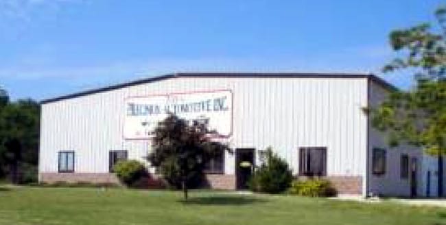
1201 N Pryor St
Kenosha, WI
Csm# 1487
70-4-120-083-4225
CSM 1487 V 1455 P 704 SW 1/4 SEC 8 T 1 R 20 A REPLAT OF CSM 1475 EXC ROW DOC #1714745 EXCP COMM SW COR CSM# 1487 THC N 25 DEG
Commercialnec
Kenosha
X
Wisconsin
55059C0141E
4225
2024
2.98 AC
2024
Kenosha West
002903
Chicago
5,600 SF
DEMOGRAPHICS near 1201 N Pryor St
1 Mile
3 Mile
5 Mile
2024 Total Population
1,894
10,240
23,046
2029 Population
1,886
10,239
23,052
Pop Growth 2024-2029
(0.42%)
(0.01%)
+ 0.03%
Average Age
41
42
42
2024 Total Households
727
4,057
9,115
HH Growth 2024-2029
(0.55%)
(0.10%)
(0.05%)
Median Household Inc
$80,430
$79,905
$83,724
Avg Household Size
2.60
2.50
2.50
2024 Avg HH Vehicles
2.00
2.00
2.00
Median Home Value
$308,013
$273,191
$272,071
Median Year Built
1977
1975
1976
Nearby Places
Map Layers
Map Styles
 Street
 Aerial
- Restaurants
- Banks
- Shops
- Fitness
- Groceries
PUBLIC TRANSPORTATION
COMMUTER RAIL
Antioch Station (North Central Service - Northeast Illinois Regional Commuter Railroad (Metra))
DRIVE
WALK
Distance
Antioch Station (North Central Service - Northeast Illinois Regional Commuter Railroad (Metra))
16 min
9.5 mi
AIRPORT
General Mitchell International
DRIVE
WALK
Distance
General Mitchell International
53 min
39.4 mi
Freight Ports
Port Milwaukee
DRIVE
WALK
Distance
Port Milwaukee
57 min
43.3 mi
Nearby Properties
Address
Land Use
TOTAL SIZE
Lot Size
Zoning
Address
Land Use
TOTAL SIZE
Lot Size
Zoning
11,000 SF
6.52 AC
Address
Land Use
TOTAL SIZE
Lot Size
Zoning
Address
Land Use
TOTAL SIZE
Lot Size
Zoning
22,984 SF
2.74 AC
Address
Land Use
TOTAL SIZE
Lot Size
Zoning
9,471 SF
2.91 AC
Address
Land Use
TOTAL SIZE
Lot Size
Zoning
22,750 SF
2.42 AC
Address
Land Use
TOTAL SIZE
Lot Size
Zoning
22,750 SF
2.39 AC
Address
Land Use
TOTAL SIZE
Lot Size
Zoning
12,528 SF
8.32 AC
Address
Land Use
TOTAL SIZE
Lot Size
Zoning
20,345 SF
3.54 AC
Address
Land Use
TOTAL SIZE
Lot Size
Zoning
15,048 SF
1.92 AC
Address
Land Use
TOTAL SIZE
Lot Size
Zoning
1.65 AC
Address
Land Use
TOTAL SIZE
Lot Size
Zoning
23,600 SF
5.19 AC
Address
Land Use
TOTAL SIZE
Lot Size
Zoning
11,500 SF
2.43 AC
Address
Land Use
TOTAL SIZE
Lot Size
Zoning
21,723 SF
6.37 AC
Address
Land Use
TOTAL SIZE
Lot Size
Zoning
14,620 SF
1.66 AC
Address
Land Use
TOTAL SIZE
Lot Size
Zoning
14,620 SF
1.60 AC
Address
Land Use
TOTAL SIZE
Lot Size
Zoning
10,142 SF
2.45 AC
Address
Land Use
TOTAL SIZE
Lot Size
Zoning
1,104 SF
6.98 AC
Address
Land Use
TOTAL SIZE
Lot Size
Zoning
3,310 SF
1.72 AC
Address
Land Use
TOTAL SIZE
Lot Size
Zoning
3,952 SF
4.64 AC
Address
Land Use
TOTAL SIZE
Lot Size
Zoning
4,865 SF
34.21 AC
Address
Land Use
TOTAL SIZE
Lot Size
Zoning
1,288 SF
1.83 AC
Address
Land Use
TOTAL SIZE
Lot Size
Zoning
7,912 SF
1.63 AC
Address
Land Use
TOTAL SIZE
Lot Size
Zoning
1.48 AC
Address
Land Use
TOTAL SIZE
Lot Size
Zoning
11,160 SF
5.45 AC
Address
Land Use
TOTAL SIZE
Lot Size
Zoning
16,748 SF
1.01 AC
Address
Land Use
TOTAL SIZE
Lot Size
Zoning
2,985 SF
1 AC
Address
Land Use
TOTAL SIZE
Lot Size
Zoning
6,189 SF
1.71 AC
Address
Land Use
TOTAL SIZE
Lot Size
Zoning
2,188 SF
0.79 AC
Address
Land Use
TOTAL SIZE
Lot Size
Zoning
13,680 SF
1.10 AC
Address
Land Use
TOTAL SIZE
Lot Size
Zoning
5,399 SF
1.03 AC
The World's #1 Commercial Real Estate Marketplace
Connect with us
© 2026 CoStar Group
The information above has been obtained from sources believed reliable. While we do not doubt its accuracy we have not verified it and make no guarantee, warranty or representation about it. It is your responsibility to independently confirm its accuracy and completeness. Any projections, opinions, assumptions, or estimates used are for example only and do not represent the current or future performance of the property. The value of this transaction to you depends on tax and other factors which should be evaluated by your tax, financial, and legal advisors. You and your advisors should conduct a careful, independent investigation of the property to determine to your satisfaction the suitability of the property for your needs.