Property Record
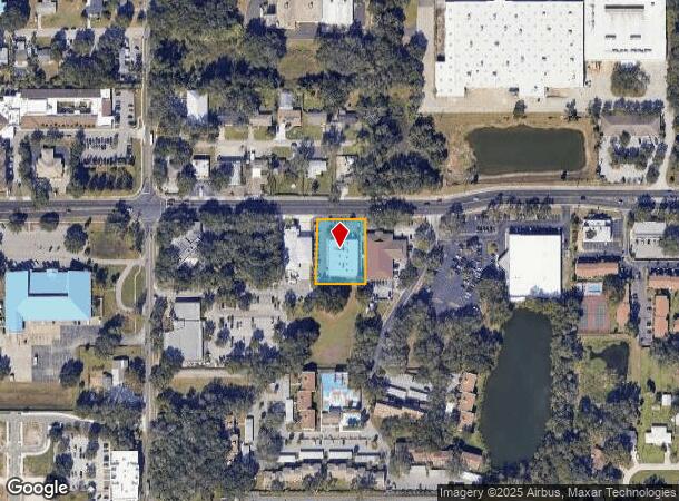
1201 Oakfield Dr, Brandon, FL 33511


NEARBY LISTINGS FOR SALE OR LEASE
Property Detail
1201 Oakfield Dr
Tampa-St. Petersburg-Clearwater, FL
Unplatted
U-27-29-20-ZZZ-000002-66060.0
E 150 FT OF N 264 FT OF NW 1/4 OF SW 1/4 OF NW 1/4 LESS RD
Officebuilding
Hillsborough
X
Florida
12057C0391H
66060
2024
0.69 AC
2025
East Tampa
013307
Tampa/St Petersburg
10,036 SF
DEMOGRAPHICS near 1201 Oakfield Dr
1 Mile
3 Mile
5 Mile
2024 Total Population
12,185
102,017
242,458
2029 Population
13,430
111,210
264,404
Pop Growth 2024-2029
+ 10.22%
+ 9.01%
+ 9.05%
Average Age
39
39
39
2024 Total Households
4,955
40,307
91,993
HH Growth 2024-2029
+ 10.49%
+ 9.37%
+ 9.43%
Median Household Inc
$55,670
$67,022
$67,974
Avg Household Size
2.30
2.50
2.60
2024 Avg HH Vehicles
1.00
2.00
2.00
Median Home Value
$241,082
$265,785
$267,780
Median Year Built
1991
1992
1993
Nearby Places
Map Layers
Map Styles
 Street
 Aerial
- Restaurants
- Banks
- Shops
- Fitness
- Groceries
PUBLIC TRANSPORTATION
AIRPORT
Tampa International
DRIVE
WALK
Distance
Tampa International
31 min
18.5 mi
St Pete-Clearwater International
DRIVE
WALK
Distance
St Pete-Clearwater International
48 min
28.5 mi
Nearby Properties
Address
Land Use
TOTAL SIZE
Lot Size
Zoning
Address
Land Use
TOTAL SIZE
Lot Size
Zoning
733,263 SF
72.88 AC
PD
Address
Land Use
TOTAL SIZE
Lot Size
Zoning
868,482 SF
60.83 AC
PD
Address
Land Use
TOTAL SIZE
Lot Size
Zoning
589,526 SF
18.06 AC
PD
Address
Land Use
TOTAL SIZE
Lot Size
Zoning
574,867 SF
31.07 AC
PD
Address
Land Use
TOTAL SIZE
Lot Size
Zoning
536,433 SF
18.23 AC
PD
Address
Land Use
TOTAL SIZE
Lot Size
Zoning
501,085 SF
41.18 AC
PD
Address
Land Use
TOTAL SIZE
Lot Size
Zoning
349,931 SF
19.43 AC
PD
Address
Land Use
TOTAL SIZE
Lot Size
Zoning
379,023 SF
22.16 AC
PD
Address
Land Use
TOTAL SIZE
Lot Size
Zoning
399,989 SF
25.63 AC
PD
Address
Land Use
TOTAL SIZE
Lot Size
Zoning
378,206 SF
20.48 AC
PD
Address
Land Use
TOTAL SIZE
Lot Size
Zoning
427,830 SF
23.95 AC
PD
Address
Land Use
TOTAL SIZE
Lot Size
Zoning
398,440 SF
48.63 AC
IPD-1
Address
Land Use
TOTAL SIZE
Lot Size
Zoning
317,413 SF
14.60 AC
PD
Address
Land Use
TOTAL SIZE
Lot Size
Zoning
349,531 SF
17.15 AC
PD
Address
Land Use
TOTAL SIZE
Lot Size
Zoning
343,903 SF
16.71 AC
PD
Address
Land Use
TOTAL SIZE
Lot Size
Zoning
358,987 SF
49.16 AC
PD
Address
Land Use
TOTAL SIZE
Lot Size
Zoning
402,388 SF
34.49 AC
PD
Address
Land Use
TOTAL SIZE
Lot Size
Zoning
426,236 SF
21.09 AC
PD
Address
Land Use
TOTAL SIZE
Lot Size
Zoning
105,896 SF
38.08 AC
PD
Address
Land Use
TOTAL SIZE
Lot Size
Zoning
378,173 SF
20.06 AC
PD
Address
Land Use
TOTAL SIZE
Lot Size
Zoning
337,223 SF
35.27 AC
PD
Address
Land Use
TOTAL SIZE
Lot Size
Zoning
328,279 SF
15.31 AC
PD
Address
Land Use
TOTAL SIZE
Lot Size
Zoning
391,668 SF
27.43 AC
PD
Address
Land Use
TOTAL SIZE
Lot Size
Zoning
273,935 SF
15.42 AC
PD
Address
Land Use
TOTAL SIZE
Lot Size
Zoning
340,192 SF
18.70 AC
PD
Address
Land Use
TOTAL SIZE
Lot Size
Zoning
286,084 SF
15.67 AC
PD
Address
Land Use
TOTAL SIZE
Lot Size
Zoning
268,924 SF
16.26 AC
PD
Address
Land Use
TOTAL SIZE
Lot Size
Zoning
240,305 SF
20.01 AC
RMC-20
Address
Land Use
TOTAL SIZE
Lot Size
Zoning
283,777 SF
36.66 AC
PD
Address
Land Use
TOTAL SIZE
Lot Size
Zoning
135,692 SF
11.13 AC
PD
The World's #1 Commercial Real Estate Marketplace
Connect with us
© 2026 CoStar Group
The information above has been obtained from sources believed reliable. While we do not doubt its accuracy we have not verified it and make no guarantee, warranty or representation about it. It is your responsibility to independently confirm its accuracy and completeness. Any projections, opinions, assumptions, or estimates used are for example only and do not represent the current or future performance of the property. The value of this transaction to you depends on tax and other factors which should be evaluated by your tax, financial, and legal advisors. You and your advisors should conduct a careful, independent investigation of the property to determine to your satisfaction the suitability of the property for your needs.