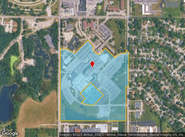
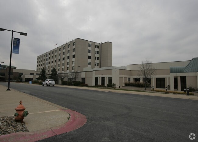
Property Record
1201 S Main St, Crown Point, IN 46307

NEARBY LISTINGS FOR SALE OR LEASE
Property Detail
1201 S Main St
45-16-17-300-012.000-042
SLY PT NE1/4 SW1/4 & N1/2 SE1/4 SW1/4 S.17 T.34 R.8 37.518 AC
Taxexempt
Lake
X
Indiana
18089C0263E
1
2023
37.52 AC
2024
Indiana
043104
Chicago
642,771 SF
Chicago-Naperville-Elgin, IL-IN-WI
DEMOGRAPHICS near 1201 S Main St
1 Mile
3 Mile
5 Mile
2024 Total Population
6,878
33,283
67,735
2029 Population
6,851
33,334
68,357
Pop Growth 2024-2029
(0.39%)
+ 0.15%
+ 0.92%
Average Age
41
41
42
2024 Total Households
2,409
12,325
25,967
HH Growth 2024-2029
(0.50%)
+ 0.08%
+ 0.93%
Median Household Inc
$94,490
$89,950
$86,136
Avg Household Size
2.70
2.60
2.50
2024 Avg HH Vehicles
2.00
2.00
2.00
Median Home Value
$281,170
$273,713
$263,884
Median Year Built
1974
1985
1993
Nearby Places
Map Layers
Map Styles
 Street
 Aerial
- Restaurants
- Banks
- Shops
- Fitness
- Groceries
Nearby Properties
Address
Land Use
TOTAL SIZE
Lot Size
Zoning
Address
Land Use
TOTAL SIZE
Lot Size
Zoning
565,253 SF
59.49 AC
Address
Land Use
TOTAL SIZE
Lot Size
Zoning
129,204 SF
16.57 AC
Address
Land Use
TOTAL SIZE
Lot Size
Zoning
184,544 SF
16.76 AC
Address
Land Use
TOTAL SIZE
Lot Size
Zoning
304,425 SF
18.45 AC
Address
Land Use
TOTAL SIZE
Lot Size
Zoning
133,291 SF
R33
Address
Land Use
TOTAL SIZE
Lot Size
Zoning
89,578 SF
2.59 AC
Address
Land Use
TOTAL SIZE
Lot Size
Zoning
63,992 SF
8.07 AC
Address
Land Use
TOTAL SIZE
Lot Size
Zoning
40,890 SF
11.27 AC
Address
Land Use
TOTAL SIZE
Lot Size
Zoning
113,353 SF
12.89 AC
Address
Land Use
TOTAL SIZE
Lot Size
Zoning
123,316 SF
14.88 AC
R33
Address
Land Use
TOTAL SIZE
Lot Size
Zoning
55,149 SF
2.76 AC
Address
Land Use
TOTAL SIZE
Lot Size
Zoning
85,898 SF
18.29 AC
R33
Address
Land Use
TOTAL SIZE
Lot Size
Zoning
122,908 SF
9.58 AC
Address
Land Use
TOTAL SIZE
Lot Size
Zoning
171,123 SF
10.90 AC
Address
Land Use
TOTAL SIZE
Lot Size
Zoning
52,944 SF
7.93 AC
Address
Land Use
TOTAL SIZE
Lot Size
Zoning
Address
Land Use
TOTAL SIZE
Lot Size
Zoning
73,280 SF
6.47 AC
R33
Address
Land Use
TOTAL SIZE
Lot Size
Zoning
21,600 SF
17.81 AC
R33
Address
Land Use
TOTAL SIZE
Lot Size
Zoning
57,328 SF
1.56 AC
Address
Land Use
TOTAL SIZE
Lot Size
Zoning
33,828 SF
2.85 AC
Address
Land Use
TOTAL SIZE
Lot Size
Zoning
28.64 AC
Address
Land Use
TOTAL SIZE
Lot Size
Zoning
126,249 SF
5.58 AC
Address
Land Use
TOTAL SIZE
Lot Size
Zoning
35,360 SF
6.97 AC
Address
Land Use
TOTAL SIZE
Lot Size
Zoning
4,956 SF
1.56 AC
Address
Land Use
TOTAL SIZE
Lot Size
Zoning
28,080 SF
12.77 AC
Address
Land Use
TOTAL SIZE
Lot Size
Zoning
36,915 SF
10 AC
Address
Land Use
TOTAL SIZE
Lot Size
Zoning
12,060 SF
2.30 AC
Address
Land Use
TOTAL SIZE
Lot Size
Zoning
41,252 SF
7.24 AC
Address
Land Use
TOTAL SIZE
Lot Size
Zoning
15,296 SF
7.11 AC
The World's #1 Commercial Real Estate Marketplace
Connect with us
© 2025 CoStar Group
The information above has been obtained from sources believed reliable. While we do not doubt its accuracy we have not verified it and make no guarantee, warranty or representation about it. It is your responsibility to independently confirm its accuracy and completeness. Any projections, opinions, assumptions, or estimates used are for example only and do not represent the current or future performance of the property. The value of this transaction to you depends on tax and other factors which should be evaluated by your tax, financial, and legal advisors. You and your advisors should conduct a careful, independent investigation of the property to determine to your satisfaction the suitability of the property for your needs.