Property Record
1201 W 136Th St, Kansas City, MO 64145


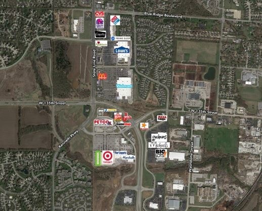
NEARBY LISTINGS FOR SALE OR LEASE
Property Detail
1201 W 136Th St
Kansas City, MO-KS
State Line Station
66-340-04-02-00-0-00-000
STATE LINE STATION----LOT 1
Storebuilding
Jackson
AE
Missouri
29095C0388G
1
2024
13.37 AC
2025
South Kansas City MO
013405
Kansas City
168,467 SF
DEMOGRAPHICS near 1201 W 136Th St
1 Mile
3 Mile
5 Mile
2024 Total Population
4,075
42,622
142,217
2029 Population
4,185
43,766
146,700
Pop Growth 2024-2029
+ 2.70%
+ 2.68%
+ 3.15%
Average Age
45
43
42
2024 Total Households
1,772
16,304
58,840
HH Growth 2024-2029
+ 2.65%
+ 2.55%
+ 3.24%
Median Household Inc
$98,761
$135,194
$95,349
Avg Household Size
2.30
2.50
2.30
2024 Avg HH Vehicles
2.00
2.00
2.00
Median Home Value
$398,979
$480,419
$382,215
Median Year Built
1995
1992
1990
Nearby Places
Map Layers
Map Styles
 Street
 Aerial
- Restaurants
- Banks
- Shops
- Fitness
- Groceries
PUBLIC TRANSPORTATION
AIRPORT
Kansas City International
DRIVE
WALK
Distance
Kansas City International
52 min
40.9 mi
Freight Ports
Tulsa Port Of Catoosa
DRIVE
WALK
Distance
Tulsa Port Of Catoosa
250 min
223.1 mi
SALE & LEASE HISTORY
LISTING DATE
SALE/LEASE

Mar 13, 2017
For Lease
Nearby Properties
Address
Land Use
TOTAL SIZE
Lot Size
Zoning
Address
Land Use
TOTAL SIZE
Lot Size
Zoning
364,818 SF
25.48 AC
R-1
Address
Land Use
TOTAL SIZE
Lot Size
Zoning
384,819 SF
67.59 AC
AG
Address
Land Use
TOTAL SIZE
Lot Size
Zoning
184,524 SF
33.20 AC
AG
Address
Land Use
TOTAL SIZE
Lot Size
Zoning
173,314 SF
25.83 AC
R-1
Address
Land Use
TOTAL SIZE
Lot Size
Zoning
79,917 SF
7.86 AC
SD-NCR
Address
Land Use
TOTAL SIZE
Lot Size
Zoning
102,411 SF
17.02 AC
AG
Address
Land Use
TOTAL SIZE
Lot Size
Zoning
166,097 SF
37.29 AC
R-1
Address
Land Use
TOTAL SIZE
Lot Size
Zoning
105,110 SF
8.93 AC
AG
Address
Land Use
TOTAL SIZE
Lot Size
Zoning
72,184 SF
9.53 AC
AG
Address
Land Use
TOTAL SIZE
Lot Size
Zoning
319,892 SF
Address
Land Use
TOTAL SIZE
Lot Size
Zoning
66,083 SF
14.91 AC
R-1
Address
Land Use
TOTAL SIZE
Lot Size
Zoning
9,508 SF
8.29 AC
RP-1
Address
Land Use
TOTAL SIZE
Lot Size
Zoning
159,274 SF
14.38 AC
SD-CR
Address
Land Use
TOTAL SIZE
Lot Size
Zoning
28,633 SF
13.25 AC
R-1
Address
Land Use
TOTAL SIZE
Lot Size
Zoning
68,493 SF
9.92 AC
R-1
Address
Land Use
TOTAL SIZE
Lot Size
Zoning
40,181 SF
1.80 AC
MXD
Address
Land Use
TOTAL SIZE
Lot Size
Zoning
43,021 SF
7.47 AC
SD-O
Address
Land Use
TOTAL SIZE
Lot Size
Zoning
36,012 SF
18.10 AC
AG
Address
Land Use
TOTAL SIZE
Lot Size
Zoning
227,676 SF
15.86 AC
Address
Land Use
TOTAL SIZE
Lot Size
Zoning
26,022 SF
109.48 AC
IP-2J
Address
Land Use
TOTAL SIZE
Lot Size
Zoning
60,960 SF
4.82 AC
SD-NCR
Address
Land Use
TOTAL SIZE
Lot Size
Zoning
45,775 SF
17.05 AC
BP
Address
Land Use
TOTAL SIZE
Lot Size
Zoning
92,726 SF
6.83 AC
CP-2
Address
Land Use
TOTAL SIZE
Lot Size
Zoning
50,177 SF
5.54 AC
CP-2
Address
Land Use
TOTAL SIZE
Lot Size
Zoning
64,785 SF
24.54 AC
RP-4 (CURR
Address
Land Use
TOTAL SIZE
Lot Size
Zoning
41,203 SF
8.03 AC
MXD
Address
Land Use
TOTAL SIZE
Lot Size
Zoning
201,683 SF
5.38 AC
CP-2
Address
Land Use
TOTAL SIZE
Lot Size
Zoning
75,368 SF
26.38 AC
RP-3
Address
Land Use
TOTAL SIZE
Lot Size
Zoning
220,756 SF
19.65 AC
Address
Land Use
TOTAL SIZE
Lot Size
Zoning
122,684 SF
1.63 AC
R
The World's #1 Commercial Real Estate Marketplace
Connect with us
© 2026 CoStar Group
The information above has been obtained from sources believed reliable. While we do not doubt its accuracy we have not verified it and make no guarantee, warranty or representation about it. It is your responsibility to independently confirm its accuracy and completeness. Any projections, opinions, assumptions, or estimates used are for example only and do not represent the current or future performance of the property. The value of this transaction to you depends on tax and other factors which should be evaluated by your tax, financial, and legal advisors. You and your advisors should conduct a careful, independent investigation of the property to determine to your satisfaction the suitability of the property for your needs.