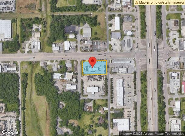
Property Record
1201 W Main St, La Porte, TX 77571

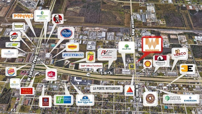

NEARBY LISTINGS FOR SALE OR LEASE
Property Detail
1201 W Main St
Houston-Pasadena-The Woodlands, TX
Emrojc R/P
1378210010001
RES A BLK 1 EMROJC R/P
Restaurantdrivein
Harris
AE
Texas
48201C0945M
1
2024
0.94 AC
2025
NASA/Clear Lake
343700
Houston
3,481 SF
DEMOGRAPHICS near 1201 W Main St
1 Mile
3 Mile
5 Mile
2024 Total Population
3,993
24,289
52,477
2029 Population
4,058
24,834
53,531
Pop Growth 2024-2029
+ 1.63%
+ 2.24%
+ 2.01%
Average Age
37
39
39
2024 Total Households
1,525
8,803
18,501
HH Growth 2024-2029
+ 0.98%
+ 2.08%
+ 1.93%
Median Household Inc
$62,585
$83,516
$81,740
Avg Household Size
2.60
2.70
2.80
2024 Avg HH Vehicles
2.00
2.00
2.00
Median Home Value
$151,804
$207,964
$208,226
Median Year Built
1981
1985
1983
Nearby Places
Map Layers
Map Styles
 Street
 Aerial
- Restaurants
- Banks
- Shops
- Fitness
- Groceries
SALE & LEASE HISTORY
LISTING DATE
SALE/LEASE

Sep 26, 2018
For Sale
Sep 19, 2018
For Sale
Nov 05, 2018
For Sale
May 16, 2018
For Sale
Mar 26, 2019
For Sale
Jul 20, 2018
For Sale
Jul 03, 2018
For Sale
Jan 18, 2018
For Sale
Dec 26, 2017
For Sale
Aug 14, 2018
For Sale
Nearby Properties
Address
Land Use
TOTAL SIZE
Lot Size
Zoning
Address
Land Use
TOTAL SIZE
Lot Size
Zoning
45.75 AC
Address
Land Use
TOTAL SIZE
Lot Size
Zoning
45.78 AC
Address
Land Use
TOTAL SIZE
Lot Size
Zoning
179.52 AC
Address
Land Use
TOTAL SIZE
Lot Size
Zoning
38.27 AC
Address
Land Use
TOTAL SIZE
Lot Size
Zoning
47.21 AC
Address
Land Use
TOTAL SIZE
Lot Size
Zoning
Address
Land Use
TOTAL SIZE
Lot Size
Zoning
156.07 AC
Address
Land Use
TOTAL SIZE
Lot Size
Zoning
61.40 AC
Address
Land Use
TOTAL SIZE
Lot Size
Zoning
1,120,800 SF
35.24 AC
Address
Land Use
TOTAL SIZE
Lot Size
Zoning
748,500 SF
42.13 AC
Address
Land Use
TOTAL SIZE
Lot Size
Zoning
610,402 SF
34.69 AC
Address
Land Use
TOTAL SIZE
Lot Size
Zoning
602,060 SF
34.15 AC
Address
Land Use
TOTAL SIZE
Lot Size
Zoning
30.58 AC
Address
Land Use
TOTAL SIZE
Lot Size
Zoning
348,294 SF
18.02 AC
Address
Land Use
TOTAL SIZE
Lot Size
Zoning
102.68 AC
Address
Land Use
TOTAL SIZE
Lot Size
Zoning
287,729 SF
20 AC
Address
Land Use
TOTAL SIZE
Lot Size
Zoning
40.14 AC
Address
Land Use
TOTAL SIZE
Lot Size
Zoning
416,005 SF
21.47 AC
Address
Land Use
TOTAL SIZE
Lot Size
Zoning
415,662 SF
21.49 AC
Address
Land Use
TOTAL SIZE
Lot Size
Zoning
45.18 AC
Address
Land Use
TOTAL SIZE
Lot Size
Zoning
365,728 SF
25.30 AC
Address
Land Use
TOTAL SIZE
Lot Size
Zoning
306,482 SF
22.96 AC
Address
Land Use
TOTAL SIZE
Lot Size
Zoning
46.57 AC
Address
Land Use
TOTAL SIZE
Lot Size
Zoning
297,698 SF
19.14 AC
Address
Land Use
TOTAL SIZE
Lot Size
Zoning
289,475 SF
14.83 AC
Address
Land Use
TOTAL SIZE
Lot Size
Zoning
40.46 AC
Address
Land Use
TOTAL SIZE
Lot Size
Zoning
260,411 SF
12.11 AC
Address
Land Use
TOTAL SIZE
Lot Size
Zoning
297,671 SF
20.07 AC
Address
Land Use
TOTAL SIZE
Lot Size
Zoning
253,487 SF
14.40 AC
Address
Land Use
TOTAL SIZE
Lot Size
Zoning
251,516 SF
12.34 AC
The World's #1 Commercial Real Estate Marketplace
Connect with us
© 2026 CoStar Group
The information above has been obtained from sources believed reliable. While we do not doubt its accuracy we have not verified it and make no guarantee, warranty or representation about it. It is your responsibility to independently confirm its accuracy and completeness. Any projections, opinions, assumptions, or estimates used are for example only and do not represent the current or future performance of the property. The value of this transaction to you depends on tax and other factors which should be evaluated by your tax, financial, and legal advisors. You and your advisors should conduct a careful, independent investigation of the property to determine to your satisfaction the suitability of the property for your needs.