Property Record
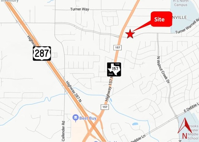
1201 W Turner Warnell Rd, Arlington, TX 76001


Property Detail
1201 W Turner Warnell Rd
Dallas-Fort Worth-Arlington, TX
SOUTH COOPER ESTATES ADDITION BLOCK 16 LOT 1
41226151
TARRANT
Residentialacreage
Texas
B and X Area of moderate flood hazard, usually the area between the limits of the 100-year and 500-year floods.
1
2024
3.91 AC
2025
Arlington/Mansfield
111409
Dallas/Ft Worth
NEARBY LISTINGS FOR SALE OR LEASE
DEMOGRAPHICS near 1201 W Turner Warnell Rd
1 mile
3 mile
5 mile
2025 Total Population
10,253
101,373
219,918
2030 Population
10,709
106,413
231,592
Pop Growth 2025-2030
+ 4.45%
+ 4.97%
+ 5.31%
Average Age
38
38
38
2025 Total Households
3,151
33,014
73,416
HH Growth 2025-2030
+ 4.67%
+ 5.20%
+ 5.48%
Median Household Inc
$127,761
$106,248
$100,998
Avg Household Size
3.20
3.00
2.90
2025 Avg HH Vehicles
3.00
2.00
2.00
Median Home Value
$394,111
$361,780
$355,532
Median Year Built
2001
1999
1998
Nearby Places
Map Layers
Map Styles
 Street
 Aerial
Layers
 Traffic
 Biking
Places
Listings with unknown addresses are not visible on the map
- Restaurants
- Banks
- Shops
- Fitness
- Groceries
PUBLIC TRANSPORTATION
AIRPORT
Dallas-Fort Worth International
Drive
Walk
Distance
Dallas-Fort Worth International
38 min
26.0 mi
Dallas Love Field
Drive
Walk
Distance
Dallas Love Field
47 min
34.7 mi
Freight Ports
Port of Shreveport
Drive
Walk
Distance
Port of Shreveport
238 min
220.4 mi
SALE & LEASE HISTORY
LISTING DATE
SALE/LEASE

Sep 24, 2016
For Sale
Mar 29, 2017
For Sale
Jun 05, 2020
For Sale
Jan 12, 2017
For Sale
Nearby Properties
Address
Land Use
TOTAL SIZE
Lot Size
Zoning
Address
Land Use
TOTAL SIZE
Lot Size
Zoning
348,951 SF
18.66 AC
Address
Land Use
TOTAL SIZE
Lot Size
Zoning
419,875 SF
108.14 AC
Address
Land Use
TOTAL SIZE
Lot Size
Zoning
317,142 SF
11.40 AC
Address
Land Use
TOTAL SIZE
Lot Size
Zoning
160,000 SF
26.90 AC
Address
Land Use
TOTAL SIZE
Lot Size
Zoning
413,000 SF
19.16 AC
Address
Land Use
TOTAL SIZE
Lot Size
Zoning
298,988 SF
7.16 AC
Address
Land Use
TOTAL SIZE
Lot Size
Zoning
276,467 SF
7.61 AC
Address
Land Use
TOTAL SIZE
Lot Size
Zoning
246,204 SF
15.16 AC
Address
Land Use
TOTAL SIZE
Lot Size
Zoning
249,922 SF
17.26 AC
Address
Land Use
TOTAL SIZE
Lot Size
Zoning
255,134 SF
21.62 AC
Address
Land Use
TOTAL SIZE
Lot Size
Zoning
170,082 SF
36.49 AC
Address
Land Use
TOTAL SIZE
Lot Size
Zoning
724,286 SF
48.41 AC
Address
Land Use
TOTAL SIZE
Lot Size
Zoning
208,630 SF
8.62 AC
Address
Land Use
TOTAL SIZE
Lot Size
Zoning
231,551 SF
25.69 AC
Address
Land Use
TOTAL SIZE
Lot Size
Zoning
171,820 SF
59.63 AC
Address
Land Use
TOTAL SIZE
Lot Size
Zoning
98,664 SF
5.47 AC
Address
Land Use
TOTAL SIZE
Lot Size
Zoning
234,580 SF
65.82 AC
Address
Land Use
TOTAL SIZE
Lot Size
Zoning
182,763 SF
10.54 AC
Address
Land Use
TOTAL SIZE
Lot Size
Zoning
229,168 SF
6.13 AC
Address
Land Use
TOTAL SIZE
Lot Size
Zoning
399,496 SF
23.29 AC
Address
Land Use
TOTAL SIZE
Lot Size
Zoning
149,494 SF
3.73 AC
Address
Land Use
TOTAL SIZE
Lot Size
Zoning
79,070 SF
11.98 AC
Address
Land Use
TOTAL SIZE
Lot Size
Zoning
276,267 SF
16.10 AC
Address
Land Use
TOTAL SIZE
Lot Size
Zoning
427,622 SF
24.26 AC
Address
Land Use
TOTAL SIZE
Lot Size
Zoning
111,764 SF
10.34 AC
Address
Land Use
TOTAL SIZE
Lot Size
Zoning
160,000 SF
37.89 AC
Address
Land Use
TOTAL SIZE
Lot Size
Zoning
302,278 SF
20.61 AC
Address
Land Use
TOTAL SIZE
Lot Size
Zoning
275,337 SF
14 AC
Address
Land Use
TOTAL SIZE
Lot Size
Zoning
85,000 SF
13.03 AC
Address
Land Use
TOTAL SIZE
Lot Size
Zoning
158,103 SF
13.27 AC
The World's #1 Commercial Real Estate Marketplace
Connect with us
© 2026 CoStar Group
The information above has been obtained from sources believed reliable. While we do not doubt its accuracy we have not verified it and make no guarantee, warranty or representation about it. It is your responsibility to independently confirm its accuracy and completeness. Any projections, opinions, assumptions, or estimates used are for example only and do not represent the current or future performance of the property. The value of this transaction to you depends on tax and other factors which should be evaluated by your tax, financial, and legal advisors. You and your advisors should conduct a careful, independent investigation of the property to determine to your satisfaction the suitability of the property for your needs.