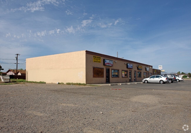
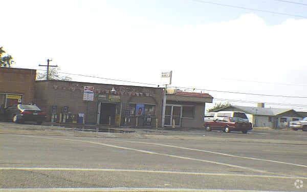
Property Record
12017 W Thunderbird Rd, El Mirage, AZ 85335

NEARBY LISTINGS FOR SALE OR LEASE
Property Detail
12017 W Thunderbird Rd
501-36-946
Brisas Lot 110
Storebuilding
PT NE4 NW4 SEC 13 T3N R1W BEG 955F W OF N4 COR OF SD SEC TH S 233F TO PT ON N LI SUNNYVALE UNIT 2 MCR 105-34 TH W ALG SD N LI 100F TH N 233F TO N LI OF SD SEC TH E ALG SD N LI OF SD SEC 100F TO POB P/F 00-0761679 EX N 40F TH/OF D/P 10560-591 & EX POR
X
Maricopa
04013C1680L
Arizona
2025
0.41 AC
2025
Sun City
060903
Phoenix
3,072 SF
Phoenix-Mesa-Scottsdale, AZ
DEMOGRAPHICS near 12017 W Thunderbird Rd
1 Mile
3 Mile
5 Mile
2024 Total Population
19,940
97,514
244,240
2029 Population
21,416
105,672
264,957
Pop Growth 2024-2029
+ 7.40%
+ 8.37%
+ 8.48%
Average Age
32
45
47
2024 Total Households
5,554
38,920
101,901
HH Growth 2024-2029
+ 7.45%
+ 8.64%
+ 8.71%
Median Household Inc
$65,842
$58,478
$62,311
Avg Household Size
3.50
2.40
2.30
2024 Avg HH Vehicles
2.00
2.00
2.00
Median Home Value
$244,450
$258,561
$286,648
Median Year Built
2002
1990
1991
Nearby Places
Map Layers
Map Styles
 Street
 Aerial
- Restaurants
- Banks
- Shops
- Fitness
- Groceries
PUBLIC TRANSPORTATION
AIRPORT
Phoenix Sky Harbor International
DRIVE
WALK
Distance
Phoenix Sky Harbor International
41 min
30.6 mi
Freight Ports
Port of San Diego
DRIVE
WALK
Distance
Port of San Diego
392 min
350.0 mi
Nearby Properties
Address
Land Use
TOTAL SIZE
Lot Size
Zoning
Address
Land Use
TOTAL SIZE
Lot Size
Zoning
35.74 AC
Address
Land Use
TOTAL SIZE
Lot Size
Zoning
1,010,365 SF
29.94 AC
C2
Address
Land Use
TOTAL SIZE
Lot Size
Zoning
53.02 AC
Address
Land Use
TOTAL SIZE
Lot Size
Zoning
16,341 SF
174.45 AC
R-43
Address
Land Use
TOTAL SIZE
Lot Size
Zoning
1,113,127 SF
48.24 AC
C2
Address
Land Use
TOTAL SIZE
Lot Size
Zoning
294,360 SF
21.69 AC
EI
Address
Land Use
TOTAL SIZE
Lot Size
Zoning
225,457 SF
70.07 AC
PAD
Address
Land Use
TOTAL SIZE
Lot Size
Zoning
20,948 SF
2.39 AC
R-6
Address
Land Use
TOTAL SIZE
Lot Size
Zoning
418,305 SF
24.06 AC
PAD
Address
Land Use
TOTAL SIZE
Lot Size
Zoning
333,066 SF
16.33 AC
PAD
Address
Land Use
TOTAL SIZE
Lot Size
Zoning
38,400 SF
4.97 AC
I-2
Address
Land Use
TOTAL SIZE
Lot Size
Zoning
247,178 SF
33.92 AC
PAD
Address
Land Use
TOTAL SIZE
Lot Size
Zoning
106,356 SF
14.16 AC
PAD
Address
Land Use
TOTAL SIZE
Lot Size
Zoning
77,400 SF
20.34 AC
PAD
Address
Land Use
TOTAL SIZE
Lot Size
Zoning
145,491 SF
37.61 AC
PAD
Address
Land Use
TOTAL SIZE
Lot Size
Zoning
707,380 SF
46.26 AC
I-2
Address
Land Use
TOTAL SIZE
Lot Size
Zoning
67,932 SF
14.90 AC
PAD
Address
Land Use
TOTAL SIZE
Lot Size
Zoning
199,390 SF
24.59 AC
C-C
Address
Land Use
TOTAL SIZE
Lot Size
Zoning
65,749 SF
14.58 AC
PAD
Address
Land Use
TOTAL SIZE
Lot Size
Zoning
270,000 SF
16.26 AC
PAD
Address
Land Use
TOTAL SIZE
Lot Size
Zoning
153,525 SF
14.48 AC
PAD
Address
Land Use
TOTAL SIZE
Lot Size
Zoning
112,957 SF
17.40 AC
PAD
Address
Land Use
TOTAL SIZE
Lot Size
Zoning
151,598 SF
9.89 AC
PAD
Address
Land Use
TOTAL SIZE
Lot Size
Zoning
123,820 SF
4.53 AC
C-C
Address
Land Use
TOTAL SIZE
Lot Size
Zoning
19,858 SF
0.64 AC
C-2
Address
Land Use
TOTAL SIZE
Lot Size
Zoning
296,540 SF
11 AC
Address
Land Use
TOTAL SIZE
Lot Size
Zoning
97,910 SF
26.16 AC
PAD
Address
Land Use
TOTAL SIZE
Lot Size
Zoning
94,438 SF
12 AC
PAD
Address
Land Use
TOTAL SIZE
Lot Size
Zoning
199,545 SF
8.99 AC
PAD
Address
Land Use
TOTAL SIZE
Lot Size
Zoning
137,467 SF
9.49 AC
PAD
The World's #1 Commercial Real Estate Marketplace
Connect with us
© 2025 CoStar Group
The information above has been obtained from sources believed reliable. While we do not doubt its accuracy we have not verified it and make no guarantee, warranty or representation about it. It is your responsibility to independently confirm its accuracy and completeness. Any projections, opinions, assumptions, or estimates used are for example only and do not represent the current or future performance of the property. The value of this transaction to you depends on tax and other factors which should be evaluated by your tax, financial, and legal advisors. You and your advisors should conduct a careful, independent investigation of the property to determine to your satisfaction the suitability of the property for your needs.