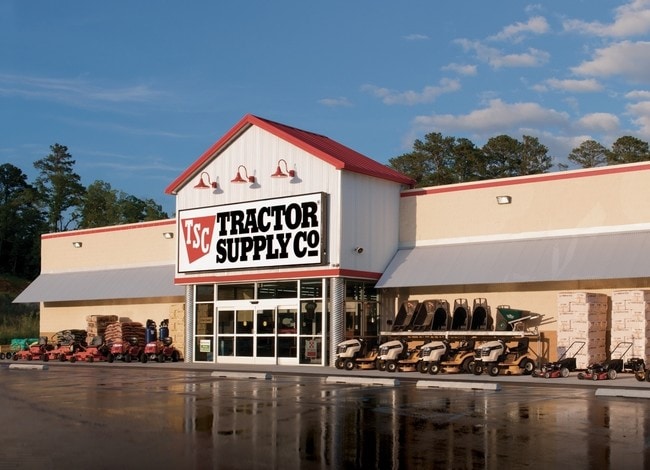
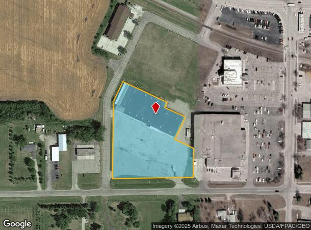
Property Record
1202 4Th Ave S, Wahpeton, ND 58075

NEARBY LISTINGS FOR SALE OR LEASE
Property Detail
1202 4Th Ave S
Wahpeton, ND-MN
Wahp Holbrook Hobson
50130114684001
WAHP HOLBROOK HOBSON: (M&B 196) BEG E1/4 CR 7 132 47 N40.02' W40.02' W380.08' N35.02' W100.02' POB: W429.69' N413.85' NE117.2
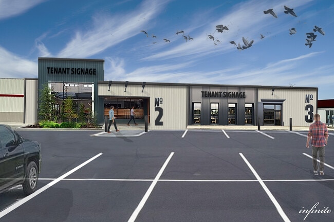
Commercialnec
Richland
X
North Dakota
27167C0388D
3.85 AC
2024
North Dakota Area
2024
Other Market Areas
970800
DEMOGRAPHICS near 1202 4Th Ave S
1 Mile
3 Mile
5 Mile
2024 Total Population
4,660
12,072
12,497
2029 Population
4,700
12,070
12,487
Pop Growth 2024-2029
+ 0.86%
(0.02%)
(0.08%)
Average Age
39
39
39
2024 Total Households
2,000
5,047
5,210
HH Growth 2024-2029
+ 0.95%
(0.06%)
(0.13%)
Median Household Inc
$40,189
$48,960
$50,613
Avg Household Size
2.10
2.20
2.20
2024 Avg HH Vehicles
2.00
2.00
2.00
Median Home Value
$136,460
$160,200
$161,501
Median Year Built
1971
1973
1973
Nearby Places
Map Layers
Map Styles
 Street
 Aerial
- Restaurants
- Banks
- Shops
- Fitness
- Groceries
SALE & LEASE HISTORY
LISTING DATE
SALE/LEASE

Sep 25, 2016
For Lease
May 20, 2022
For Lease
May 09, 2018
For Sale
Jun 30, 2017
For Sale
Feb 05, 2025
For Sale
Dec 23, 2021
For Sale
Aug 31, 2017
For Lease
Nearby Properties
Address
Land Use
TOTAL SIZE
Lot Size
Zoning
Address
Land Use
TOTAL SIZE
Lot Size
Zoning
157,968 SF
61 AC
Address
Land Use
TOTAL SIZE
Lot Size
Zoning
103,802 SF
7.04 AC
Address
Land Use
TOTAL SIZE
Lot Size
Zoning
11.10 AC
Address
Land Use
TOTAL SIZE
Lot Size
Zoning
10,671 SF
0.41 AC
Address
Land Use
TOTAL SIZE
Lot Size
Zoning
22.62 AC
Address
Land Use
TOTAL SIZE
Lot Size
Zoning
8.12 AC
Address
Land Use
TOTAL SIZE
Lot Size
Zoning
20.34 AC
Address
Land Use
TOTAL SIZE
Lot Size
Zoning
30.52 AC
Address
Land Use
TOTAL SIZE
Lot Size
Zoning
8.74 AC
Address
Land Use
TOTAL SIZE
Lot Size
Zoning
2.70 AC
Address
Land Use
TOTAL SIZE
Lot Size
Zoning
0.06 AC
Address
Land Use
TOTAL SIZE
Lot Size
Zoning
4.51 AC
Address
Land Use
TOTAL SIZE
Lot Size
Zoning
0.96 AC
Address
Land Use
TOTAL SIZE
Lot Size
Zoning
24.75 AC
Address
Land Use
TOTAL SIZE
Lot Size
Zoning
4,900 SF
35.73 AC
Address
Land Use
TOTAL SIZE
Lot Size
Zoning
4.11 AC
Address
Land Use
TOTAL SIZE
Lot Size
Zoning
3,333 SF
3.18 AC
Address
Land Use
TOTAL SIZE
Lot Size
Zoning
12.45 AC
Address
Land Use
TOTAL SIZE
Lot Size
Zoning
1.38 AC
Address
Land Use
TOTAL SIZE
Lot Size
Zoning
0.93 AC
Address
Land Use
TOTAL SIZE
Lot Size
Zoning
1.11 AC
Address
Land Use
TOTAL SIZE
Lot Size
Zoning
0.18 AC
Address
Land Use
TOTAL SIZE
Lot Size
Zoning
576 SF
2.17 AC
Address
Land Use
TOTAL SIZE
Lot Size
Zoning
0.01 AC
Address
Land Use
TOTAL SIZE
Lot Size
Zoning
483 SF
0.40 AC
Address
Land Use
TOTAL SIZE
Lot Size
Zoning
918 SF
1.99 AC
Address
Land Use
TOTAL SIZE
Lot Size
Zoning
2.13 AC
Address
Land Use
TOTAL SIZE
Lot Size
Zoning
200 SF
1.27 AC
The World's #1 Commercial Real Estate Marketplace
Connect with us
© 2026 CoStar Group
The information above has been obtained from sources believed reliable. While we do not doubt its accuracy we have not verified it and make no guarantee, warranty or representation about it. It is your responsibility to independently confirm its accuracy and completeness. Any projections, opinions, assumptions, or estimates used are for example only and do not represent the current or future performance of the property. The value of this transaction to you depends on tax and other factors which should be evaluated by your tax, financial, and legal advisors. You and your advisors should conduct a careful, independent investigation of the property to determine to your satisfaction the suitability of the property for your needs.