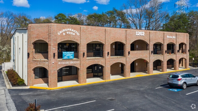
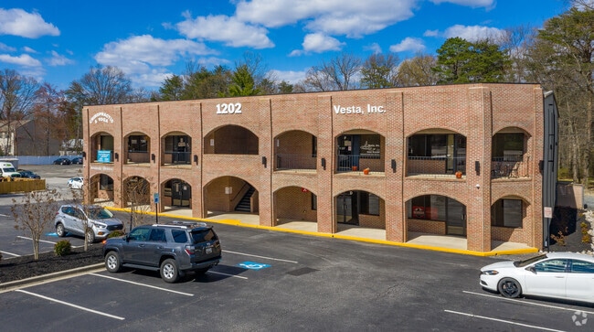
Property Record
1202 Annapolis Rd, Odenton, MD 21113

Current Lease Availabilities
Property Detail
1202 Annapolis Rd
04-000-90019313
LT B OR 46193 SQ FT NR BONAVENTURE
Officebuilding
Anne Arundel
O-EOD
Maryland
B and X Area of moderate flood hazard, usually the area between the limits of the 100-year and 500-year floods.
b
2024
1.05 AC
2025
I-97/Crain Hwy Corridor
740304
Baltimore
18,412 SF
Baltimore-Columbia-Towson, MD
NEARBY LISTINGS FOR SALE OR LEASE
DEMOGRAPHICS near 1202 Annapolis Rd
1 mile
3 mile
5 mile
2025 Total Population
9,417
57,531
154,360
2030 Population
9,498
57,826
156,189
Pop Growth 2025-2030
+ 0.86%
+ 0.51%
+ 1.18%
Average Age
39
38
38
2025 Total Households
3,720
21,608
56,731
HH Growth 2025-2030
+ 0.97%
+ 0.59%
+ 1.23%
Median Household Inc
$114,293
$122,124
$119,891
Avg Household Size
2.50
2.60
2.60
2025 Avg HH Vehicles
2.00
2.00
2.00
Median Home Value
$473,618
$438,417
$470,282
Median Year Built
1993
1996
1992
Nearby Places
Map Layers
Map Styles
 Street
 Aerial
Layers
 Traffic
 Biking
Places
Listings with unknown addresses are not visible on the map
- Restaurants
- Banks
- Shops
- Fitness
- Groceries
PUBLIC TRANSPORTATION
TRANSIT/SUBWAY
Odenton (Penn Line - Maryland Area Regional Commuter Trains (The MARC))
Drive
Walk
Distance
Odenton (Penn Line - Maryland Area Regional Commuter Trains (The MARC))
3 min
20 min
1.1 mi
COMMUTER RAIL
Odenton (Penn Line - Maryland Area Regional Commuter Trains (The MARC))
Drive
Walk
Distance
Odenton (Penn Line - Maryland Area Regional Commuter Trains (The MARC))
3 min
20 min
1.1 mi
Jessup (Camden Line - Maryland Area Regional Commuter Trains (The MARC))
Drive
Walk
Distance
Jessup (Camden Line - Maryland Area Regional Commuter Trains (The MARC))
15 min
7.1 mi
AIRPORT
Baltimore/Washington International Thurgood Marshall
Drive
Walk
Distance
Baltimore/Washington International Thurgood Marshall
17 min
9.0 mi
Ronald Reagan Washington Ntl
Drive
Walk
Distance
Ronald Reagan Washington Ntl
51 min
32.0 mi
Freight Ports
Port of Baltimore
Drive
Walk
Distance
Port of Baltimore
30 min
18.5 mi
Nearby Properties
Address
Land Use
TOTAL SIZE
Lot Size
Zoning
Address
Land Use
TOTAL SIZE
Lot Size
Zoning
472,057 SF
15.16 AC
OCOR
Address
Land Use
TOTAL SIZE
Lot Size
Zoning
155,020 SF
19.86 AC
R22
Address
Land Use
TOTAL SIZE
Lot Size
Zoning
432,928 SF
6.33 AC
O-COR
Address
Land Use
TOTAL SIZE
Lot Size
Zoning
88,272 SF
3.43 AC
OTRA
Address
Land Use
TOTAL SIZE
Lot Size
Zoning
279,318 SF
14.38 AC
R22
Address
Land Use
TOTAL SIZE
Lot Size
Zoning
14.65 AC
R15
Address
Land Use
TOTAL SIZE
Lot Size
Zoning
255,561 SF
15.93 AC
R22
Address
Land Use
TOTAL SIZE
Lot Size
Zoning
499,471 SF
10.10 AC
O-COR
Address
Land Use
TOTAL SIZE
Lot Size
Zoning
311,870 SF
10.03 AC
Address
Land Use
TOTAL SIZE
Lot Size
Zoning
296,453 SF
16.23 AC
R15
Address
Land Use
TOTAL SIZE
Lot Size
Zoning
342,024 SF
30.72 AC
W1B
Address
Land Use
TOTAL SIZE
Lot Size
Zoning
230,204 SF
6.74 AC
O COR
Address
Land Use
TOTAL SIZE
Lot Size
Zoning
237,377 SF
9.86 AC
R15
Address
Land Use
TOTAL SIZE
Lot Size
Zoning
265,645 SF
12.79 AC
R15
Address
Land Use
TOTAL SIZE
Lot Size
Zoning
24.49 AC
C3
Address
Land Use
TOTAL SIZE
Lot Size
Zoning
125.95 AC
R5
Address
Land Use
TOTAL SIZE
Lot Size
Zoning
185,440 SF
3.53 AC
W2
Address
Land Use
TOTAL SIZE
Lot Size
Zoning
155,269 SF
13.27 AC
O-EOD
Address
Land Use
TOTAL SIZE
Lot Size
Zoning
342,464 SF
22.95 AC
O-IND
Address
Land Use
TOTAL SIZE
Lot Size
Zoning
89,936 SF
16.40 AC
R15
Address
Land Use
TOTAL SIZE
Lot Size
Zoning
232,480 SF
16.17 AC
R15
Address
Land Use
TOTAL SIZE
Lot Size
Zoning
37,320 SF
18.76 AC
O-COR
Address
Land Use
TOTAL SIZE
Lot Size
Zoning
117,156 SF
3.70 AC
O-NOD
Address
Land Use
TOTAL SIZE
Lot Size
Zoning
43,842 SF
27.74 AC
C4
Address
Land Use
TOTAL SIZE
Lot Size
Zoning
10.95 AC
O-EOD
Address
Land Use
TOTAL SIZE
Lot Size
Zoning
111,617 SF
11.87 AC
O-NOD
Address
Land Use
TOTAL SIZE
Lot Size
Zoning
215,104 SF
22.27 AC
W1
Address
Land Use
TOTAL SIZE
Lot Size
Zoning
86,496 SF
6.86 AC
R5
Address
Land Use
TOTAL SIZE
Lot Size
Zoning
63,000 SF
22.90 AC
R1
Address
Land Use
TOTAL SIZE
Lot Size
Zoning
70,784 SF
18 AC
R15
The World's #1 Commercial Real Estate Marketplace
Connect with us
© 2026 CoStar Group
The information above has been obtained from sources believed reliable. While we do not doubt its accuracy we have not verified it and make no guarantee, warranty or representation about it. It is your responsibility to independently confirm its accuracy and completeness. Any projections, opinions, assumptions, or estimates used are for example only and do not represent the current or future performance of the property. The value of this transaction to you depends on tax and other factors which should be evaluated by your tax, financial, and legal advisors. You and your advisors should conduct a careful, independent investigation of the property to determine to your satisfaction the suitability of the property for your needs.