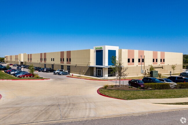
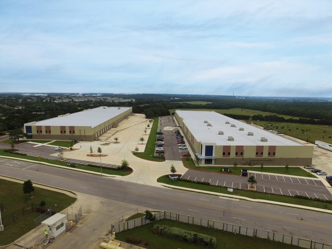
Property Record
1202 Bmc Dr, Cedar Park, TX 78613


Property Detail
1202 Bmc Dr
R496904
S10499 - BMC LUMBER SUB 2 (REPLAT), BLOCK A, LOT 2, ACRES 8.088
Commercialnec
WILLIAMSON
3-PUD
Texas
B and X Area of moderate flood hazard, usually the area between the limits of the 100-year and 500-year floods.
2
2024
8.09 AC
2025
Cedar Park
020347
Austin
125,465 SF
Austin-Round Rock-San Marcos, TX
NEARBY LISTINGS FOR SALE OR LEASE
DEMOGRAPHICS near 1202 Bmc Dr
1 mile
3 mile
5 mile
2025 Total Population
9,612
100,834
257,227
2030 Population
10,847
114,063
288,537
Pop Growth 2025-2030
+ 12.85%
+ 13.12%
+ 12.17%
Average Age
35
37
37
2025 Total Households
3,327
39,373
96,634
HH Growth 2025-2030
+ 13.13%
+ 13.69%
+ 12.81%
Median Household Inc
$128,798
$116,260
$124,013
Avg Household Size
2.90
2.50
2.60
2025 Avg HH Vehicles
2.00
2.00
2.00
Median Home Value
$596,850
$569,358
$547,158
Median Year Built
2006
2007
2002
Nearby Places
Map Layers
Map Styles
 Street
 Aerial
Transit
 Traffic
 Biking
Places
Listings with unknown addresses are not visible on the map
- Restaurants
- Banks
- Shops
- Fitness
- Groceries
PUBLIC TRANSPORTATION
AIRPORT
Austin-Bergstrom International
Drive
Walk
Distance
Austin-Bergstrom International
45 min
31.1 mi
SALE & LEASE HISTORY
LISTING DATE
SALE/LEASE

Sep 25, 2016
For Lease
Sep 23, 2016
For Sale
Sep 23, 2016
For Sale
Nearby Properties
Address
Land Use
TOTAL SIZE
Lot Size
Zoning
Address
Land Use
TOTAL SIZE
Lot Size
Zoning
535,000 SF
24.46 AC
Address
Land Use
TOTAL SIZE
Lot Size
Zoning
676,868 SF
13.54 AC
3-PD
Address
Land Use
TOTAL SIZE
Lot Size
Zoning
557,037 SF
29.48 AC
Address
Land Use
TOTAL SIZE
Lot Size
Zoning
256,338 SF
26.47 AC
Address
Land Use
TOTAL SIZE
Lot Size
Zoning
338,919 SF
42.88 AC
Address
Land Use
TOTAL SIZE
Lot Size
Zoning
277,152 SF
45.29 AC
Address
Land Use
TOTAL SIZE
Lot Size
Zoning
376,081 SF
8.62 AC
Address
Land Use
TOTAL SIZE
Lot Size
Zoning
363,544 SF
8.54 AC
Address
Land Use
TOTAL SIZE
Lot Size
Zoning
423,057 SF
21.90 AC
4-GRMUCO
Address
Land Use
TOTAL SIZE
Lot Size
Zoning
493,699 SF
28.29 AC
Address
Land Use
TOTAL SIZE
Lot Size
Zoning
385,918 SF
23.61 AC
Address
Land Use
TOTAL SIZE
Lot Size
Zoning
370,331 SF
14.10 AC
Address
Land Use
TOTAL SIZE
Lot Size
Zoning
557,037 SF
32.48 AC
Address
Land Use
TOTAL SIZE
Lot Size
Zoning
468,870 SF
22 AC
4-GRMUCO
Address
Land Use
TOTAL SIZE
Lot Size
Zoning
644,443 SF
7.02 AC
Address
Land Use
TOTAL SIZE
Lot Size
Zoning
350,637 SF
10.36 AC
Address
Land Use
TOTAL SIZE
Lot Size
Zoning
320,454 SF
19.56 AC
Address
Land Use
TOTAL SIZE
Lot Size
Zoning
313,727 SF
6.64 AC
Address
Land Use
TOTAL SIZE
Lot Size
Zoning
324,508 SF
24.08 AC
Address
Land Use
TOTAL SIZE
Lot Size
Zoning
408,335 SF
31.16 AC
Address
Land Use
TOTAL SIZE
Lot Size
Zoning
197,066 SF
16.10 AC
Address
Land Use
TOTAL SIZE
Lot Size
Zoning
301,811 SF
18.22 AC
Address
Land Use
TOTAL SIZE
Lot Size
Zoning
338,434 SF
40.57 AC
3-PD
Address
Land Use
TOTAL SIZE
Lot Size
Zoning
365,955 SF
22.84 AC
Address
Land Use
TOTAL SIZE
Lot Size
Zoning
272,168 SF
5.12 AC
Address
Land Use
TOTAL SIZE
Lot Size
Zoning
239,754 SF
19.14 AC
3-PUD
Address
Land Use
TOTAL SIZE
Lot Size
Zoning
356,499 SF
9.39 AC
Address
Land Use
TOTAL SIZE
Lot Size
Zoning
329,104 SF
19.97 AC
Address
Land Use
TOTAL SIZE
Lot Size
Zoning
181,000 SF
30.14 AC
Address
Land Use
TOTAL SIZE
Lot Size
Zoning
381,740 SF
22.58 AC
The World's #1 Commercial Real Estate Marketplace
Connect with us
© 2026 CoStar Group
The information above has been obtained from sources believed reliable. While we do not doubt its accuracy we have not verified it and make no guarantee, warranty or representation about it. It is your responsibility to independently confirm its accuracy and completeness. Any projections, opinions, assumptions, or estimates used are for example only and do not represent the current or future performance of the property. The value of this transaction to you depends on tax and other factors which should be evaluated by your tax, financial, and legal advisors. You and your advisors should conduct a careful, independent investigation of the property to determine to your satisfaction the suitability of the property for your needs.