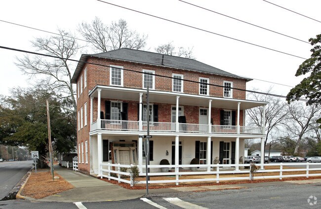
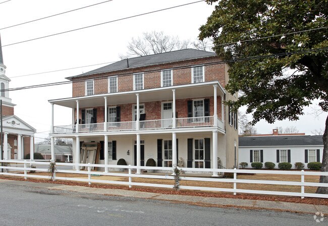
Property Record
1202 Broad St, Camden, SC 29020
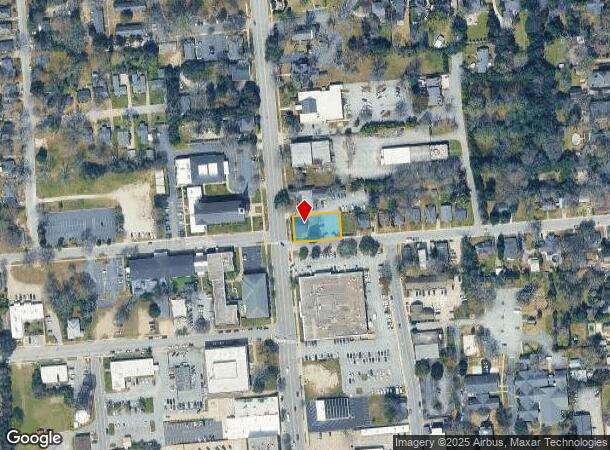
NEARBY LISTINGS FOR SALE OR LEASE
Property Detail
1202 Broad St
C284-08-00-170
2121-100 90ES2800047
Officebuilding
Kershaw
X
South Carolina
45055C0451F
0.30 AC
2025
Kershaw County
2025
Columbia
970800
Columbia, SC
2,800 SF
DEMOGRAPHICS near 1202 Broad St
1 Mile
3 Mile
5 Mile
2024 Total Population
4,692
14,728
22,621
2029 Population
5,200
16,180
24,733
Pop Growth 2024-2029
+ 10.83%
+ 9.86%
+ 9.34%
Average Age
43
43
42
2024 Total Households
2,030
6,237
9,426
HH Growth 2024-2029
+ 10.54%
+ 9.70%
+ 9.21%
Median Household Inc
$39,004
$40,846
$41,951
Avg Household Size
2.20
2.30
2.30
2024 Avg HH Vehicles
2.00
2.00
2.00
Median Home Value
$224,359
$167,510
$162,121
Median Year Built
1972
1976
1979
Nearby Places
Map Layers
Map Styles
 Street
 Aerial
- Restaurants
- Banks
- Shops
- Fitness
- Groceries
PUBLIC TRANSPORTATION
COMMUTER RAIL
Camden Amtrak Station (Silver Star - Amtrak)
DRIVE
WALK
Distance
Camden Amtrak Station (Silver Star - Amtrak)
3 min
1.3 mi
Freight Ports
North Charleston Terminal
DRIVE
WALK
Distance
North Charleston Terminal
145 min
125.6 mi
Nearby Properties
Address
Land Use
TOTAL SIZE
Lot Size
Zoning
Address
Land Use
TOTAL SIZE
Lot Size
Zoning
15.09 AC
MUNICIPAL
Address
Land Use
TOTAL SIZE
Lot Size
Zoning
183,825 SF
20.09 AC
MUNICIPAL
Address
Land Use
TOTAL SIZE
Lot Size
Zoning
117,844 SF
12.21 AC
MUNICIPAL
Address
Land Use
TOTAL SIZE
Lot Size
Zoning
141,018 SF
8.44 AC
MUNICIPAL
Address
Land Use
TOTAL SIZE
Lot Size
Zoning
116,508 SF
14.91 AC
MUNICIPAL
Address
Land Use
TOTAL SIZE
Lot Size
Zoning
101,650 SF
8.48 AC
Address
Land Use
TOTAL SIZE
Lot Size
Zoning
47,718 SF
4.56 AC
MUNICIPAL
Address
Land Use
TOTAL SIZE
Lot Size
Zoning
85,915 SF
3.57 AC
MUNICIPAL
Address
Land Use
TOTAL SIZE
Lot Size
Zoning
37,794 SF
28.77 AC
GD
Address
Land Use
TOTAL SIZE
Lot Size
Zoning
60,023 SF
5.70 AC
B2
Address
Land Use
TOTAL SIZE
Lot Size
Zoning
36,380 SF
3.61 AC
MUNICIPAL
Address
Land Use
TOTAL SIZE
Lot Size
Zoning
75,636 SF
6.28 AC
MUNICIPAL
Address
Land Use
TOTAL SIZE
Lot Size
Zoning
15,214 SF
1.28 AC
MUNICIPAL
Address
Land Use
TOTAL SIZE
Lot Size
Zoning
71,157 SF
7.19 AC
MUNICIPAL
Address
Land Use
TOTAL SIZE
Lot Size
Zoning
66,678 SF
5.28 AC
R6
Address
Land Use
TOTAL SIZE
Lot Size
Zoning
20.23 AC
MUNICIPAL
Address
Land Use
TOTAL SIZE
Lot Size
Zoning
82,125 SF
8.42 AC
GD
Address
Land Use
TOTAL SIZE
Lot Size
Zoning
22,076 SF
3.53 AC
MUNICIPAL
Address
Land Use
TOTAL SIZE
Lot Size
Zoning
54,906 SF
4.51 AC
Address
Land Use
TOTAL SIZE
Lot Size
Zoning
8,804 SF
0.73 AC
Address
Land Use
TOTAL SIZE
Lot Size
Zoning
41.08 AC
I1
Address
Land Use
TOTAL SIZE
Lot Size
Zoning
8,480 SF
3.75 AC
GD
Address
Land Use
TOTAL SIZE
Lot Size
Zoning
80,614 SF
7.70 AC
MUNICIPAL
Address
Land Use
TOTAL SIZE
Lot Size
Zoning
91,301 SF
7.32 AC
MUNICIPAL
Address
Land Use
TOTAL SIZE
Lot Size
Zoning
29.23 AC
MUNICIPAL
Address
Land Use
TOTAL SIZE
Lot Size
Zoning
31,296 SF
4.07 AC
MUNICIPAL
Address
Land Use
TOTAL SIZE
Lot Size
Zoning
40,804 SF
3 AC
MUNICIPAL
Address
Land Use
TOTAL SIZE
Lot Size
Zoning
10,726 SF
1.50 AC
MUNICIPAL
Address
Land Use
TOTAL SIZE
Lot Size
Zoning
10,985 SF
4.95 AC
Address
Land Use
TOTAL SIZE
Lot Size
Zoning
5,726 SF
1.61 AC
The World's #1 Commercial Real Estate Marketplace
Connect with us
© 2025 CoStar Group
The information above has been obtained from sources believed reliable. While we do not doubt its accuracy we have not verified it and make no guarantee, warranty or representation about it. It is your responsibility to independently confirm its accuracy and completeness. Any projections, opinions, assumptions, or estimates used are for example only and do not represent the current or future performance of the property. The value of this transaction to you depends on tax and other factors which should be evaluated by your tax, financial, and legal advisors. You and your advisors should conduct a careful, independent investigation of the property to determine to your satisfaction the suitability of the property for your needs.