Property Record
1202 Donelson Ave, Old Hickory, TN 37138


Property Detail
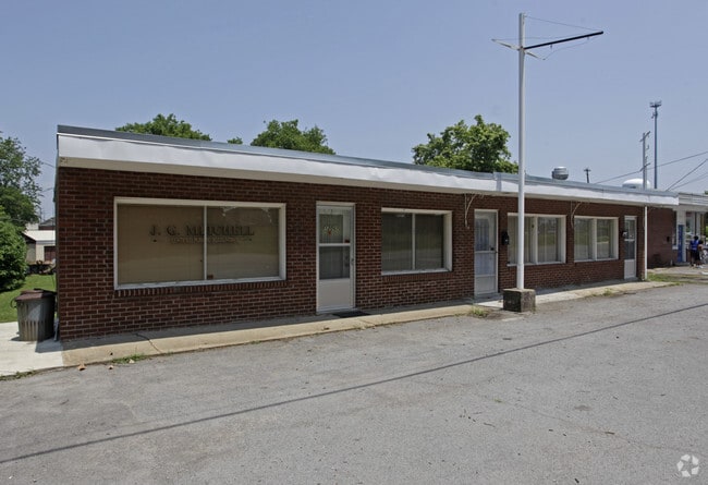
1202 Donelson Ave
044-10-0-014.01
PARCEL B 3 SEC D VILLAGE OF OLD HICKORY
Officebuilding
Davidson
CS
Tennessee
B and X Area of moderate flood hazard, usually the area between the limits of the 100-year and 500-year floods.
0.16 AC
2025
Donelson-Hermitage
2025
Nashville
010501
Nashville-Davidson--Murfreesboro--Franklin, TN
1,740 SF
NEARBY LISTINGS FOR SALE OR LEASE
DEMOGRAPHICS near 1202 Donelson Ave
1 mile
3 mile
5 mile
2025 Total Population
4,609
42,602
128,046
2030 Population
4,804
44,414
133,704
Pop Growth 2025-2030
+ 4.23%
+ 4.25%
+ 4.42%
Average Age
44
41
41
2025 Total Households
2,217
17,993
53,224
HH Growth 2025-2030
+ 4.60%
+ 4.60%
+ 4.73%
Median Household Inc
$72,826
$73,349
$76,356
Avg Household Size
2.00
2.30
2.40
2025 Avg HH Vehicles
2.00
2.00
2.00
Median Home Value
$340,313
$345,055
$374,714
Median Year Built
1969
1979
1982
Nearby Places
Map Layers
Map Styles
 Street
 Aerial
Layers
 Traffic
 Biking
Places
Listings with unknown addresses are not visible on the map
- Restaurants
- Banks
- Shops
- Fitness
- Groceries
PUBLIC TRANSPORTATION
COMMUTER RAIL
Hermitage (East Corridor Line - Tennessee Regional Transportation Authority Music City Star (Music City Star))
Drive
Walk
Distance
Hermitage (East Corridor Line - Tennessee Regional Transportation Authority Music City Star (Music City Star))
13 min
7.1 mi
Donelson (East Corridor Line - Tennessee Regional Transportation Authority Music City Star (Music City Star))
Drive
Walk
Distance
Donelson (East Corridor Line - Tennessee Regional Transportation Authority Music City Star (Music City Star))
16 min
9.0 mi
AIRPORT
Nashville International
Drive
Walk
Distance
Nashville International
22 min
12.8 mi
Nearby Properties
Address
Land Use
TOTAL SIZE
Lot Size
Zoning
Address
Land Use
TOTAL SIZE
Lot Size
Zoning
26,434 SF
12.86 AC
RM20
Address
Land Use
TOTAL SIZE
Lot Size
Zoning
102,738 SF
6.25 AC
MULTIZONE
Address
Land Use
TOTAL SIZE
Lot Size
Zoning
11,088 SF
21.28 AC
RS7.5
Address
Land Use
TOTAL SIZE
Lot Size
Zoning
336,784 SF
41.54 AC
IR
Address
Land Use
TOTAL SIZE
Lot Size
Zoning
169,292 SF
12 AC
RM20
Address
Land Use
TOTAL SIZE
Lot Size
Zoning
3,312 SF
33.03 AC
IR
Address
Land Use
TOTAL SIZE
Lot Size
Zoning
191,733 SF
62.90 AC
MULTI-ZONE
Address
Land Use
TOTAL SIZE
Lot Size
Zoning
93,000 SF
16.44 AC
IR
Address
Land Use
TOTAL SIZE
Lot Size
Zoning
3,864 SF
4.05 AC
RS5
Address
Land Use
TOTAL SIZE
Lot Size
Zoning
31,919 SF
14.69 AC
Address
Land Use
TOTAL SIZE
Lot Size
Zoning
29,068 SF
13.30 AC
TCR
Address
Land Use
TOTAL SIZE
Lot Size
Zoning
68,131 SF
4.16 AC
MUL
Address
Land Use
TOTAL SIZE
Lot Size
Zoning
22,850 SF
1.91 AC
R10
Address
Land Use
TOTAL SIZE
Lot Size
Zoning
93,232 SF
5.40 AC
RM20
Address
Land Use
TOTAL SIZE
Lot Size
Zoning
36,231 SF
57.17 AC
MULTI-ZONE
Address
Land Use
TOTAL SIZE
Lot Size
Zoning
15,456 SF
23.18 AC
Address
Land Use
TOTAL SIZE
Lot Size
Zoning
8,744 SF
8.73 AC
RM15
Address
Land Use
TOTAL SIZE
Lot Size
Zoning
18,502 SF
16.20 AC
RM9
Address
Land Use
TOTAL SIZE
Lot Size
Zoning
78,715 SF
13.33 AC
MUN
Address
Land Use
TOTAL SIZE
Lot Size
Zoning
417,742 SF
35.12 AC
IR
Address
Land Use
TOTAL SIZE
Lot Size
Zoning
18,358 SF
7.97 AC
RM20
Address
Land Use
TOTAL SIZE
Lot Size
Zoning
14,768 SF
9.46 AC
RS7.5
Address
Land Use
TOTAL SIZE
Lot Size
Zoning
2,560 SF
2.86 AC
R15
Address
Land Use
TOTAL SIZE
Lot Size
Zoning
37,979 SF
9.95 AC
RS10
Address
Land Use
TOTAL SIZE
Lot Size
Zoning
736 SF
11.50 AC
RM9
Address
Land Use
TOTAL SIZE
Lot Size
Zoning
18,762 SF
13.02 AC
Address
Land Use
TOTAL SIZE
Lot Size
Zoning
52,212 SF
6.72 AC
IWD
Address
Land Use
TOTAL SIZE
Lot Size
Zoning
93,120 SF
10.12 AC
MULTI-ZONE
Address
Land Use
TOTAL SIZE
Lot Size
Zoning
111,110 SF
7.89 AC
IWD
Address
Land Use
TOTAL SIZE
Lot Size
Zoning
114,836 SF
18.75 AC
RS10
The World's #1 Commercial Real Estate Marketplace
Connect with us
© 2026 CoStar Group
The information above has been obtained from sources believed reliable. While we do not doubt its accuracy we have not verified it and make no guarantee, warranty or representation about it. It is your responsibility to independently confirm its accuracy and completeness. Any projections, opinions, assumptions, or estimates used are for example only and do not represent the current or future performance of the property. The value of this transaction to you depends on tax and other factors which should be evaluated by your tax, financial, and legal advisors. You and your advisors should conduct a careful, independent investigation of the property to determine to your satisfaction the suitability of the property for your needs.