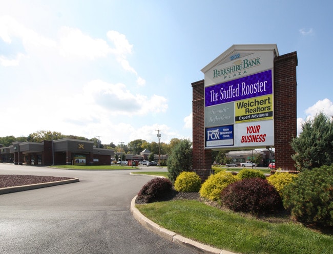
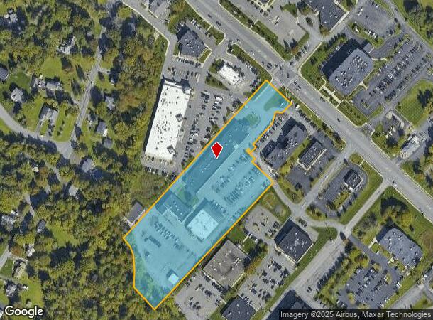
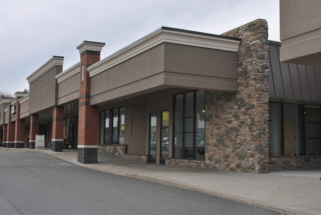
Property Record
1202 Troy Schenectady Rd, Latham, NY 12110
NEARBY LISTINGS FOR SALE OR LEASE
Property Detail
1202 Troy Schenectady Rd
012689-018-000-0001-003-001-0000
Final Subdivision Plan Archmont Knolls P
Officebuilding
Albany
X
New York
36001C0064D
3.001
2025
5.40 AC
2024
E Outer Albany County
013703
Albany/Schenectady/Troy
18,996 SF
Albany-Schenectady-Troy, NY
DEMOGRAPHICS near 1202 Troy Schenectady Rd
1 Mile
3 Mile
5 Mile
2024 Total Population
2,724
28,783
104,468
2029 Population
2,770
29,250
106,151
Pop Growth 2024-2029
+ 1.69%
+ 1.62%
+ 1.61%
Average Age
43
43
43
2024 Total Households
919
11,243
42,553
HH Growth 2024-2029
+ 1.74%
+ 1.63%
+ 1.60%
Median Household Inc
$126,118
$100,507
$95,210
Avg Household Size
2.70
2.50
2.40
2024 Avg HH Vehicles
2.00
2.00
2.00
Median Home Value
$325,793
$294,499
$274,876
Median Year Built
1974
1976
1972
Nearby Places
- Restaurants
- Banks
- Shops
- Fitness
- Groceries
PUBLIC TRANSPORTATION
AIRPORT
Albany International
DRIVE
WALK
Distance
Albany International
6 min
2.7 mi
Freight Ports
Albany, NY Port
DRIVE
WALK
Distance
Albany, NY Port
1 min
10.5 mi
SALE & LEASE HISTORY
LISTING DATE
SALE/LEASE

Apr 15, 2017
For Lease
Nearby Properties
Address
Land Use
TOTAL SIZE
Lot Size
Zoning
Address
Land Use
TOTAL SIZE
Lot Size
Zoning
821,670 SF
803.50 AC
17
Address
Land Use
TOTAL SIZE
Lot Size
Zoning
90,316 SF
57.10 AC
04 - FARM
Address
Land Use
TOTAL SIZE
Lot Size
Zoning
226,171 SF
26.39 AC
12
Address
Land Use
TOTAL SIZE
Lot Size
Zoning
84,242 SF
43.60 AC
12
Address
Land Use
TOTAL SIZE
Lot Size
Zoning
25,786 SF
8 AC
17
Address
Land Use
TOTAL SIZE
Lot Size
Zoning
167,222 SF
15.65 AC
14
Address
Land Use
TOTAL SIZE
Lot Size
Zoning
162,500 SF
19.90 AC
17
Address
Land Use
TOTAL SIZE
Lot Size
Zoning
83,120 SF
126.75 AC
25
Address
Land Use
TOTAL SIZE
Lot Size
Zoning
117,074 SF
25.30 AC
CN
Address
Land Use
TOTAL SIZE
Lot Size
Zoning
151,287 SF
11.20 AC
12
Address
Land Use
TOTAL SIZE
Lot Size
Zoning
214,716 SF
28.40 AC
19
Address
Land Use
TOTAL SIZE
Lot Size
Zoning
9,774 SF
49.20 AC
43
Address
Land Use
TOTAL SIZE
Lot Size
Zoning
303 SF
29.20 AC
CN
Address
Land Use
TOTAL SIZE
Lot Size
Zoning
53,852 SF
43.35 AC
25
Address
Land Use
TOTAL SIZE
Lot Size
Zoning
25,112 SF
13.16 AC
04 - FARM
Address
Land Use
TOTAL SIZE
Lot Size
Zoning
108,656 SF
6.44 AC
12
Address
Land Use
TOTAL SIZE
Lot Size
Zoning
144,030 SF
19.70 AC
19
Address
Land Use
TOTAL SIZE
Lot Size
Zoning
16,545 SF
21.40 AC
04 - FARM
Address
Land Use
TOTAL SIZE
Lot Size
Zoning
133,112 SF
17.56 AC
16
Address
Land Use
TOTAL SIZE
Lot Size
Zoning
149,241 SF
26.80 AC
17
Address
Land Use
TOTAL SIZE
Lot Size
Zoning
83,800 SF
3.84 AC
14
Address
Land Use
TOTAL SIZE
Lot Size
Zoning
6,944 SF
13.02 AC
R3
Address
Land Use
TOTAL SIZE
Lot Size
Zoning
111,888 SF
9.60 AC
17
Address
Land Use
TOTAL SIZE
Lot Size
Zoning
282,414 SF
25.64 AC
17
Address
Land Use
TOTAL SIZE
Lot Size
Zoning
41,128 SF
18.67 AC
17
Address
Land Use
TOTAL SIZE
Lot Size
Zoning
209,910 SF
19.91 AC
17
Address
Land Use
TOTAL SIZE
Lot Size
Zoning
41,688 SF
8.80 AC
08 - GOVER
Address
Land Use
TOTAL SIZE
Lot Size
Zoning
32,830 SF
17.85 AC
12
Address
Land Use
TOTAL SIZE
Lot Size
Zoning
117,343 SF
19.08 AC
16
Address
Land Use
TOTAL SIZE
Lot Size
Zoning
42,393 SF
8.39 AC
17
The World's #1 Commercial Real Estate Marketplace
Connect with us
© 2025 CoStar Group
The information above has been obtained from sources believed reliable. While we do not doubt its accuracy we have not verified it and make no guarantee, warranty or representation about it. It is your responsibility to independently confirm its accuracy and completeness. Any projections, opinions, assumptions, or estimates used are for example only and do not represent the current or future performance of the property. The value of this transaction to you depends on tax and other factors which should be evaluated by your tax, financial, and legal advisors. You and your advisors should conduct a careful, independent investigation of the property to determine to your satisfaction the suitability of the property for your needs.