Property Record
12025 Dixie, Redford, MI 48239

NEARBY LISTINGS FOR SALE OR LEASE
Property Detail
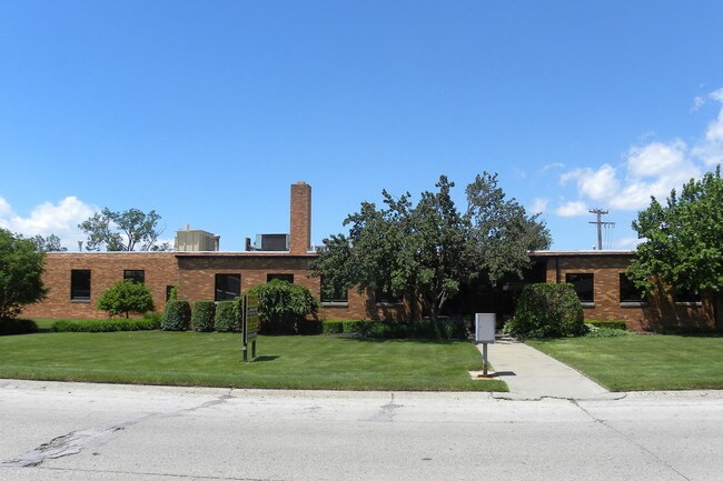
12025 Dixie
Detroit-Warren-Dearborn, MI
Pob Redford Industrial
79-036-02-0032-000
29S30A2 N 28 FT OF THE S 35 FT OF LOT 30 LEHO INDUSTRIAL ACRES NO. 2 T1S R10E L77 P77 WCR
Manufacturinglight
Wayne
X
Michigan
26163C0231E
30
2024
2.43 AC
2025
Dearborn
555300
Detroit
50,471 SF
DEMOGRAPHICS near 12025 Dixie
1 Mile
3 Mile
5 Mile
2024 Total Population
11,585
104,388
336,596
2029 Population
11,083
101,231
326,679
Pop Growth 2024-2029
(4.33%)
(3.02%)
(2.95%)
Average Age
39
39
39
2024 Total Households
4,587
40,927
130,259
HH Growth 2024-2029
(4.34%)
(3.12%)
(3.03%)
Median Household Inc
$58,542
$54,411
$52,751
Avg Household Size
2.50
2.50
2.50
2024 Avg HH Vehicles
2.00
2.00
2.00
Median Home Value
$135,306
$139,256
$144,059
Median Year Built
1954
1955
1954
Nearby Places
Map Layers
Map Styles
 Street
 Aerial
- Restaurants
- Banks
- Shops
- Fitness
- Groceries
PUBLIC TRANSPORTATION
COMMUTER RAIL
DRIVE
WALK
Distance
16 min
6.7 mi
AIRPORT
Detroit Metro Wayne County
DRIVE
WALK
Distance
Detroit Metro Wayne County
30 min
15.9 mi
Windsor International
DRIVE
WALK
Distance
Windsor International
43 min
25.5 mi
Freight Ports
DRIVE
WALK
Distance
82 min
59.2 mi
Nearby Properties
Address
Land Use
TOTAL SIZE
Lot Size
Zoning
Address
Land Use
TOTAL SIZE
Lot Size
Zoning
1,071,675 SF
59.61 AC
M-2
Address
Land Use
TOTAL SIZE
Lot Size
Zoning
335,133 SF
22.08 AC
Address
Land Use
TOTAL SIZE
Lot Size
Zoning
909,159 SF
55.33 AC
M-2
Address
Land Use
TOTAL SIZE
Lot Size
Zoning
1,156,275 SF
75.88 AC
M-2
Address
Land Use
TOTAL SIZE
Lot Size
Zoning
85.45 AC
Address
Land Use
TOTAL SIZE
Lot Size
Zoning
261,917 SF
9.31 AC
PD
Address
Land Use
TOTAL SIZE
Lot Size
Zoning
1,013,885 SF
36.48 AC
M-1
Address
Land Use
TOTAL SIZE
Lot Size
Zoning
399,770 SF
34.90 AC
M-2
Address
Land Use
TOTAL SIZE
Lot Size
Zoning
121,420 SF
16.01 AC
C-2
Address
Land Use
TOTAL SIZE
Lot Size
Zoning
835,383 SF
36.85 AC
Address
Land Use
TOTAL SIZE
Lot Size
Zoning
300,936 SF
18.40 AC
M4
Address
Land Use
TOTAL SIZE
Lot Size
Zoning
1,529,287 SF
76.96 AC
M-1
Address
Land Use
TOTAL SIZE
Lot Size
Zoning
158,354 SF
43.70 AC
M4
Address
Land Use
TOTAL SIZE
Lot Size
Zoning
205,368 SF
20.22 AC
C-2
Address
Land Use
TOTAL SIZE
Lot Size
Zoning
216,268 SF
23.58 AC
C-2
Address
Land Use
TOTAL SIZE
Lot Size
Zoning
167,562 SF
9.25 AC
R5
Address
Land Use
TOTAL SIZE
Lot Size
Zoning
151,605 SF
14.66 AC
C-2
Address
Land Use
TOTAL SIZE
Lot Size
Zoning
286,524 SF
16.58 AC
Address
Land Use
TOTAL SIZE
Lot Size
Zoning
179,412 SF
2.17 AC
Address
Land Use
TOTAL SIZE
Lot Size
Zoning
129,975 SF
6.89 AC
R5
Address
Land Use
TOTAL SIZE
Lot Size
Zoning
57,739 SF
1.71 AC
Address
Land Use
TOTAL SIZE
Lot Size
Zoning
104,567 SF
2.14 AC
PD
Address
Land Use
TOTAL SIZE
Lot Size
Zoning
115,215 SF
8.83 AC
C-2
Address
Land Use
TOTAL SIZE
Lot Size
Zoning
149,735 SF
6.64 AC
Address
Land Use
TOTAL SIZE
Lot Size
Zoning
141,206 SF
14.01 AC
M-1
Address
Land Use
TOTAL SIZE
Lot Size
Zoning
152,424 SF
5.02 AC
Address
Land Use
TOTAL SIZE
Lot Size
Zoning
135,924 SF
12.90 AC
C-2
Address
Land Use
TOTAL SIZE
Lot Size
Zoning
89,152 SF
7.44 AC
R-9
Address
Land Use
TOTAL SIZE
Lot Size
Zoning
134,090 SF
14.18 AC
C-2
Address
Land Use
TOTAL SIZE
Lot Size
Zoning
160,300 SF
11.15 AC
M-2
The World's #1 Commercial Real Estate Marketplace
Connect with us
© 2025 CoStar Group
The information above has been obtained from sources believed reliable. While we do not doubt its accuracy we have not verified it and make no guarantee, warranty or representation about it. It is your responsibility to independently confirm its accuracy and completeness. Any projections, opinions, assumptions, or estimates used are for example only and do not represent the current or future performance of the property. The value of this transaction to you depends on tax and other factors which should be evaluated by your tax, financial, and legal advisors. You and your advisors should conduct a careful, independent investigation of the property to determine to your satisfaction the suitability of the property for your needs.