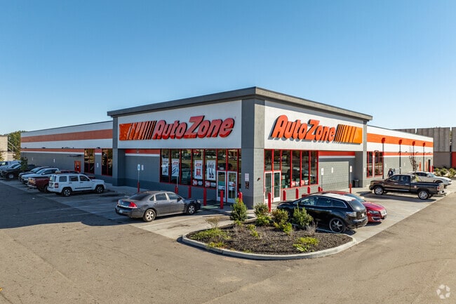
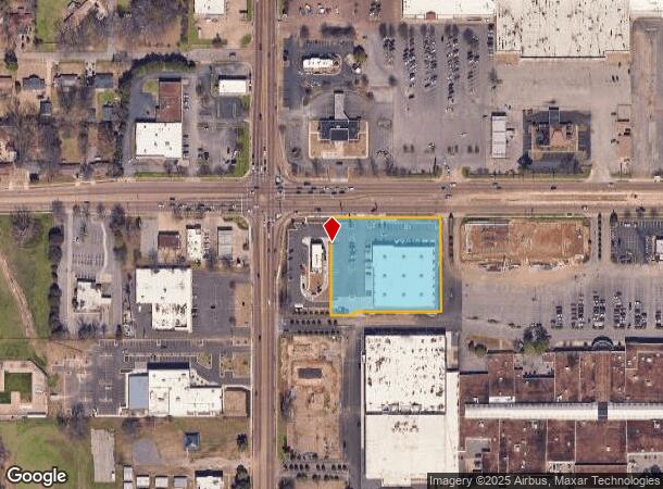
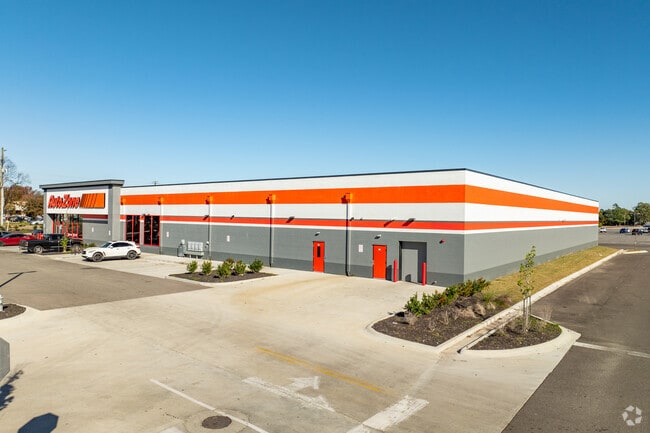
Property Record
1203 E Shelby Dr, Memphis, TN 38116
NEARBY LISTINGS FOR SALE OR LEASE
Property Detail
1203 E Shelby Dr
Memphis
Goldsmiths Regional Sc
Memphis, TN-MS-AR
ES HWY 51 S COR E SHELBY DR SE CAPLEVILLE RD SE SS E SHELBY DR
07-9061-0-0215
Shelby
Storebuilding
Tennessee
2024
p2
2025
2.09 AC
022121
South
32,760 SF
DEMOGRAPHICS near 1203 E Shelby Dr
1 Mile
3 Mile
5 Mile
2024 Total Population
8,187
63,663
136,576
2029 Population
8,022
63,948
139,735
Pop Growth 2024-2029
(2.02%)
+ 0.45%
+ 2.31%
Average Age
40
38
38
2024 Total Households
3,172
24,244
51,990
HH Growth 2024-2029
(2.24%)
+ 0.38%
+ 2.27%
Median Household Inc
$43,953
$41,102
$41,882
Avg Household Size
2.50
2.60
2.60
2024 Avg HH Vehicles
1.00
2.00
2.00
Median Home Value
$142,418
$98,298
$98,599
Median Year Built
1965
1965
1969
Nearby Places
Map Layers
Map Styles
 Street
 Aerial
- Restaurants
- Banks
- Shops
- Fitness
- Groceries
PUBLIC TRANSPORTATION
AIRPORT
Memphis International
DRIVE
WALK
Distance
Memphis International
9 min
5.3 mi
SALE & LEASE HISTORY
LISTING DATE
SALE/LEASE

Aug 01, 2024
For Sale
Nearby Properties
Address
Land Use
TOTAL SIZE
Lot Size
Zoning
Address
Land Use
TOTAL SIZE
Lot Size
Zoning
1,013,319 SF
38.86 AC
EMP
Address
Land Use
TOTAL SIZE
Lot Size
Zoning
732,894 SF
79.73 AC
WD
Address
Land Use
TOTAL SIZE
Lot Size
Zoning
1,009,363 SF
78.56 AC
EMP
Address
Land Use
TOTAL SIZE
Lot Size
Zoning
180,831 SF
13.11 AC
EMP
Address
Land Use
TOTAL SIZE
Lot Size
Zoning
279,419 SF
172.07 AC
EMP
Address
Land Use
TOTAL SIZE
Lot Size
Zoning
357,582 SF
5.61 AC
EMP
Address
Land Use
TOTAL SIZE
Lot Size
Zoning
146,316 SF
18.07 AC
CMU-3
Address
Land Use
TOTAL SIZE
Lot Size
Zoning
853,440 SF
39.22 AC
EMP
Address
Land Use
TOTAL SIZE
Lot Size
Zoning
321.59 AC
R-8
Address
Land Use
TOTAL SIZE
Lot Size
Zoning
144,078 SF
17.93 AC
RU-3
Address
Land Use
TOTAL SIZE
Lot Size
Zoning
38,600 SF
30.35 AC
RU-3
Address
Land Use
TOTAL SIZE
Lot Size
Zoning
345,806 SF
33.16 AC
RU-3
Address
Land Use
TOTAL SIZE
Lot Size
Zoning
47.65 AC
R-8
Address
Land Use
TOTAL SIZE
Lot Size
Zoning
14,075 SF
9.36 AC
RU-3
Address
Land Use
TOTAL SIZE
Lot Size
Zoning
95,307 SF
25.91 AC
RU-3
Address
Land Use
TOTAL SIZE
Lot Size
Zoning
214,950 SF
17.05 AC
CMU-2
Address
Land Use
TOTAL SIZE
Lot Size
Zoning
52,347 SF
11.55 AC
R-8
Address
Land Use
TOTAL SIZE
Lot Size
Zoning
81,790 SF
17.82 AC
CMU-2
Address
Land Use
TOTAL SIZE
Lot Size
Zoning
432,700 SF
28.16 AC
EMP
Address
Land Use
TOTAL SIZE
Lot Size
Zoning
810,225 SF
47.71 AC
M-1
Address
Land Use
TOTAL SIZE
Lot Size
Zoning
188,404 SF
59.17 AC
R-8
Address
Land Use
TOTAL SIZE
Lot Size
Zoning
165,227 SF
25.12 AC
RU-3
Address
Land Use
TOTAL SIZE
Lot Size
Zoning
147,890 SF
16.92 AC
EMP
Address
Land Use
TOTAL SIZE
Lot Size
Zoning
43,476 SF
4.62 AC
CMU-3
Address
Land Use
TOTAL SIZE
Lot Size
Zoning
367,132 SF
18.54 AC
EMP
Address
Land Use
TOTAL SIZE
Lot Size
Zoning
61,164 SF
36.95 AC
RU-3
Address
Land Use
TOTAL SIZE
Lot Size
Zoning
230,103 SF
22.07 AC
CMU-2
Address
Land Use
TOTAL SIZE
Lot Size
Zoning
233,060 SF
20 AC
EMP
Address
Land Use
TOTAL SIZE
Lot Size
Zoning
79,658 SF
7 AC
RU-3
Address
Land Use
TOTAL SIZE
Lot Size
Zoning
80,264 SF
10.15 AC
RU-3
The World's #1 Commercial Real Estate Marketplace
Connect with us
© 2026 CoStar Group
The information above has been obtained from sources believed reliable. While we do not doubt its accuracy we have not verified it and make no guarantee, warranty or representation about it. It is your responsibility to independently confirm its accuracy and completeness. Any projections, opinions, assumptions, or estimates used are for example only and do not represent the current or future performance of the property. The value of this transaction to you depends on tax and other factors which should be evaluated by your tax, financial, and legal advisors. You and your advisors should conduct a careful, independent investigation of the property to determine to your satisfaction the suitability of the property for your needs.