Property Record
1203 Townsgate Ct, Plant City, FL 33563


NEARBY LISTINGS FOR SALE OR LEASE
Property Detail
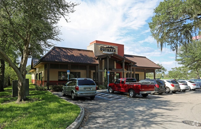
1203 Townsgate Ct
Tampa-St. Petersburg-Clearwater, FL
Townsgate West
P-19-28-22-57S-000000-00001.0
TOWNSGATE WEST LOT 1 LESS R/W FOR I-4 LYING WITHIN THE FOLLOWING: BEG AT NE COR OF SD SUB RUN S 18 DEG 49 MIN 39 SEC W 70.55 FT S 75 DEG 27 MIN 17 SEC W 735.56 FT S 82 DEG 21 MIN 20 SEC W 308.36 FT S 87 DEG 00 MIN 48 SEC W 105.06 FT TO W LINE OF SD S
Restaurantbuilding
Hillsborough
A
Florida
12057C0269H
1
2024
5.16 AC
2024
Eastern Outlying
012701
Tampa/St Petersburg
13,579 SF
DEMOGRAPHICS near 1203 Townsgate Ct
1 Mile
3 Mile
5 Mile
2024 Total Population
4,134
40,547
70,151
2029 Population
4,504
44,285
76,647
Pop Growth 2024-2029
+ 8.95%
+ 9.22%
+ 9.26%
Average Age
38
39
39
2024 Total Households
1,563
14,735
24,357
HH Growth 2024-2029
+ 9.28%
+ 9.52%
+ 9.55%
Median Household Inc
$43,273
$53,756
$57,779
Avg Household Size
2.60
2.70
2.80
2024 Avg HH Vehicles
2.00
2.00
2.00
Median Home Value
$150,183
$202,312
$247,463
Median Year Built
1982
1983
1986
Nearby Places
Map Layers
Map Styles
 Street
 Aerial
- Restaurants
- Banks
- Shops
- Fitness
- Groceries
PUBLIC TRANSPORTATION
AIRPORT
Tampa International
DRIVE
WALK
Distance
Tampa International
38 min
27.5 mi
St Pete-Clearwater International
DRIVE
WALK
Distance
St Pete-Clearwater International
55 min
37.6 mi
Freight Ports
Port of Tampa Bay
DRIVE
WALK
Distance
Port of Tampa Bay
31 min
21.8 mi
Nearby Properties
Address
Land Use
TOTAL SIZE
Lot Size
Zoning
Address
Land Use
TOTAL SIZE
Lot Size
Zoning
519,942 SF
130.03 AC
I
Address
Land Use
TOTAL SIZE
Lot Size
Zoning
286,824 SF
43.15 AC
PD
Address
Land Use
TOTAL SIZE
Lot Size
Zoning
235,102 SF
7.73 AC
P
Address
Land Use
TOTAL SIZE
Lot Size
Zoning
243,294 SF
19.80 AC
CC
Address
Land Use
TOTAL SIZE
Lot Size
Zoning
400,224 SF
39.13 AC
I
Address
Land Use
TOTAL SIZE
Lot Size
Zoning
296,496 SF
77.52 AC
P
Address
Land Use
TOTAL SIZE
Lot Size
Zoning
496,217 SF
35.02 AC
I
Address
Land Use
TOTAL SIZE
Lot Size
Zoning
93,924 SF
3.96 AC
DC
Address
Land Use
TOTAL SIZE
Lot Size
Zoning
213,188 SF
16.10 AC
PD
Address
Land Use
TOTAL SIZE
Lot Size
Zoning
152,518 SF
43.50 AC
C-1A
Address
Land Use
TOTAL SIZE
Lot Size
Zoning
35,426 SF
39.92 AC
P
Address
Land Use
TOTAL SIZE
Lot Size
Zoning
145,222 SF
36.47 AC
PD
Address
Land Use
TOTAL SIZE
Lot Size
Zoning
192,911 SF
16.36 AC
PD
Address
Land Use
TOTAL SIZE
Lot Size
Zoning
247,608 SF
25.84 AC
PD
Address
Land Use
TOTAL SIZE
Lot Size
Zoning
252,166 SF
22.88 AC
I
Address
Land Use
TOTAL SIZE
Lot Size
Zoning
122,234 SF
191.15 AC
I
Address
Land Use
TOTAL SIZE
Lot Size
Zoning
159,805 SF
78.29 AC
P
Address
Land Use
TOTAL SIZE
Lot Size
Zoning
139,392 SF
73.31 AC
RO
Address
Land Use
TOTAL SIZE
Lot Size
Zoning
127,470 SF
7.84 AC
R-20
Address
Land Use
TOTAL SIZE
Lot Size
Zoning
73,613 SF
57.94 AC
R-1A
Address
Land Use
TOTAL SIZE
Lot Size
Zoning
125,744 SF
19.48 AC
I
Address
Land Use
TOTAL SIZE
Lot Size
Zoning
242,449 SF
19.97 AC
R-6
Address
Land Use
TOTAL SIZE
Lot Size
Zoning
481,620 SF
23.85 AC
I
Address
Land Use
TOTAL SIZE
Lot Size
Zoning
66,199 SF
4.32 AC
P
Address
Land Use
TOTAL SIZE
Lot Size
Zoning
90,436 SF
6.11 AC
C-1
Address
Land Use
TOTAL SIZE
Lot Size
Zoning
40,530 SF
2.36 AC
DC
Address
Land Use
TOTAL SIZE
Lot Size
Zoning
33,282 SF
16.94 AC
RO
Address
Land Use
TOTAL SIZE
Lot Size
Zoning
90,504 SF
5.33 AC
I
Address
Land Use
TOTAL SIZE
Lot Size
Zoning
149,952 SF
19.41 AC
I
Address
Land Use
TOTAL SIZE
Lot Size
Zoning
59,031 SF
29.87 AC
R-6
The World's #1 Commercial Real Estate Marketplace
Connect with us
© 2026 CoStar Group
The information above has been obtained from sources believed reliable. While we do not doubt its accuracy we have not verified it and make no guarantee, warranty or representation about it. It is your responsibility to independently confirm its accuracy and completeness. Any projections, opinions, assumptions, or estimates used are for example only and do not represent the current or future performance of the property. The value of this transaction to you depends on tax and other factors which should be evaluated by your tax, financial, and legal advisors. You and your advisors should conduct a careful, independent investigation of the property to determine to your satisfaction the suitability of the property for your needs.