Property Record
12030 Etris Rd, Roswell, GA 30075


NEARBY LISTINGS FOR SALE OR LEASE
Property Detail
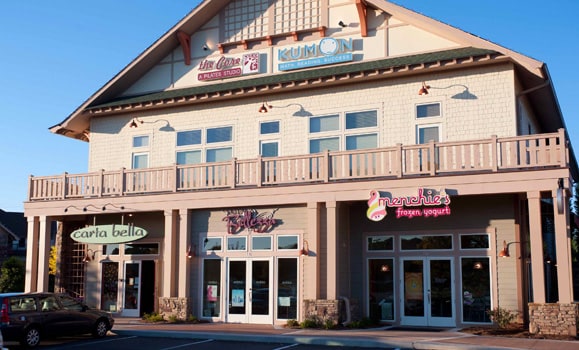
12030 Etris Rd
Regionalshoppingcenterormallwithanchorstore
Fulton
X
Georgia
13121C0053G
6.46 AC
2024
N Fulton/Forsyth County
2025
Atlanta
011417
Atlanta-Sandy Springs-Roswell, GA
57,845 SF
22-3730-1283-456-5
DEMOGRAPHICS near 12030 Etris Rd
1 Mile
3 Mile
5 Mile
2024 Total Population
7,435
45,510
135,311
2029 Population
7,497
46,413
139,475
Pop Growth 2024-2029
+ 0.83%
+ 1.98%
+ 3.08%
Average Age
42
41
40
2024 Total Households
2,663
16,789
50,949
HH Growth 2024-2029
+ 0.98%
+ 2.14%
+ 3.25%
Median Household Inc
$142,192
$148,109
$132,397
Avg Household Size
2.70
2.70
2.60
2024 Avg HH Vehicles
2.00
2.00
2.00
Median Home Value
$474,888
$485,343
$484,540
Median Year Built
1991
1992
1991
Nearby Places
Map Layers
Map Styles
 Street
 Aerial
- Restaurants
- Banks
- Shops
- Fitness
- Groceries
SALE & LEASE HISTORY
LISTING DATE
SALE/LEASE

Nov 16, 2016
For Lease
Nearby Properties
Address
Land Use
TOTAL SIZE
Lot Size
Zoning
Address
Land Use
TOTAL SIZE
Lot Size
Zoning
3,459,339 SF
26.51 AC
OI
Address
Land Use
TOTAL SIZE
Lot Size
Zoning
11.82 AC
Address
Land Use
TOTAL SIZE
Lot Size
Zoning
260,648 SF
34.20 AC
C3C
Address
Land Use
TOTAL SIZE
Lot Size
Zoning
2,674,992 SF
28.94 AC
R4C
Address
Land Use
TOTAL SIZE
Lot Size
Zoning
938,151 SF
21.22 AC
C3
Address
Land Use
TOTAL SIZE
Lot Size
Zoning
2,289 SF
84.27 AC
AG1
Address
Land Use
TOTAL SIZE
Lot Size
Zoning
1,185,316 SF
19.09 AC
R4
Address
Land Use
TOTAL SIZE
Lot Size
Zoning
264,255 SF
51 AC
E2
Address
Land Use
TOTAL SIZE
Lot Size
Zoning
306,753 SF
19.77 AC
HMS
Address
Land Use
TOTAL SIZE
Lot Size
Zoning
402,680 SF
35.81 AC
Address
Land Use
TOTAL SIZE
Lot Size
Zoning
71,000 SF
48.73 AC
E1
Address
Land Use
TOTAL SIZE
Lot Size
Zoning
139,081 SF
13.71 AC
C3
Address
Land Use
TOTAL SIZE
Lot Size
Zoning
3,727,094 SF
5.92 AC
OI
Address
Land Use
TOTAL SIZE
Lot Size
Zoning
179,182 SF
15.06 AC
OI
Address
Land Use
TOTAL SIZE
Lot Size
Zoning
377,080 SF
19.37 AC
E1
Address
Land Use
TOTAL SIZE
Lot Size
Zoning
2,198,900 SF
14.34 AC
R4C
Address
Land Use
TOTAL SIZE
Lot Size
Zoning
236,902 SF
0.23 AC
I1
Address
Land Use
TOTAL SIZE
Lot Size
Zoning
205,806 SF
2.01 AC
R2
Address
Land Use
TOTAL SIZE
Lot Size
Zoning
52,148 SF
6.99 AC
C1
Address
Land Use
TOTAL SIZE
Lot Size
Zoning
299,502 SF
19.77 AC
E2
Address
Land Use
TOTAL SIZE
Lot Size
Zoning
1,199,716 SF
7.10 AC
C1
Address
Land Use
TOTAL SIZE
Lot Size
Zoning
46.70 AC
R1
Address
Land Use
TOTAL SIZE
Lot Size
Zoning
180,336 SF
14.59 AC
R1
Address
Land Use
TOTAL SIZE
Lot Size
Zoning
236,370 SF
27.52 AC
R5
Address
Land Use
TOTAL SIZE
Lot Size
Zoning
175,624 SF
8.18 AC
LI
Address
Land Use
TOTAL SIZE
Lot Size
Zoning
229,640 SF
25.02 AC
I1C
Address
Land Use
TOTAL SIZE
Lot Size
Zoning
156,126 SF
9.89 AC
I1C
Address
Land Use
TOTAL SIZE
Lot Size
Zoning
32.02 AC
Address
Land Use
TOTAL SIZE
Lot Size
Zoning
349,531 SF
5.89 AC
LI
Address
Land Use
TOTAL SIZE
Lot Size
Zoning
95,478 SF
3 AC
The World's #1 Commercial Real Estate Marketplace
Connect with us
© 2025 CoStar Group
The information above has been obtained from sources believed reliable. While we do not doubt its accuracy we have not verified it and make no guarantee, warranty or representation about it. It is your responsibility to independently confirm its accuracy and completeness. Any projections, opinions, assumptions, or estimates used are for example only and do not represent the current or future performance of the property. The value of this transaction to you depends on tax and other factors which should be evaluated by your tax, financial, and legal advisors. You and your advisors should conduct a careful, independent investigation of the property to determine to your satisfaction the suitability of the property for your needs.