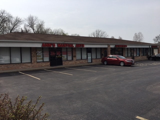
Property Record
12032 Tesson Ferry Rd, Saint Louis, MO 63128


Current Lease Availabilities
Property Detail
12032 Tesson Ferry Rd
28L-33-0322
367.50 FEET W OF CONCORD SCHOOL RD
Storebuilding
Saint Louis
C-8
Missouri
B and X Area of moderate flood hazard, usually the area between the limits of the 100-year and 500-year floods.
1.12 AC
2024
South County
2025
St. Louis
221337
St. Louis, MO-IL
7,020 SF
NEARBY LISTINGS FOR SALE OR LEASE
DEMOGRAPHICS near 12032 Tesson Ferry Rd
1 mile
3 mile
5 mile
2025 Total Population
9,065
74,423
201,151
2030 Population
8,919
73,434
198,810
Pop Growth 2025-2030
(1.61%)
(1.33%)
(1.16%)
Average Age
44
44
43
2025 Total Households
3,915
32,335
86,102
HH Growth 2025-2030
(1.61%)
(1.35%)
(1.23%)
Median Household Inc
$84,665
$84,589
$84,434
Avg Household Size
2.30
2.20
2.30
2025 Avg HH Vehicles
2.00
2.00
2.00
Median Home Value
$322,546
$301,742
$267,605
Median Year Built
1965
1969
1967
Nearby Places
Map Layers
Map Styles
 Street
 Aerial
Layers
 Traffic
 Biking
Places
Listings with unknown addresses are not visible on the map
- Restaurants
- Banks
- Shops
- Fitness
- Groceries
PUBLIC TRANSPORTATION
COMMUTER RAIL
Shrewsbury-Lansdowne (Shrewsbury-Lansdowne I-44 Emerson Park - St. Louis MetroLink (MetroLink))
Drive
Walk
Distance
Shrewsbury-Lansdowne (Shrewsbury-Lansdowne I-44 Emerson Park - St. Louis MetroLink (MetroLink))
15 min
7.0 mi
Sunnen (Shrewsbury-Lansdowne I-44 Emerson Park - St. Louis MetroLink (MetroLink))
Drive
Walk
Distance
Sunnen (Shrewsbury-Lansdowne I-44 Emerson Park - St. Louis MetroLink (MetroLink))
15 min
7.2 mi
AIRPORT
St Louis Lambert International
Drive
Walk
Distance
St Louis Lambert International
33 min
19.3 mi
Scott AFB/Midamerica St Louis
Drive
Walk
Distance
Scott AFB/Midamerica St Louis
56 min
40.0 mi
Nearby Properties
Address
Land Use
TOTAL SIZE
Lot Size
Zoning
Address
Land Use
TOTAL SIZE
Lot Size
Zoning
31.45 AC
Address
Land Use
TOTAL SIZE
Lot Size
Zoning
31.42 AC
R2
Address
Land Use
TOTAL SIZE
Lot Size
Zoning
93,822 SF
33.97 AC
C-8
Address
Land Use
TOTAL SIZE
Lot Size
Zoning
851,923 SF
32.28 AC
101PDMXD
Address
Land Use
TOTAL SIZE
Lot Size
Zoning
739,781 SF
22.08 AC
C3
Address
Land Use
TOTAL SIZE
Lot Size
Zoning
Address
Land Use
TOTAL SIZE
Lot Size
Zoning
40.60 AC
R4
Address
Land Use
TOTAL SIZE
Lot Size
Zoning
142,232 SF
28.76 AC
NU
Address
Land Use
TOTAL SIZE
Lot Size
Zoning
140,783 SF
15.51 AC
C-8
Address
Land Use
TOTAL SIZE
Lot Size
Zoning
396 SF
8.57 AC
69M-1
Address
Land Use
TOTAL SIZE
Lot Size
Zoning
26.62 AC
R3
Address
Land Use
TOTAL SIZE
Lot Size
Zoning
6.93 AC
101R-2
Address
Land Use
TOTAL SIZE
Lot Size
Zoning
113,971 SF
6.64 AC
C-8
Address
Land Use
TOTAL SIZE
Lot Size
Zoning
103,204 SF
1.47 AC
C-8
Address
Land Use
TOTAL SIZE
Lot Size
Zoning
117,399 SF
0.81 AC
Address
Land Use
TOTAL SIZE
Lot Size
Zoning
142,800 SF
13.38 AC
106PL1
Address
Land Use
TOTAL SIZE
Lot Size
Zoning
21.55 AC
C-8
Address
Land Use
TOTAL SIZE
Lot Size
Zoning
386,377 SF
21.34 AC
R7
Address
Land Use
TOTAL SIZE
Lot Size
Zoning
22.67 AC
PCD
Address
Land Use
TOTAL SIZE
Lot Size
Zoning
262,264 SF
16.27 AC
R6
Address
Land Use
TOTAL SIZE
Lot Size
Zoning
2,369 SF
10.70 AC
R4
Address
Land Use
TOTAL SIZE
Lot Size
Zoning
1,800 SF
116.73 AC
PS
Address
Land Use
TOTAL SIZE
Lot Size
Zoning
163,144 SF
14.14 AC
C-8
Address
Land Use
TOTAL SIZE
Lot Size
Zoning
36,112 SF
84.29 AC
AA
Address
Land Use
TOTAL SIZE
Lot Size
Zoning
185,035 SF
8.94 AC
106PL1
Address
Land Use
TOTAL SIZE
Lot Size
Zoning
98,008 SF
10.19 AC
C-8
Address
Land Use
TOTAL SIZE
Lot Size
Zoning
499,003 SF
99.34 AC
C-8
Address
Land Use
TOTAL SIZE
Lot Size
Zoning
114,707 SF
10.94 AC
C-8
Address
Land Use
TOTAL SIZE
Lot Size
Zoning
1,268 SF
19.85 AC
R2
Address
Land Use
TOTAL SIZE
Lot Size
Zoning
2,130 SF
19.72 AC
B
The World's #1 Commercial Real Estate Marketplace
Connect with us
© 2026 CoStar Group
The information above has been obtained from sources believed reliable. While we do not doubt its accuracy we have not verified it and make no guarantee, warranty or representation about it. It is your responsibility to independently confirm its accuracy and completeness. Any projections, opinions, assumptions, or estimates used are for example only and do not represent the current or future performance of the property. The value of this transaction to you depends on tax and other factors which should be evaluated by your tax, financial, and legal advisors. You and your advisors should conduct a careful, independent investigation of the property to determine to your satisfaction the suitability of the property for your needs.