Property Record
12033 N Us Highway 131, Schoolcraft, MI 49087
NEARBY LISTINGS FOR SALE OR LEASE
-
-
View all Schoolcraft listings for sale on LoopNet.com
Property Detail
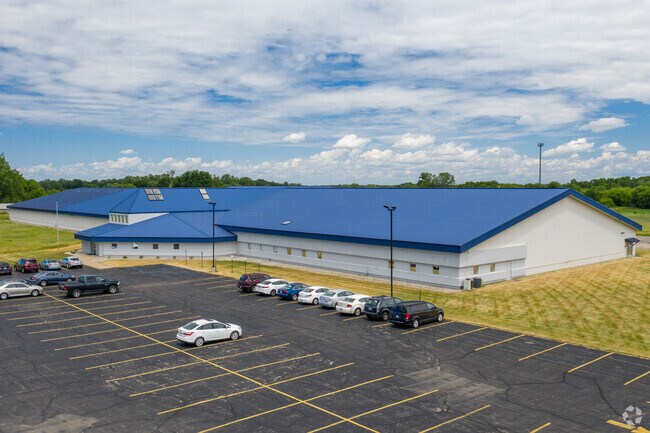
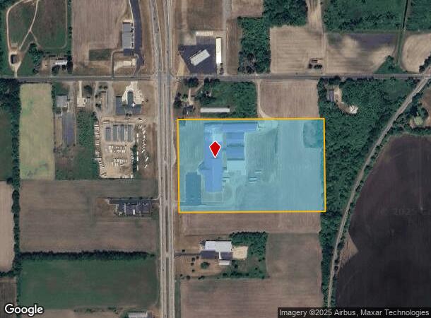
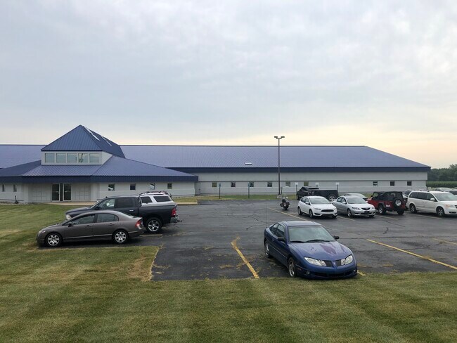
12033 N Us Highway 131
14-07-205-040
COM AT N QTR COR SEC 7, T4S, R11W; TH N 89DEG 31' 27"E 792.35 FT ON N LN OF NE QTR OF SD SEC; TH S 00DEG 28' 33" E 322.84 FT
Commercialnec
Kalamazoo
X
Michigan
26077C0295E
20.98 AC
2025
Southern Kalamazoo County
2025
West Michigan
006102
Kalamazoo-Portage, MI
137,342 SF
DEMOGRAPHICS near 12033 N Us Highway 131
1 Mile
3 Mile
5 Mile
2024 Total Population
511
6,109
32,790
2029 Population
507
6,073
32,672
Pop Growth 2024-2029
(0.78%)
(0.59%)
(0.36%)
Average Age
42
41
40
2024 Total Households
201
2,435
13,026
HH Growth 2024-2029
(1.00%)
(0.62%)
(0.32%)
Median Household Inc
$69,545
$82,621
$87,069
Avg Household Size
2.50
2.50
2.50
2024 Avg HH Vehicles
2.00
2.00
2.00
Median Home Value
$274,999
$236,993
$263,119
Median Year Built
1986
1978
1982
Nearby Places
Map Layers
Map Styles
 Street
 Aerial
- Restaurants
- Banks
- Shops
- Fitness
- Groceries
PUBLIC TRANSPORTATION
AIRPORT
Kalamazoo/Battle Creek International
DRIVE
WALK
Distance
Kalamazoo/Battle Creek International
20 min
12.4 mi
SALE & LEASE HISTORY
LISTING DATE
SALE/LEASE

Sep 24, 2016
For Lease
Sep 24, 2016
For Sale
Oct 31, 2019
For Sale
Jul 31, 2019
For Lease
Nearby Properties
Address
Land Use
TOTAL SIZE
Lot Size
Zoning
Address
Land Use
TOTAL SIZE
Lot Size
Zoning
9,246 SF
10.24 AC
RM-1
Address
Land Use
TOTAL SIZE
Lot Size
Zoning
Address
Land Use
TOTAL SIZE
Lot Size
Zoning
22,809 SF
6.80 AC
RM-1
Address
Land Use
TOTAL SIZE
Lot Size
Zoning
19,497 SF
6.38 AC
SCHTWP.ORG
Address
Land Use
TOTAL SIZE
Lot Size
Zoning
10.93 AC
Address
Land Use
TOTAL SIZE
Lot Size
Zoning
2,062 SF
142.41 AC
AG
Address
Land Use
TOTAL SIZE
Lot Size
Zoning
6.10 AC
Address
Land Use
TOTAL SIZE
Lot Size
Zoning
62,520 SF
5.95 AC
Address
Land Use
TOTAL SIZE
Lot Size
Zoning
7,972 SF
26.05 AC
AG
Address
Land Use
TOTAL SIZE
Lot Size
Zoning
40.81 AC
Address
Land Use
TOTAL SIZE
Lot Size
Zoning
433.65 AC
R-1C
Address
Land Use
TOTAL SIZE
Lot Size
Zoning
2,150 SF
135.77 AC
AG
Address
Land Use
TOTAL SIZE
Lot Size
Zoning
4.80 AC
Address
Land Use
TOTAL SIZE
Lot Size
Zoning
2,097 SF
141.25 AC
AG
Address
Land Use
TOTAL SIZE
Lot Size
Zoning
49,196 SF
4.02 AC
Address
Land Use
TOTAL SIZE
Lot Size
Zoning
3.40 AC
I-1
Address
Land Use
TOTAL SIZE
Lot Size
Zoning
Address
Land Use
TOTAL SIZE
Lot Size
Zoning
5,760 SF
2.36 AC
Address
Land Use
TOTAL SIZE
Lot Size
Zoning
1,872 SF
160.88 AC
AG
Address
Land Use
TOTAL SIZE
Lot Size
Zoning
205.43 AC
AG
Address
Land Use
TOTAL SIZE
Lot Size
Zoning
2,768 SF
156.20 AC
AG
Address
Land Use
TOTAL SIZE
Lot Size
Zoning
19,528 SF
4.68 AC
Address
Land Use
TOTAL SIZE
Lot Size
Zoning
6,247 SF
4.03 AC
Address
Land Use
TOTAL SIZE
Lot Size
Zoning
2,222 SF
101.66 AC
AG
Address
Land Use
TOTAL SIZE
Lot Size
Zoning
6,144 SF
1 AC
Address
Land Use
TOTAL SIZE
Lot Size
Zoning
2.43 AC
I-1
Address
Land Use
TOTAL SIZE
Lot Size
Zoning
5.41 AC
PH679-4304
Address
Land Use
TOTAL SIZE
Lot Size
Zoning
19,642 SF
10.08 AC
Address
Land Use
TOTAL SIZE
Lot Size
Zoning
20,726 SF
2.21 AC
The World's #1 Commercial Real Estate Marketplace
Connect with us
© 2026 CoStar Group
The information above has been obtained from sources believed reliable. While we do not doubt its accuracy we have not verified it and make no guarantee, warranty or representation about it. It is your responsibility to independently confirm its accuracy and completeness. Any projections, opinions, assumptions, or estimates used are for example only and do not represent the current or future performance of the property. The value of this transaction to you depends on tax and other factors which should be evaluated by your tax, financial, and legal advisors. You and your advisors should conduct a careful, independent investigation of the property to determine to your satisfaction the suitability of the property for your needs.