Property Record
12036 Highway 169 W, Hibbing, MN 55746


NEARBY LISTINGS FOR SALE OR LEASE
-
-
View all Hibbing listings for sale on LoopNet.com
Property Detail
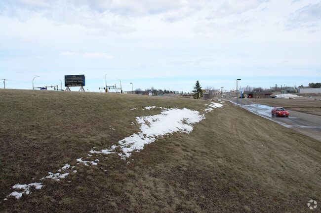
12036 Highway 169 W
Duluth, MN-WI
Irongate
139014200060
LOT 6, EXCEPT THAT PART OF LOT 6, WHICH LIESBETWEEN LOTS 2 AND 3, IRONGATE AND LIESEASTERLY OF THE NORTHERLY EXTENSION OF
Commercialnec
St Louis
D
Minnesota
27137C2250E
6
2025
27.97 AC
2024
North St Louis County
012400
Duluth
281,148 SF
DEMOGRAPHICS near 12036 Highway 169 W
1 Mile
3 Mile
5 Mile
2024 Total Population
1,834
13,871
15,252
2029 Population
1,821
13,800
15,173
Pop Growth 2024-2029
(0.71%)
(0.51%)
(0.52%)
Average Age
41
42
42
2024 Total Households
855
6,420
6,975
HH Growth 2024-2029
(0.82%)
(0.58%)
(0.57%)
Median Household Inc
$43,735
$50,327
$50,872
Avg Household Size
2.10
2.10
2.10
2024 Avg HH Vehicles
2.00
2.00
2.00
Median Home Value
$81,446
$114,170
$115,858
Median Year Built
1961
1954
1955
Nearby Places
Map Layers
Map Styles
 Street
 Aerial
- Restaurants
- Banks
- Shops
- Fitness
- Groceries
SALE & LEASE HISTORY
LISTING DATE
SALE/LEASE

Sep 24, 2016
For Sale
Nearby Properties
Address
Land Use
TOTAL SIZE
Lot Size
Zoning
Address
Land Use
TOTAL SIZE
Lot Size
Zoning
318,514 SF
7.83 AC
Address
Land Use
TOTAL SIZE
Lot Size
Zoning
239,600 SF
46.77 AC
Address
Land Use
TOTAL SIZE
Lot Size
Zoning
28,628 SF
18.62 AC
Address
Land Use
TOTAL SIZE
Lot Size
Zoning
42,599 SF
5.11 AC
Address
Land Use
TOTAL SIZE
Lot Size
Zoning
146,134 SF
2.29 AC
Address
Land Use
TOTAL SIZE
Lot Size
Zoning
15,244 SF
9.50 AC
Address
Land Use
TOTAL SIZE
Lot Size
Zoning
49,996 SF
15.60 AC
Address
Land Use
TOTAL SIZE
Lot Size
Zoning
185,202 SF
14.55 AC
Address
Land Use
TOTAL SIZE
Lot Size
Zoning
129,151 SF
5.12 AC
Address
Land Use
TOTAL SIZE
Lot Size
Zoning
79,011 SF
8.17 AC
Address
Land Use
TOTAL SIZE
Lot Size
Zoning
99,240 SF
6.66 AC
Address
Land Use
TOTAL SIZE
Lot Size
Zoning
52,497 SF
6.06 AC
Address
Land Use
TOTAL SIZE
Lot Size
Zoning
82,579 SF
11.75 AC
Address
Land Use
TOTAL SIZE
Lot Size
Zoning
36,675 SF
19.18 AC
Address
Land Use
TOTAL SIZE
Lot Size
Zoning
77,532 SF
13.60 AC
Address
Land Use
TOTAL SIZE
Lot Size
Zoning
72,759 SF
9.62 AC
Address
Land Use
TOTAL SIZE
Lot Size
Zoning
53,508 SF
3.05 AC
Address
Land Use
TOTAL SIZE
Lot Size
Zoning
112,076 SF
12.90 AC
Address
Land Use
TOTAL SIZE
Lot Size
Zoning
27,200 SF
11.54 AC
Address
Land Use
TOTAL SIZE
Lot Size
Zoning
9,408 SF
5.40 AC
Address
Land Use
TOTAL SIZE
Lot Size
Zoning
75,000 SF
1.06 AC
Address
Land Use
TOTAL SIZE
Lot Size
Zoning
23,421 SF
2.27 AC
Address
Land Use
TOTAL SIZE
Lot Size
Zoning
29,470 SF
0.79 AC
Address
Land Use
TOTAL SIZE
Lot Size
Zoning
999,999 SF
1.87 AC
Address
Land Use
TOTAL SIZE
Lot Size
Zoning
22,503 SF
4 AC
Address
Land Use
TOTAL SIZE
Lot Size
Zoning
55,534 SF
3.01 AC
Address
Land Use
TOTAL SIZE
Lot Size
Zoning
16,080 SF
0.72 AC
Address
Land Use
TOTAL SIZE
Lot Size
Zoning
39,920 SF
2.69 AC
Address
Land Use
TOTAL SIZE
Lot Size
Zoning
41,918 SF
17.14 AC
Address
Land Use
TOTAL SIZE
Lot Size
Zoning
18,336 SF
6 AC
The World's #1 Commercial Real Estate Marketplace
Connect with us
© 2026 CoStar Group
The information above has been obtained from sources believed reliable. While we do not doubt its accuracy we have not verified it and make no guarantee, warranty or representation about it. It is your responsibility to independently confirm its accuracy and completeness. Any projections, opinions, assumptions, or estimates used are for example only and do not represent the current or future performance of the property. The value of this transaction to you depends on tax and other factors which should be evaluated by your tax, financial, and legal advisors. You and your advisors should conduct a careful, independent investigation of the property to determine to your satisfaction the suitability of the property for your needs.