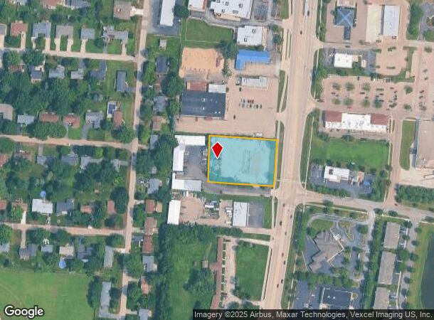
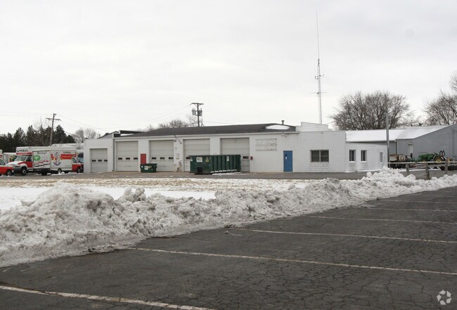
Property Record
1203 N Bridge St, Yorkville, IL 60560
NEARBY LISTINGS FOR SALE OR LEASE
-
-
-
-
McHugh Rd. & Route 34/Countryside Pkwy & Route 34
Yorkville, IL 60560
Rent Upon Request
1 - 30 AC Lot
Land
-
-
-
-
View all Yorkville listings for sale on LoopNet.com
Property Detail
1203 N Bridge St
Chicago-Naperville-Elgin, IL-IN-WI
Perkins Sub
02-28-154-021
LOT 1 PERKINS SUB CITY OF YORKVILLE
Commercialacreage
Kendall
X
Illinois
17093C0039H
1
2024
1.20 AC
2024
Western East/West Corr
890401
Chicago
1,551 SF
DEMOGRAPHICS near 1203 N Bridge St
1 Mile
3 Mile
5 Mile
2024 Total Population
5,881
27,461
63,005
2029 Population
6,446
30,470
69,641
Pop Growth 2024-2029
+ 9.61%
+ 10.96%
+ 10.53%
Average Age
40
38
37
2024 Total Households
2,225
9,416
20,920
HH Growth 2024-2029
+ 9.62%
+ 10.95%
+ 10.61%
Median Household Inc
$79,668
$98,798
$98,843
Avg Household Size
2.60
2.80
3.00
2024 Avg HH Vehicles
2.00
2.00
2.00
Median Home Value
$265,608
$276,017
$266,989
Median Year Built
1985
2001
2002
Nearby Places
Map Layers
Map Styles
 Street
 Aerial
- Restaurants
- Banks
- Shops
- Fitness
- Groceries
PUBLIC TRANSPORTATION
COMMUTER RAIL
Plano Amtrak Station (Carl Sandburg - Amtrak, Illinois Zephyr - Amtrak)
DRIVE
WALK
Distance
Plano Amtrak Station (Carl Sandburg - Amtrak, Illinois Zephyr - Amtrak)
10 min
5.3 mi
Freight Ports
Port Milwaukee
DRIVE
WALK
Distance
Port Milwaukee
151 min
122.1 mi
Nearby Properties
Address
Land Use
TOTAL SIZE
Lot Size
Zoning
Address
Land Use
TOTAL SIZE
Lot Size
Zoning
156,075 SF
16.27 AC
Address
Land Use
TOTAL SIZE
Lot Size
Zoning
339,430 SF
6.18 AC
Address
Land Use
TOTAL SIZE
Lot Size
Zoning
64,667 SF
6.15 AC
Address
Land Use
TOTAL SIZE
Lot Size
Zoning
184,454 SF
8.05 AC
Address
Land Use
TOTAL SIZE
Lot Size
Zoning
211,068 SF
13.09 AC
Address
Land Use
TOTAL SIZE
Lot Size
Zoning
177,481 SF
14.11 AC
Address
Land Use
TOTAL SIZE
Lot Size
Zoning
64,781 SF
1.62 AC
Address
Land Use
TOTAL SIZE
Lot Size
Zoning
43,544 SF
4.34 AC
Address
Land Use
TOTAL SIZE
Lot Size
Zoning
108,848 SF
5.79 AC
Address
Land Use
TOTAL SIZE
Lot Size
Zoning
107,162 SF
10.49 AC
Address
Land Use
TOTAL SIZE
Lot Size
Zoning
16,100 SF
5.14 AC
Address
Land Use
TOTAL SIZE
Lot Size
Zoning
21,800 SF
2.79 AC
Address
Land Use
TOTAL SIZE
Lot Size
Zoning
58,960 SF
1.27 AC
Address
Land Use
TOTAL SIZE
Lot Size
Zoning
54,910 SF
0.88 AC
Address
Land Use
TOTAL SIZE
Lot Size
Zoning
38,500 SF
7.06 AC
Address
Land Use
TOTAL SIZE
Lot Size
Zoning
29,693 SF
5.67 AC
Address
Land Use
TOTAL SIZE
Lot Size
Zoning
4,968 SF
1.35 AC
Address
Land Use
TOTAL SIZE
Lot Size
Zoning
19,012 SF
3.02 AC
Address
Land Use
TOTAL SIZE
Lot Size
Zoning
59,106 SF
3.46 AC
Address
Land Use
TOTAL SIZE
Lot Size
Zoning
60,078 SF
3.18 AC
Address
Land Use
TOTAL SIZE
Lot Size
Zoning
90,533 SF
7.18 AC
Address
Land Use
TOTAL SIZE
Lot Size
Zoning
52,278 SF
1.75 AC
Address
Land Use
TOTAL SIZE
Lot Size
Zoning
20,850 SF
1.06 AC
Address
Land Use
TOTAL SIZE
Lot Size
Zoning
121,275 SF
15.67 AC
Address
Land Use
TOTAL SIZE
Lot Size
Zoning
3,538 SF
2.47 AC
Address
Land Use
TOTAL SIZE
Lot Size
Zoning
20,654 SF
2.38 AC
Address
Land Use
TOTAL SIZE
Lot Size
Zoning
2.01 AC
Address
Land Use
TOTAL SIZE
Lot Size
Zoning
21,620 SF
1.45 AC
Address
Land Use
TOTAL SIZE
Lot Size
Zoning
39,784 SF
3.79 AC
Address
Land Use
TOTAL SIZE
Lot Size
Zoning
18,066 SF
1.68 AC
The World's #1 Commercial Real Estate Marketplace
Connect with us
© 2025 CoStar Group
The information above has been obtained from sources believed reliable. While we do not doubt its accuracy we have not verified it and make no guarantee, warranty or representation about it. It is your responsibility to independently confirm its accuracy and completeness. Any projections, opinions, assumptions, or estimates used are for example only and do not represent the current or future performance of the property. The value of this transaction to you depends on tax and other factors which should be evaluated by your tax, financial, and legal advisors. You and your advisors should conduct a careful, independent investigation of the property to determine to your satisfaction the suitability of the property for your needs.