Property Record
1204 N 24Th Ave E, Ellenton, FL 34222


NEARBY LISTINGS FOR SALE OR LEASE
Property Detail
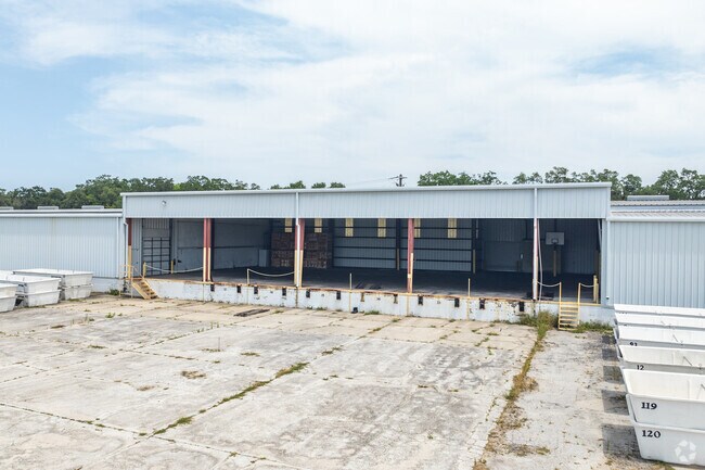
1204 N 24Th Ave E
9964-0010-9
PARCEL A. COM AT THE NE COR OF NW1/4 SEC 18-34S-18E, AS PER SURVEY OF SD SEC BY UNITED STATES LAND OFFICE; RUN TH S 0 DEG 29 MIN W A DIST OF 2434.87 FT TO THE SW COR OF THE
Agriculturalland
Manatee
X
Florida
12081C0168F
23.20 AC
2023
Manatee
2025
Tampa/St Petersburg
001904
North Port-Bradenton-Sarasota, FL
89,487 SF
DEMOGRAPHICS near 1204 N 24Th Ave E
1 Mile
3 Mile
5 Mile
2024 Total Population
4,110
60,852
157,082
2029 Population
4,836
71,497
183,861
Pop Growth 2024-2029
+ 17.66%
+ 17.49%
+ 17.05%
Average Age
41
43
44
2024 Total Households
1,539
24,019
62,748
HH Growth 2024-2029
+ 16.89%
+ 16.76%
+ 16.35%
Median Household Inc
$62,754
$57,481
$56,779
Avg Household Size
2.60
2.40
2.40
2024 Avg HH Vehicles
2.00
2.00
2.00
Median Home Value
$297,454
$243,043
$238,936
Median Year Built
1990
1990
1986
Nearby Places
Map Layers
Map Styles
 Street
 Aerial
- Restaurants
- Banks
- Shops
- Fitness
- Groceries
PUBLIC TRANSPORTATION
AIRPORT
Sarasota/Bradenton International
DRIVE
WALK
Distance
Sarasota/Bradenton International
24 min
11.7 mi
St Pete-Clearwater International
DRIVE
WALK
Distance
St Pete-Clearwater International
53 min
35.4 mi
Freight Ports
Port Manatee
DRIVE
WALK
Distance
Port Manatee
20 min
11.1 mi
SALE & LEASE HISTORY
LISTING DATE
SALE/LEASE

Jun 28, 2022
For Sale
Nearby Properties
Address
Land Use
TOTAL SIZE
Lot Size
Zoning
Address
Land Use
TOTAL SIZE
Lot Size
Zoning
622,266 SF
68.76 AC
PD-MU
Address
Land Use
TOTAL SIZE
Lot Size
Zoning
881,490 SF
83.09 AC
BR_R-3
Address
Land Use
TOTAL SIZE
Lot Size
Zoning
595,475 SF
16.90 AC
BR_T5
Address
Land Use
TOTAL SIZE
Lot Size
Zoning
349,711 SF
49.51 AC
BR_SD1
Address
Land Use
TOTAL SIZE
Lot Size
Zoning
359,241 SF
27.68 AC
PD-MU
Address
Land Use
TOTAL SIZE
Lot Size
Zoning
405,843 SF
9.09 AC
BR_T5
Address
Land Use
TOTAL SIZE
Lot Size
Zoning
277,678 SF
7.80 AC
BR_T4-O, B
Address
Land Use
TOTAL SIZE
Lot Size
Zoning
319,679 SF
31.78 AC
BR_R-1
Address
Land Use
TOTAL SIZE
Lot Size
Zoning
427,250 SF
38.18 AC
A-1 SUBURB
Address
Land Use
TOTAL SIZE
Lot Size
Zoning
98,722 SF
10.24 AC
PL_P
Address
Land Use
TOTAL SIZE
Lot Size
Zoning
432,078 SF
1.64 AC
BR_T6
Address
Land Use
TOTAL SIZE
Lot Size
Zoning
169,485 SF
7.87 AC
PD-MU
Address
Land Use
TOTAL SIZE
Lot Size
Zoning
318,507 SF
10.47 AC
BR_T4R,BR_
Address
Land Use
TOTAL SIZE
Lot Size
Zoning
2,401,721 SF
142.14 AC
PD-UI
Address
Land Use
TOTAL SIZE
Lot Size
Zoning
225,768 SF
18.47 AC
BR_R-1
Address
Land Use
TOTAL SIZE
Lot Size
Zoning
257,072 SF
10.07 AC
BR_T5
Address
Land Use
TOTAL SIZE
Lot Size
Zoning
456,375 SF
112.07 AC
PD-MU
Address
Land Use
TOTAL SIZE
Lot Size
Zoning
541,781 SF
3.48 AC
BR_T5
Address
Land Use
TOTAL SIZE
Lot Size
Zoning
885,776 SF
46.22 AC
LM LIGHT M
Address
Land Use
TOTAL SIZE
Lot Size
Zoning
499,823 SF
39.50 AC
PL_P
Address
Land Use
TOTAL SIZE
Lot Size
Zoning
270,900 SF
44.35 AC
PD-MU
Address
Land Use
TOTAL SIZE
Lot Size
Zoning
456,317 SF
46.75 AC
PD-R
Address
Land Use
TOTAL SIZE
Lot Size
Zoning
276,469 SF
10.90 AC
PD-MU
Address
Land Use
TOTAL SIZE
Lot Size
Zoning
191,100 SF
30.35 AC
PD-C
Address
Land Use
TOTAL SIZE
Lot Size
Zoning
163,582 SF
8.61 AC
PL_P
Address
Land Use
TOTAL SIZE
Lot Size
Zoning
229,863 SF
31.01 AC
PL_CG,PL_C
Address
Land Use
TOTAL SIZE
Lot Size
Zoning
86,462 SF
0.85 AC
BR_T6
Address
Land Use
TOTAL SIZE
Lot Size
Zoning
97,813 SF
2.51 AC
BR_T6
Address
Land Use
TOTAL SIZE
Lot Size
Zoning
257,697 SF
5.32 AC
PL_PD-H
Address
Land Use
TOTAL SIZE
Lot Size
Zoning
96,342 SF
0.58 AC
BR_T5
The World's #1 Commercial Real Estate Marketplace
Connect with us
© 2026 CoStar Group
The information above has been obtained from sources believed reliable. While we do not doubt its accuracy we have not verified it and make no guarantee, warranty or representation about it. It is your responsibility to independently confirm its accuracy and completeness. Any projections, opinions, assumptions, or estimates used are for example only and do not represent the current or future performance of the property. The value of this transaction to you depends on tax and other factors which should be evaluated by your tax, financial, and legal advisors. You and your advisors should conduct a careful, independent investigation of the property to determine to your satisfaction the suitability of the property for your needs.