Property Record
1204 Pound Hill Rd, North Smithfield, RI 02896


NEARBY LISTINGS FOR SALE OR LEASE
-
-
View all North Smithfield listings for sale on LoopNet.com
Property Detail
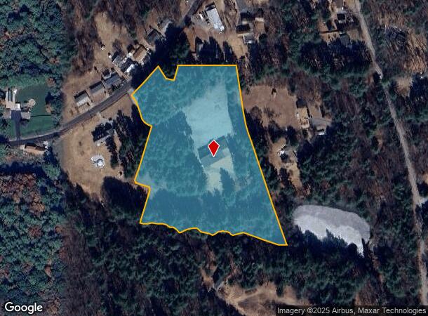
1204 Pound Hill Rd
NSMI-000007-000000-000095
Providence
Commercialbuilding
Rhode Island
X
95
44007C0152G
7.40 AC
2024
Burrillville/Glocester
2024
Providence
012803
Providence-Warwick, RI-MA
4,129 SF
DEMOGRAPHICS near 1204 Pound Hill Rd
1 Mile
3 Mile
5 Mile
2024 Total Population
1,622
21,297
70,348
2029 Population
1,627
21,193
69,836
Pop Growth 2024-2029
+ 0.31%
(0.49%)
(0.73%)
Average Age
45
42
40
2024 Total Households
616
8,462
27,994
HH Growth 2024-2029
+ 0.32%
(0.60%)
(0.84%)
Median Household Inc
$103,333
$76,574
$67,039
Avg Household Size
2.60
2.40
2.40
2024 Avg HH Vehicles
2.00
2.00
2.00
Median Home Value
$419,774
$355,249
$336,549
Median Year Built
1983
1958
1956
Nearby Places
Map Layers
Map Styles
 Street
 Aerial
- Restaurants
- Banks
- Shops
- Fitness
- Groceries
PUBLIC TRANSPORTATION
AIRPORT
Rhode Island Tf Green International
DRIVE
WALK
Distance
Rhode Island Tf Green International
36 min
24.5 mi
Worcester Regional
DRIVE
WALK
Distance
Worcester Regional
44 min
31.2 mi
Freight Ports
Port of Davisville, RI
DRIVE
WALK
Distance
Port of Davisville, RI
50 min
36.3 mi
SALE & LEASE HISTORY
LISTING DATE
SALE/LEASE

Nov 14, 2022
For Sale
Mar 29, 2018
For Sale
Nearby Properties
Address
Land Use
TOTAL SIZE
Lot Size
Zoning
Address
Land Use
TOTAL SIZE
Lot Size
Zoning
31.45 AC
M
Address
Land Use
TOTAL SIZE
Lot Size
Zoning
8,930 SF
31.56 AC
R4
Address
Land Use
TOTAL SIZE
Lot Size
Zoning
123,821 SF
12.40 AC
RA
Address
Land Use
TOTAL SIZE
Lot Size
Zoning
105,802 SF
0.94 AC
Address
Land Use
TOTAL SIZE
Lot Size
Zoning
115,203 SF
15.52 AC
RA
Address
Land Use
TOTAL SIZE
Lot Size
Zoning
34.30 AC
M
Address
Land Use
TOTAL SIZE
Lot Size
Zoning
28.39 AC
F5
Address
Land Use
TOTAL SIZE
Lot Size
Zoning
27,720 SF
4.36 AC
I
Address
Land Use
TOTAL SIZE
Lot Size
Zoning
17,748 SF
10.50 AC
REA
Address
Land Use
TOTAL SIZE
Lot Size
Zoning
60,999 SF
6.01 AC
R3
Address
Land Use
TOTAL SIZE
Lot Size
Zoning
65,809 SF
17.66 AC
BN
Address
Land Use
TOTAL SIZE
Lot Size
Zoning
91,077 SF
2.03 AC
PR1
Address
Land Use
TOTAL SIZE
Lot Size
Zoning
72,024 SF
3.53 AC
I1
Address
Land Use
TOTAL SIZE
Lot Size
Zoning
42,837 SF
11.32 AC
RS
Address
Land Use
TOTAL SIZE
Lot Size
Zoning
42,966 SF
5.08 AC
R2
Address
Land Use
TOTAL SIZE
Lot Size
Zoning
68,604 SF
8.62 AC
RA
Address
Land Use
TOTAL SIZE
Lot Size
Zoning
18.32 AC
M
Address
Land Use
TOTAL SIZE
Lot Size
Zoning
21,080 SF
34.04 AC
RA
Address
Land Use
TOTAL SIZE
Lot Size
Zoning
70,092 SF
4.15 AC
RU
Address
Land Use
TOTAL SIZE
Lot Size
Zoning
61,008 SF
6.45 AC
BH
Address
Land Use
TOTAL SIZE
Lot Size
Zoning
417,592 SF
13.58 AC
MU2
Address
Land Use
TOTAL SIZE
Lot Size
Zoning
10.34 AC
RA
Address
Land Use
TOTAL SIZE
Lot Size
Zoning
48,309 SF
13.14 AC
RA
Address
Land Use
TOTAL SIZE
Lot Size
Zoning
8,117 SF
0.76 AC
R4
Address
Land Use
TOTAL SIZE
Lot Size
Zoning
48,678 SF
2.11 AC
R3
Address
Land Use
TOTAL SIZE
Lot Size
Zoning
57,698 SF
8.36 AC
RS
Address
Land Use
TOTAL SIZE
Lot Size
Zoning
2,200 SF
5.38 AC
BN
Address
Land Use
TOTAL SIZE
Lot Size
Zoning
49,480 SF
4.53 AC
RA
Address
Land Use
TOTAL SIZE
Lot Size
Zoning
55,730 SF
8.23 AC
GC
Address
Land Use
TOTAL SIZE
Lot Size
Zoning
31,785 SF
1.01 AC
R4
The World's #1 Commercial Real Estate Marketplace
Connect with us
© 2025 CoStar Group
The information above has been obtained from sources believed reliable. While we do not doubt its accuracy we have not verified it and make no guarantee, warranty or representation about it. It is your responsibility to independently confirm its accuracy and completeness. Any projections, opinions, assumptions, or estimates used are for example only and do not represent the current or future performance of the property. The value of this transaction to you depends on tax and other factors which should be evaluated by your tax, financial, and legal advisors. You and your advisors should conduct a careful, independent investigation of the property to determine to your satisfaction the suitability of the property for your needs.