Property Record
12048 Meyers Rd, Detroit, MI 48227
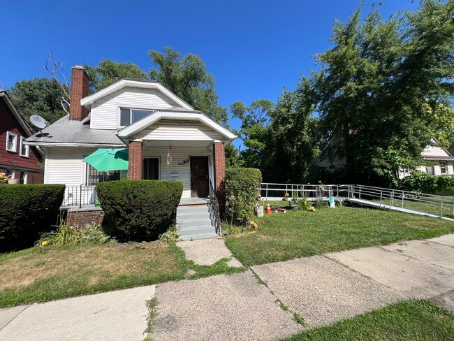

This Property Is For Sale
NEARBY LISTINGS FOR SALE OR LEASE
Property Detail
12048 Meyers Rd
Detroit-Warren-Dearborn, MI
Park Manor
18-018727
Wayne
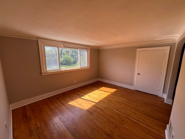
Bungalowresidential
Michigan
X
0.11 AC
26163C0100E
Mackenzie
1,512 SF
Detroit
DEMOGRAPHICS near 12048 Meyers Rd
1 Mile
3 Mile
5 Mile
2024 Total Population
15,430
180,504
425,612
2029 Population
16,201
185,044
431,586
Pop Growth 2024-2029
+ 5.00%
+ 2.52%
+ 1.40%
Average Age
39
37
38
2024 Total Households
5,998
67,087
160,516
HH Growth 2024-2029
+ 4.97%
+ 2.89%
+ 1.69%
Median Household Inc
$30,051
$34,222
$38,724
Avg Household Size
2.50
2.60
2.60
2024 Avg HH Vehicles
1.00
1.00
1.00
Median Home Value
$63,543
$78,034
$93,517
Median Year Built
1947
1947
1948
Nearby Places
Map Layers
Map Styles
 Street
 Aerial
- Restaurants
- Banks
- Shops
- Fitness
- Groceries
PUBLIC TRANSPORTATION
COMMUTER RAIL
DRIVE
WALK
Distance
13 min
6.5 mi
DRIVE
WALK
Distance
16 min
8.8 mi
AIRPORT
Windsor International
DRIVE
WALK
Distance
Windsor International
35 min
17.8 mi
Detroit Metro Wayne County
DRIVE
WALK
Distance
Detroit Metro Wayne County
34 min
20.0 mi
Freight Ports
DRIVE
WALK
Distance
81 min
64.4 mi
Nearby Properties
Address
Land Use
TOTAL SIZE
Lot Size
Zoning
Address
Land Use
TOTAL SIZE
Lot Size
Zoning
1,211,148 SF
69.13 AC
M4
Address
Land Use
TOTAL SIZE
Lot Size
Zoning
783,976 SF
52.57 AC
M4
Address
Land Use
TOTAL SIZE
Lot Size
Zoning
520,522 SF
51.78 AC
M4
Address
Land Use
TOTAL SIZE
Lot Size
Zoning
165,829 SF
5.56 AC
R5
Address
Land Use
TOTAL SIZE
Lot Size
Zoning
864,446 SF
17.98 AC
IB
Address
Land Use
TOTAL SIZE
Lot Size
Zoning
1,452 SF
19.24 AC
IC
Address
Land Use
TOTAL SIZE
Lot Size
Zoning
483,165 SF
22.98 AC
IB
Address
Land Use
TOTAL SIZE
Lot Size
Zoning
336,958 SF
15.54 AC
IB
Address
Land Use
TOTAL SIZE
Lot Size
Zoning
63,216 SF
2.87 AC
R5
Address
Land Use
TOTAL SIZE
Lot Size
Zoning
66,870 SF
2.77 AC
Address
Land Use
TOTAL SIZE
Lot Size
Zoning
331,590 SF
18.50 AC
M4
Address
Land Use
TOTAL SIZE
Lot Size
Zoning
402,213 SF
16.50 AC
M3
Address
Land Use
TOTAL SIZE
Lot Size
Zoning
79,831 SF
7.60 AC
B3
Address
Land Use
TOTAL SIZE
Lot Size
Zoning
315,973 SF
12.18 AC
M4
Address
Land Use
TOTAL SIZE
Lot Size
Zoning
143,100 SF
3.14 AC
IC
Address
Land Use
TOTAL SIZE
Lot Size
Zoning
68,729 SF
0.52 AC
B4
Address
Land Use
TOTAL SIZE
Lot Size
Zoning
69,712 SF
3.41 AC
PD
Address
Land Use
TOTAL SIZE
Lot Size
Zoning
43,095 SF
2.88 AC
R5
Address
Land Use
TOTAL SIZE
Lot Size
Zoning
46,292 SF
2.76 AC
R1
Address
Land Use
TOTAL SIZE
Lot Size
Zoning
24,078 SF
1.42 AC
BB
Address
Land Use
TOTAL SIZE
Lot Size
Zoning
89,147 SF
4.69 AC
PD
Address
Land Use
TOTAL SIZE
Lot Size
Zoning
17,266 SF
2 AC
IC
Address
Land Use
TOTAL SIZE
Lot Size
Zoning
122,319 SF
M4
Address
Land Use
TOTAL SIZE
Lot Size
Zoning
100,763 SF
28.07 AC
M4
Address
Land Use
TOTAL SIZE
Lot Size
Zoning
62,874 SF
2.60 AC
R6
Address
Land Use
TOTAL SIZE
Lot Size
Zoning
88,836 SF
2.86 AC
PD
Address
Land Use
TOTAL SIZE
Lot Size
Zoning
189,136 SF
9.44 AC
M4
Address
Land Use
TOTAL SIZE
Lot Size
Zoning
60,327 SF
1.89 AC
PD
Address
Land Use
TOTAL SIZE
Lot Size
Zoning
286,956 SF
7.80 AC
IC
Address
Land Use
TOTAL SIZE
Lot Size
Zoning
230,170 SF
11.18 AC
M4
The World's #1 Commercial Real Estate Marketplace
Connect with us
© 2026 CoStar Group
The information above has been obtained from sources believed reliable. While we do not doubt its accuracy we have not verified it and make no guarantee, warranty or representation about it. It is your responsibility to independently confirm its accuracy and completeness. Any projections, opinions, assumptions, or estimates used are for example only and do not represent the current or future performance of the property. The value of this transaction to you depends on tax and other factors which should be evaluated by your tax, financial, and legal advisors. You and your advisors should conduct a careful, independent investigation of the property to determine to your satisfaction the suitability of the property for your needs.