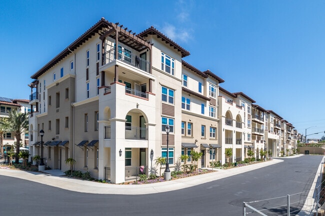
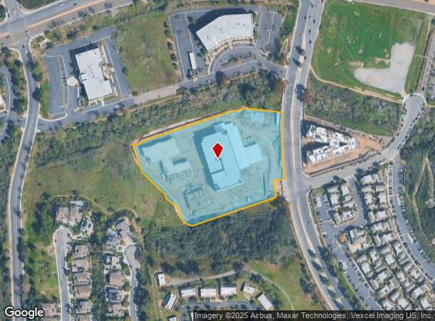
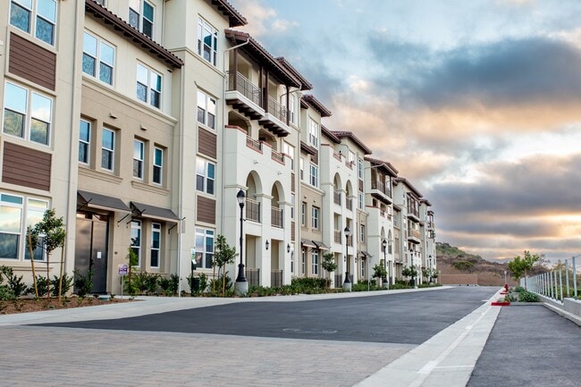
Property Record
1205 Aviara Pkwy, Carlsbad, CA 92011
NEARBY LISTINGS FOR SALE OR LEASE
-
-
View all Carlsbad listings for sale on LoopNet.com
Property Detail
1205 Aviara Pkwy
San Diego
Aviara Apts 2018-0002
San Diego-Carlsbad, CA
LOT 3 TR 16521
212-040-75
San Diego
Multifamilydwelling
California
2025
3
2025
5.91 AC
022102
Carlsbad
99,999 SF
DEMOGRAPHICS near 1205 Aviara Pkwy
1 Mile
3 Mile
5 Mile
2024 Total Population
7,181
52,611
170,639
2029 Population
7,109
52,454
169,363
Pop Growth 2024-2029
(1.00%)
(0.30%)
(0.75%)
Average Age
41
43
43
2024 Total Households
2,727
20,436
67,264
HH Growth 2024-2029
(1.03%)
(0.44%)
(0.85%)
Median Household Inc
$138,619
$134,498
$118,472
Avg Household Size
2.60
2.50
2.50
2024 Avg HH Vehicles
2.00
2.00
2.00
Median Home Value
$1,003,434
$1,028,831
$965,246
Median Year Built
1989
1992
1986
Nearby Places
Map Layers
Map Styles
 Street
 Aerial
- Restaurants
- Banks
- Shops
- Fitness
- Groceries
PUBLIC TRANSPORTATION
COMMUTER RAIL
Carlsbad Poinsettia (Coaster - San Diego North County Transit District (Coaster/Sprinter/Breeze))
DRIVE
WALK
Distance
Carlsbad Poinsettia (Coaster - San Diego North County Transit District (Coaster/Sprinter/Breeze))
6 min
2.9 mi
Carlsbad Village (Coaster - San Diego North County Transit District (Coaster/Sprinter/Breeze))
DRIVE
WALK
Distance
Carlsbad Village (Coaster - San Diego North County Transit District (Coaster/Sprinter/Breeze))
11 min
5.4 mi
AIRPORT
San Diego International
DRIVE
WALK
Distance
San Diego International
39 min
30.1 mi
Freight Ports
Port of San Diego
DRIVE
WALK
Distance
Port of San Diego
44 min
34.4 mi
Nearby Properties
Address
Land Use
TOTAL SIZE
Lot Size
Zoning
Address
Land Use
TOTAL SIZE
Lot Size
Zoning
59,518 SF
5.70 AC
P-U
Address
Land Use
TOTAL SIZE
Lot Size
Zoning
132.11 AC
C-T-Q
Address
Land Use
TOTAL SIZE
Lot Size
Zoning
26.65 AC
C-2-Q
Address
Land Use
TOTAL SIZE
Lot Size
Zoning
12.62 AC
P-C
Address
Land Use
TOTAL SIZE
Lot Size
Zoning
4.32 AC
N-LVSC
Address
Land Use
TOTAL SIZE
Lot Size
Zoning
8.76 AC
P-C
Address
Land Use
TOTAL SIZE
Lot Size
Zoning
12.71 AC
P-M
Address
Land Use
TOTAL SIZE
Lot Size
Zoning
7.31 AC
P-C
Address
Land Use
TOTAL SIZE
Lot Size
Zoning
28.15 AC
C-M
Address
Land Use
TOTAL SIZE
Lot Size
Zoning
16.79 AC
R-3-Q
Address
Land Use
TOTAL SIZE
Lot Size
Zoning
10.96 AC
C-M
Address
Land Use
TOTAL SIZE
Lot Size
Zoning
13.86 AC
C-M
Address
Land Use
TOTAL SIZE
Lot Size
Zoning
13.07 AC
P-M
Address
Land Use
TOTAL SIZE
Lot Size
Zoning
9.65 AC
P-C
Address
Land Use
TOTAL SIZE
Lot Size
Zoning
18.34 AC
P-C
Address
Land Use
TOTAL SIZE
Lot Size
Zoning
9.69 AC
C-T-Q
Address
Land Use
TOTAL SIZE
Lot Size
Zoning
5.45 AC
C-T
Address
Land Use
TOTAL SIZE
Lot Size
Zoning
20.86 AC
P-M-Q
Address
Land Use
TOTAL SIZE
Lot Size
Zoning
14.73 AC
C-L
Address
Land Use
TOTAL SIZE
Lot Size
Zoning
60.48 AC
OS
Address
Land Use
TOTAL SIZE
Lot Size
Zoning
11.10 AC
RD-M-Q
Address
Land Use
TOTAL SIZE
Lot Size
Zoning
3.17 AC
C-T
Address
Land Use
TOTAL SIZE
Lot Size
Zoning
7.42 AC
P-M
Address
Land Use
TOTAL SIZE
Lot Size
Zoning
9.74 AC
C-M
Address
Land Use
TOTAL SIZE
Lot Size
Zoning
6.38 AC
P-M
Address
Land Use
TOTAL SIZE
Lot Size
Zoning
7.38 AC
P-M-Q
Address
Land Use
TOTAL SIZE
Lot Size
Zoning
8.64 AC
R-3-Q
Address
Land Use
TOTAL SIZE
Lot Size
Zoning
95,418 SF
6.51 AC
P-C
Address
Land Use
TOTAL SIZE
Lot Size
Zoning
13.89 AC
M-Q
Address
Land Use
TOTAL SIZE
Lot Size
Zoning
55,656 SF
13.04 AC
R-1-Q
The World's #1 Commercial Real Estate Marketplace
Connect with us
© 2025 CoStar Group
The information above has been obtained from sources believed reliable. While we do not doubt its accuracy we have not verified it and make no guarantee, warranty or representation about it. It is your responsibility to independently confirm its accuracy and completeness. Any projections, opinions, assumptions, or estimates used are for example only and do not represent the current or future performance of the property. The value of this transaction to you depends on tax and other factors which should be evaluated by your tax, financial, and legal advisors. You and your advisors should conduct a careful, independent investigation of the property to determine to your satisfaction the suitability of the property for your needs.